Exposure — Tatra trails and posts
Found 19 results for exposure
Trails (19)
No photo Distance: 20.6 kmDuration: 9 h 50 minBanówka (Baníkov)
Banówka (2178 m) from the Žiarska Valley car park via Plačlivé and Hrubá kopa: 20.6 km, 9 h 50 min, chains and exposure. Trail closed 1 Nov – 31 May.
Difficulty: difficult (chains, exposure)
#slovakia#western tatras#chains+2View trailNo photo Distance: 17.9 kmDuration: 8 h 11 minPriečne sedlo (Czerwona Ławka)
Priečne sedlo (2352 m) from Hrebienok via Téryho chata to Zbojnícka chata: 17.9 km, 8 h 11 min, chains, rungs and exposure. Closed 1 Nov – 31 May.
Difficulty: very difficult (chains, exposure)
#slovakia#high tatras#chains+2View trailNo photo Distance: 13 kmDuration: 8–10 hGerlach (Gerlachovský štít)
Gerlachovský štít (2655 m), the highest peak of the Tatras and Carpathians, only with a licensed guide: chains and rungs, 13 km, 8–10 h, no marked trail.
Difficulty: climbing (UIAA I/II)
#slovakia#high tatras#highest peak+2View trail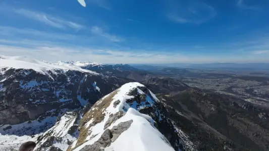 Distance: 11.8 kmDuration: 5 h 57 min
Giewont
Giewont is 1894 m high. The hike from Kuźnice in Zakopane: about 3 h up, an 11.8 km loop, chains on the summit dome and a queue to the cross. How hard and how dangerous it is.
Difficulty: medium / difficult
#western tatras#chains#exposure+1View trail- Distance: 6 kmDuration: 3 h 15 min
Giewont from Strążyska
Giewont from Dolina Strążyska in Zakopane via Grzybowiec Pass: 6 km, 3 h 15 min, +1014 m, chains on the summit dome. Parking on Strążyska street, winter closure.
Difficulty: medium / difficult
#western tatras#chains#exposure+1View trail 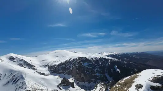 Distance: 6 kmDuration: 3 h 31 min
Giewont from Gronik
Giewont from Gronik via Dolina Małej Łąki and Kondracka Pass: 6 km, 3 h 31 min, +981 m, chains on the dome. Quieter than from Kuźnice, same queue at the cross.
Difficulty: medium / difficult
#western tatras#chains#exposure+1View trailNo photo Distance: 17.5 kmDuration: 8 h 30 minGranaty
Granaty from Kuźnice: Skrajny, Pośredni and Zadni Granat, down Żleb Kulczyńskiego. 17.5 km, 8 h 30 min, chains and exposure. A section of Orla Perć, not a stroll.
Difficulty: very difficult
#high tatras#orla perć#chains+2View trail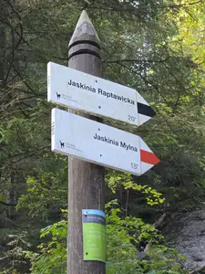 Distance: 1 kmDuration: 57 min
Jaskinia Mylna
Mylna Cave in the Kościeliska Valley: an unlit labyrinth, crawling, a chain on the way down and Pawlikowski's Window. 57 min from Polana Pisana, about 3 h from Kiry.
Difficulty: moderate (crawling, chain on the exit)
#western tatras#cave#chains+1View trailNo photo Distance: 0.5 kmDuration: 30 minJaskinia Raptawicka
Raptawicka Cave in the Kościeliska Valley: chains, a 4 m ladder and a big daylight chamber. 30 min loop from Polana Pisana, about 2 h 30 min from Kiry.
Difficulty: medium (ladder + chains)
#western tatras#cave#chains+1View trailNo photo Distance: 16 kmDuration: 7 h 29 minKościelec (The Polish Matterhorn)
Kościelec (2155 m), the 'Polish Matterhorn', from Kuźnice via Hala Gąsienicowa and Karb: 16 km, 7 h 29 min. No chains, but steep slabs and exposure.
Difficulty: very difficult (no chains!)
#high tatras#exposure#fitnessView trailNo photo Distance: 14.2 kmDuration: 7 h 20 minKozia Przełęcz
Kozia Przełęcz (2137 m) from Kuźnice via Czarny Staw and Kozia Dolinka: 14.2 km, 7 h 20 min, chains and rungs. A link to Orla Perć, not Kozi Wierch.
Difficulty: very difficult (chains, rungs)
#high tatras#orla perć#chains+1View trailNo photo Distance: 23.2 kmDuration: 10 h 49 minMięguszowiecka Pass below Chłopek
Mięguszowiecka Przełęcz pod Chłopkiem from Palenica via Morskie Oko and Czarny Staw: 23.2 km, 10 h 49 min, no chains but exposure and scrambling on rock.
Difficulty: very difficult
#high tatras#exposure#fitness+2View trailNo photo Distance: 4.3 kmDuration: 6 h 25 minOrla Perć (Zawrat - Krzyżne)
Orla Perć from Zawrat to Krzyżne: 4.3 km of ridge in 6 h 25 min, chains, rungs, a ladder and one-way traffic to Kozi Wierch. How to split it into stages.
Difficulty: very difficult (for advanced hikers only)
#high tatras#orla perć#chains+1View trailNo photo Distance: 25.5 kmDuration: 11 h 44 minRysy (from the Polish side)
Rysy (2499 m), Poland's highest peak, from Palenica via Morskie Oko and Czarny Staw: 25.5 km, 11 h 44 min, chains, snow even in July. When to start and turn back.
Difficulty: very difficult
#high tatras#highest peak#chains+2View trailNo photo Distance: 8.8 kmDuration: 5 h 50 minSiwy Wierch (Sivý vrch)
Sivý vrch (Siwy Wierch, 1805 m) in the Slovak Western Tatras: red trail over Radové skaly with chains on limestone. 8.8 km, 5 h 50 min. Closed 1 Nov – 31 May.
Difficulty: moderate (chains, exposure)
#slovakia#western tatras#chains+2View trailNo photo Distance: 18.6 kmDuration: 9 h 32 minŚwinica
Świnica (2301 m) from Kuźnice via Kasprowy Wierch: 18.6 km, 9 h 32 min, chains and exposure. The cable car shortens the climb, not the difficulty. Zawrat variants.
Difficulty: difficult
#high tatras#chains#exposure+1View trailNo photo Distance: 1.4 kmDuration: 30 minWąwóz Kraków and Smocza Jama
Wąwóz Kraków in the Kościeliska Valley: a ladder, chains and the one-way Smocza Jama cave. 30 min loop from Hala Pisana, about 4 h from Kiry. Bring a headlamp.
Difficulty: medium (ladder + chains)
#western tatras#cave#chains+1View trailNo photo Distance: 19.9 kmDuration: 8 h 34 minZawrat Pass (from Hala Gąsienicowa)
Zawrat Pass (2158 m) from Kuźnice via Hala Gąsienicowa: 19.9 km, 8 h 34 min, chains in the gully and snow into summer. The easier Five Lakes side is separate.
Difficulty: difficult
#high tatras#orla perć#chains+1View trailNo photo Distance: 18.6 kmDuration: 9 h 24 minŻleb Kulczyńskiego
Żleb Kulczyńskiego from Kuźnice via Hala Gąsienicowa and Zmarzły Staw: 18.6 km, 9 h 24 min, chains in the gully, loose rock, helmet advised. Approach to Orla Perć.
Difficulty: very difficult
#high tatras#orla perć#chains+2View trail