Giewont
- Trail color
- Elevation
- 1894 m a.s.l.
- Total ascent
- 912 m
- Distance
- 11.8 km
- Difficulty
- medium / difficult
- Duration
- 5 h 57 min
- Start
- Kuźnice
- Finish
- Kuźnice
- Location
- Western Tatras
- Family friendly
- No
- Dog friendly
- No
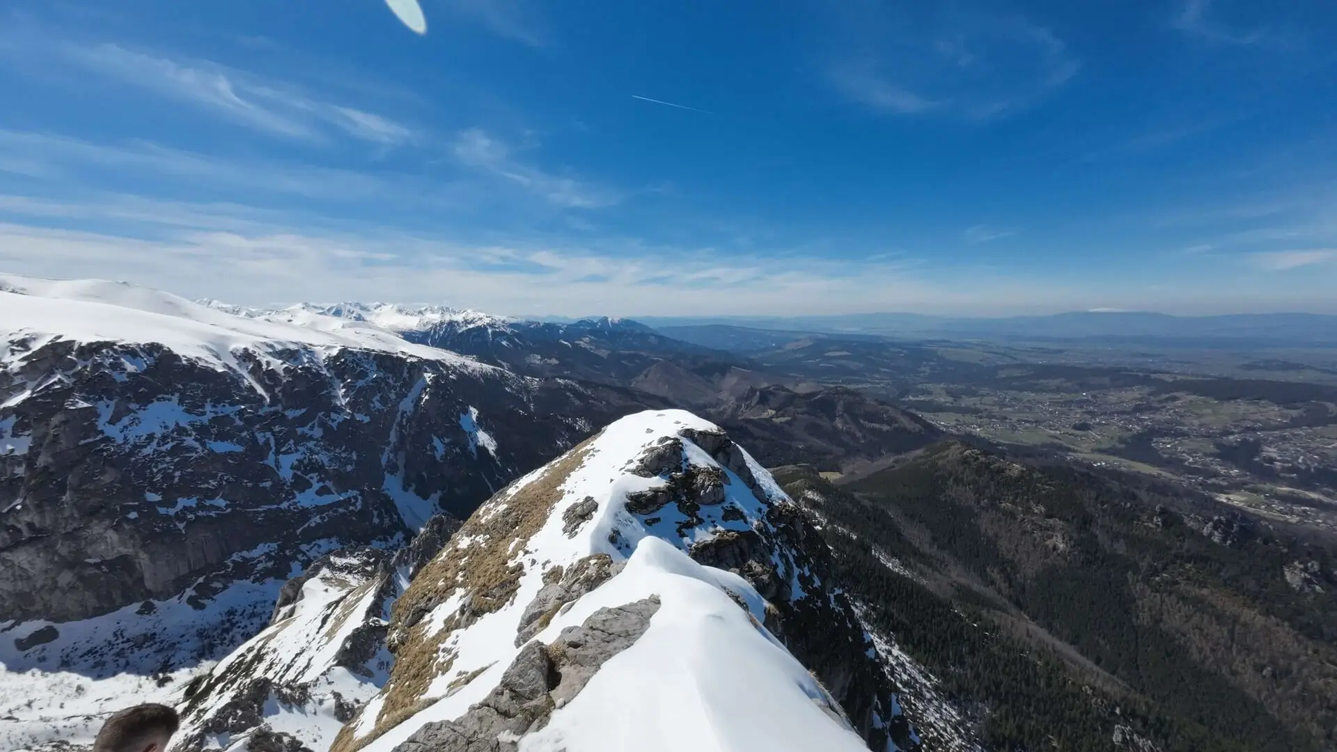
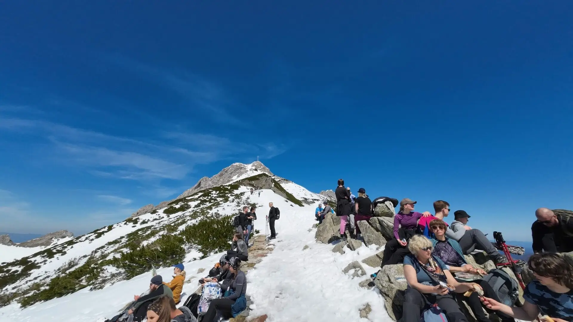
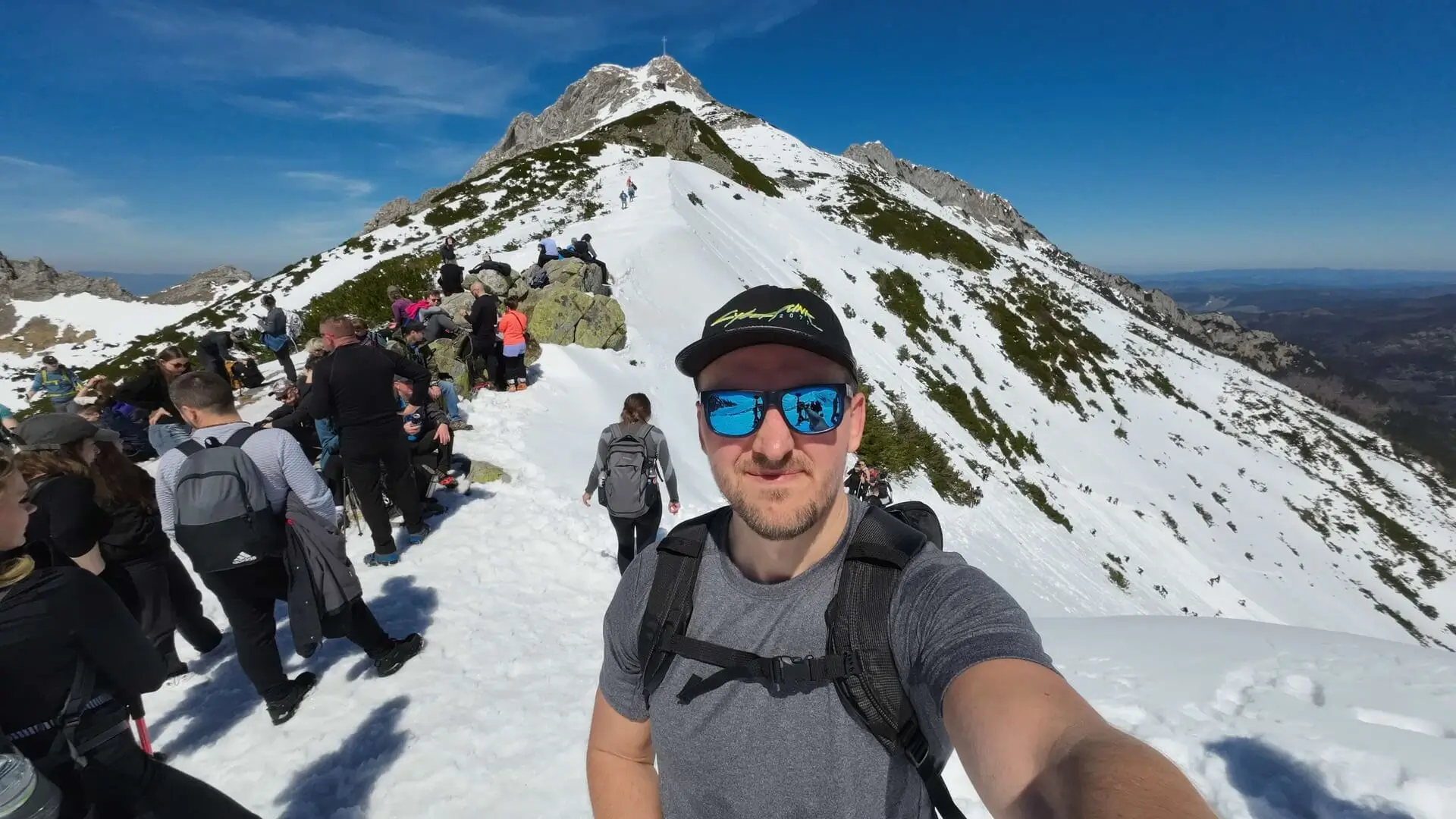
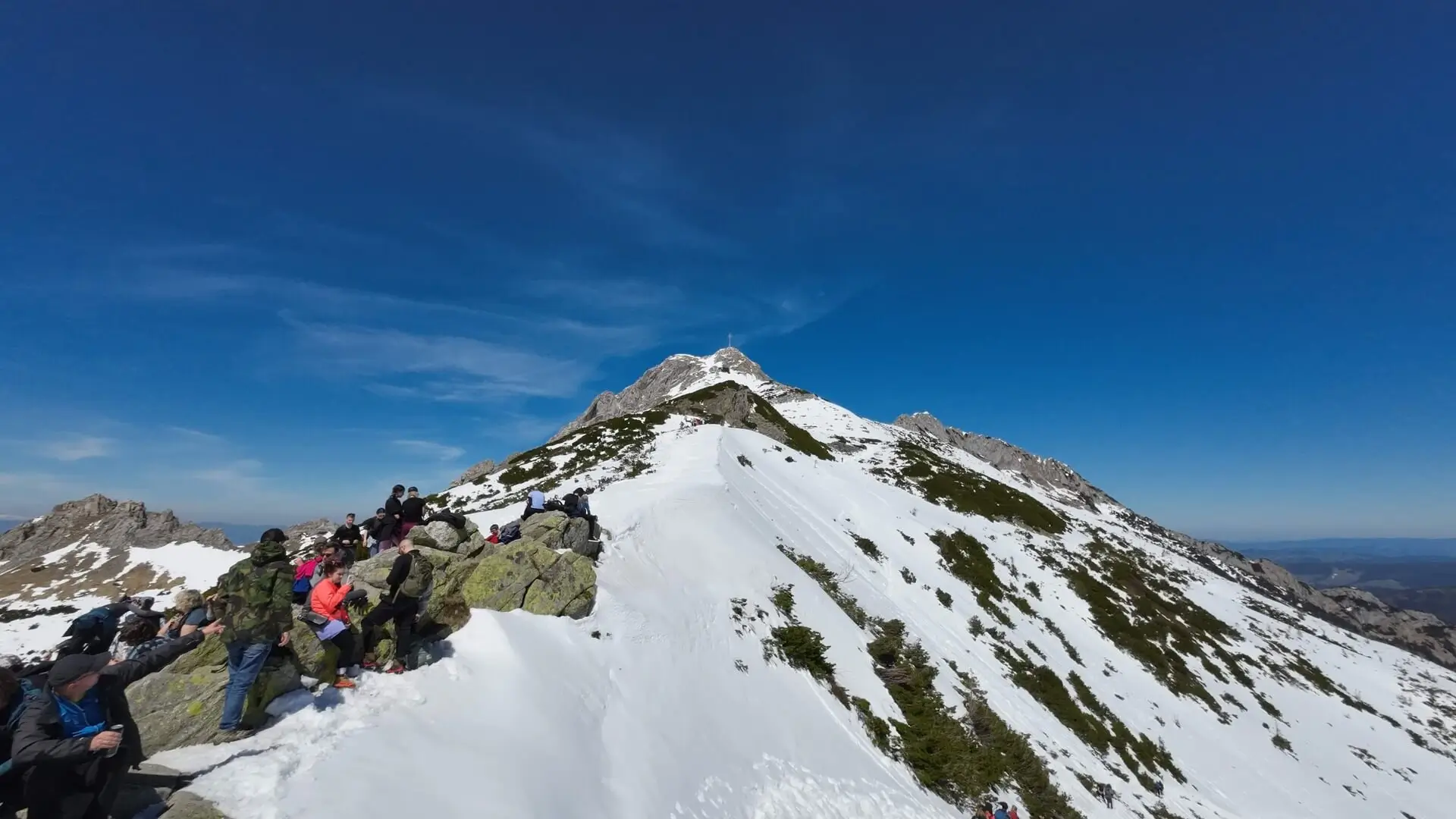
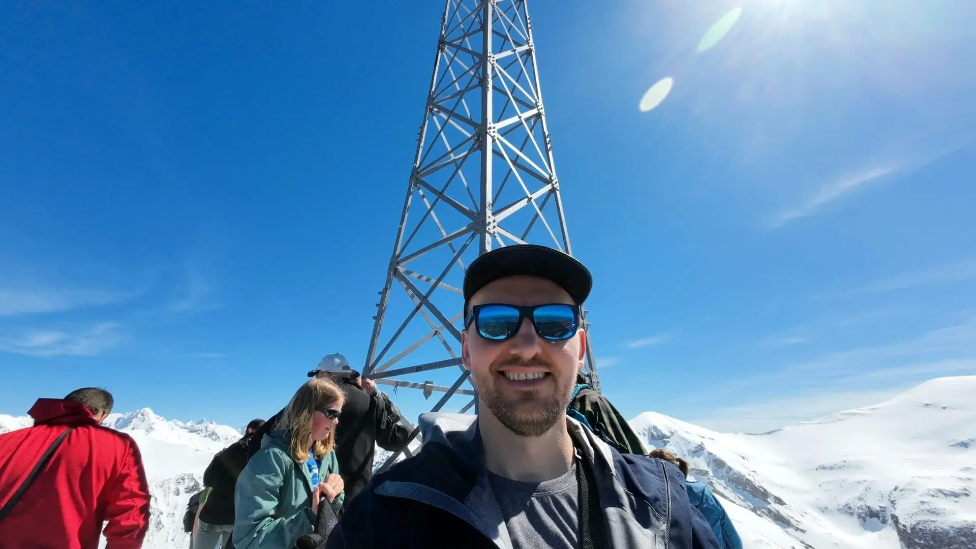
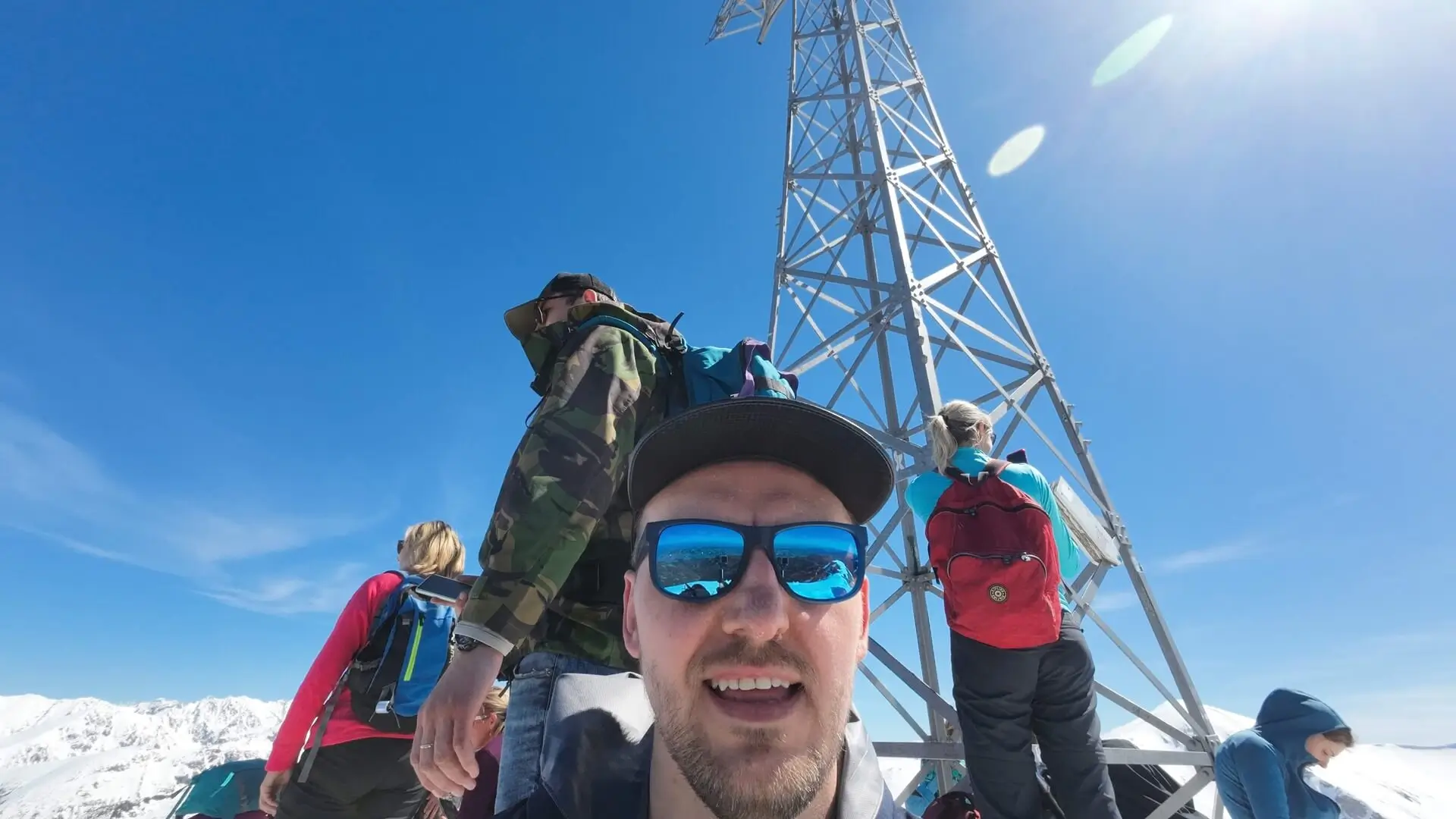
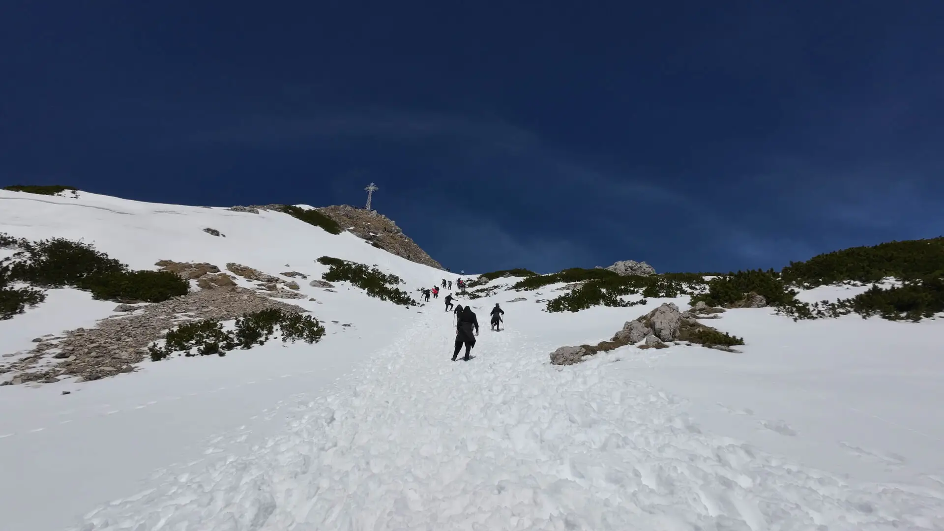
Giewont stands at 1,894 m above sea level. It is the symbol of Zakopane and the most popular hiking destination in the Tatras. The silhouette of the “Sleeping Knight” with a 15-metre iron cross on the summit attracts thousands of hikers.
Although the mountain looks accessible, this is a high-mountain trail, and the final section has secured chains and requires strict safety rules.
Trail description: the blue trail from Kuźnice
The classic way to the summit starts in Kuźnice.
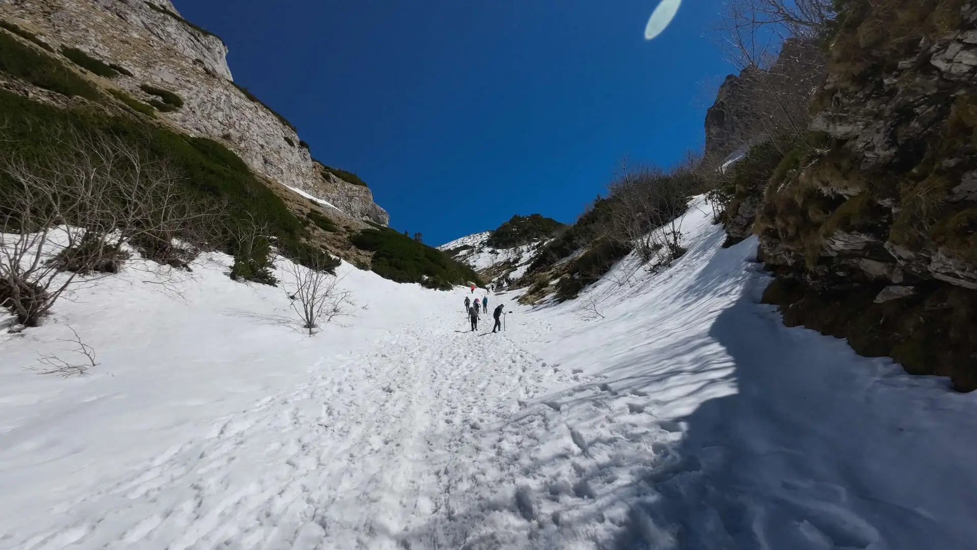
- To Hala Kondratowa: A wide, stony road leads through Kalatówki (it is worth taking a look at the Albertine convent). After about 1 hour 20 minutes we reach Hala Kondratowa. This is where the smallest mountain hut in the Tatras is located (famous for its “atmosphere”, although it is often crowded).
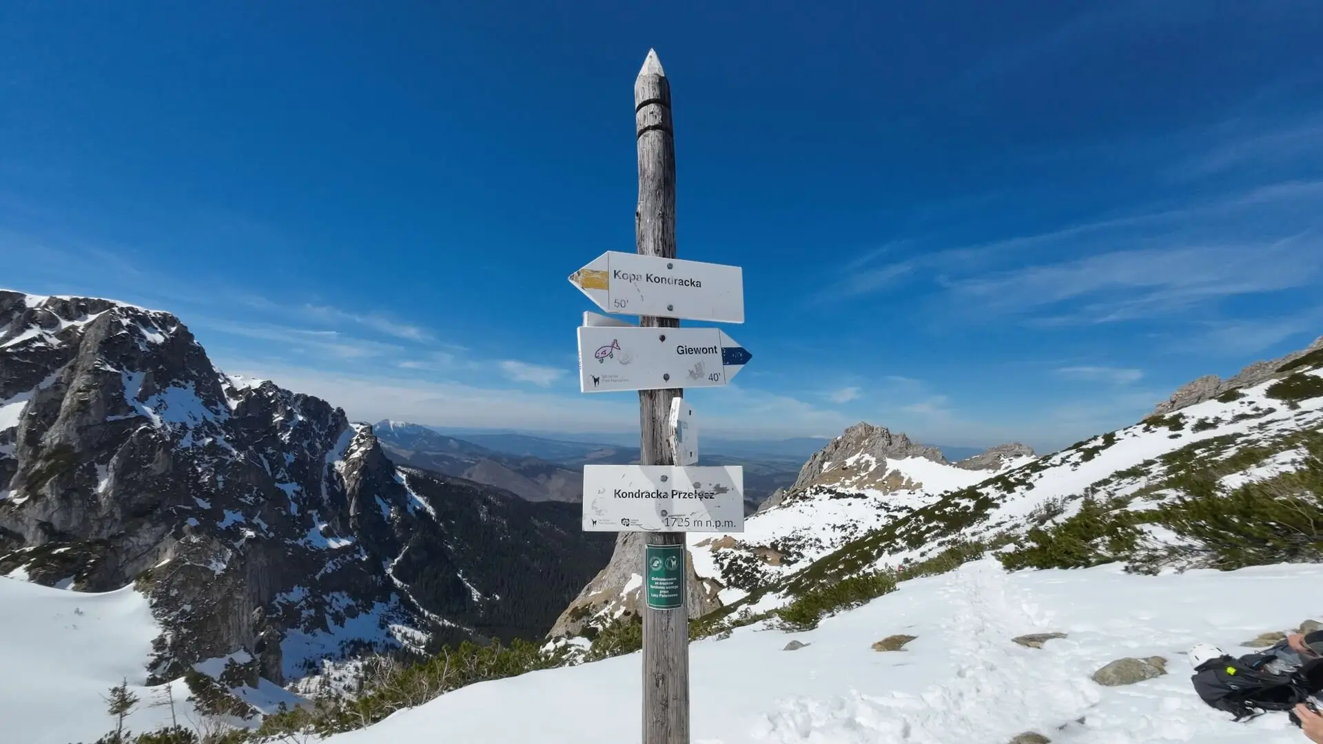
- The gruelling climb: Behind the hut the trail climbs steeply in zigzags towards Kondracka Pass. This is the most tiring part in terms of fitness.
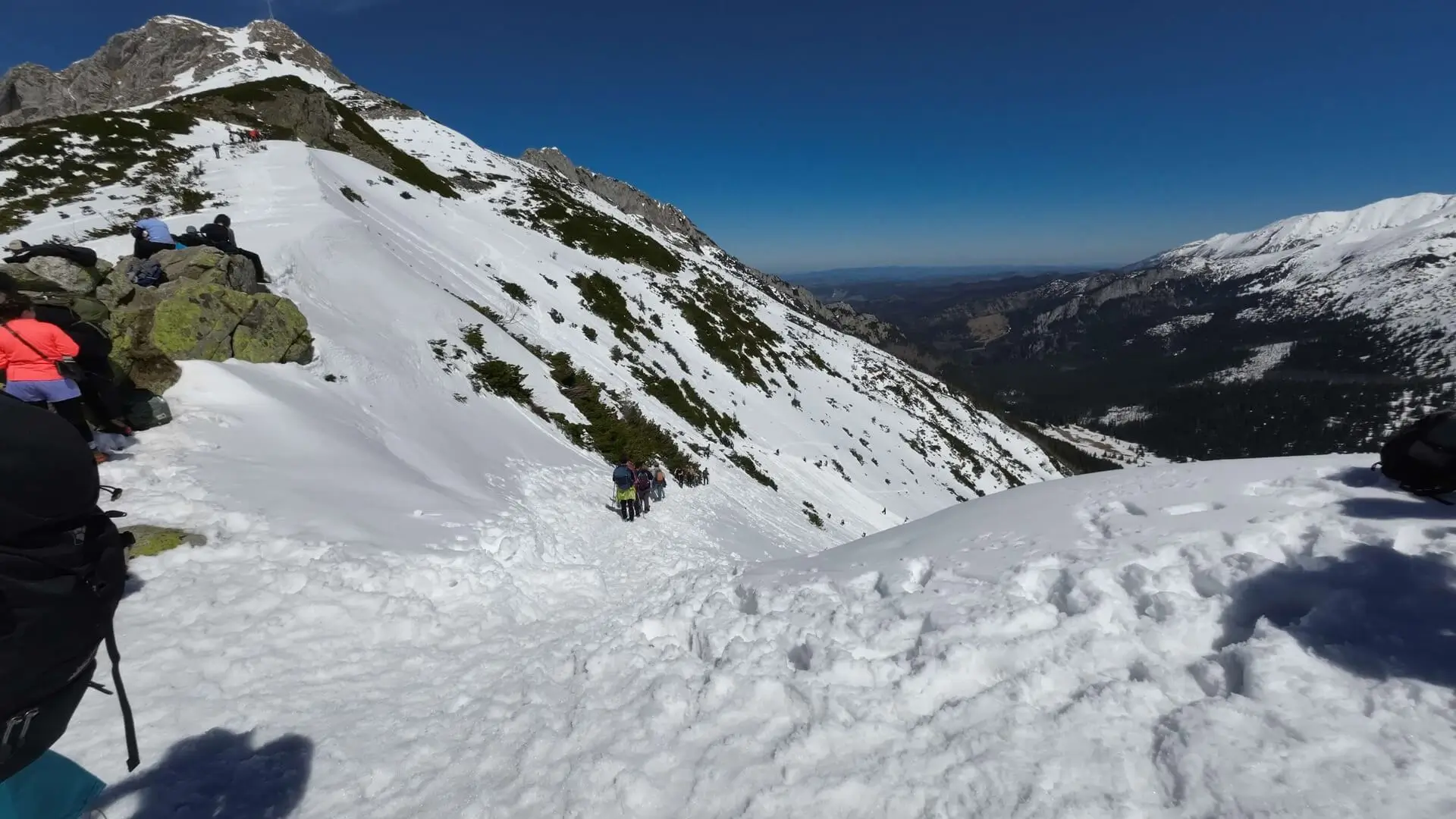
- Summit push (chains): From the pass we head to the summit dome. This is where one-way traffic begins. The right branch (looking from below) is for ascent, the left for descent. The trail is secured with chains that help you overcome the rock steps.
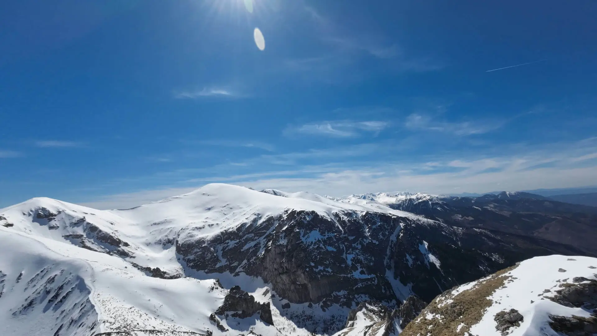
Panorama
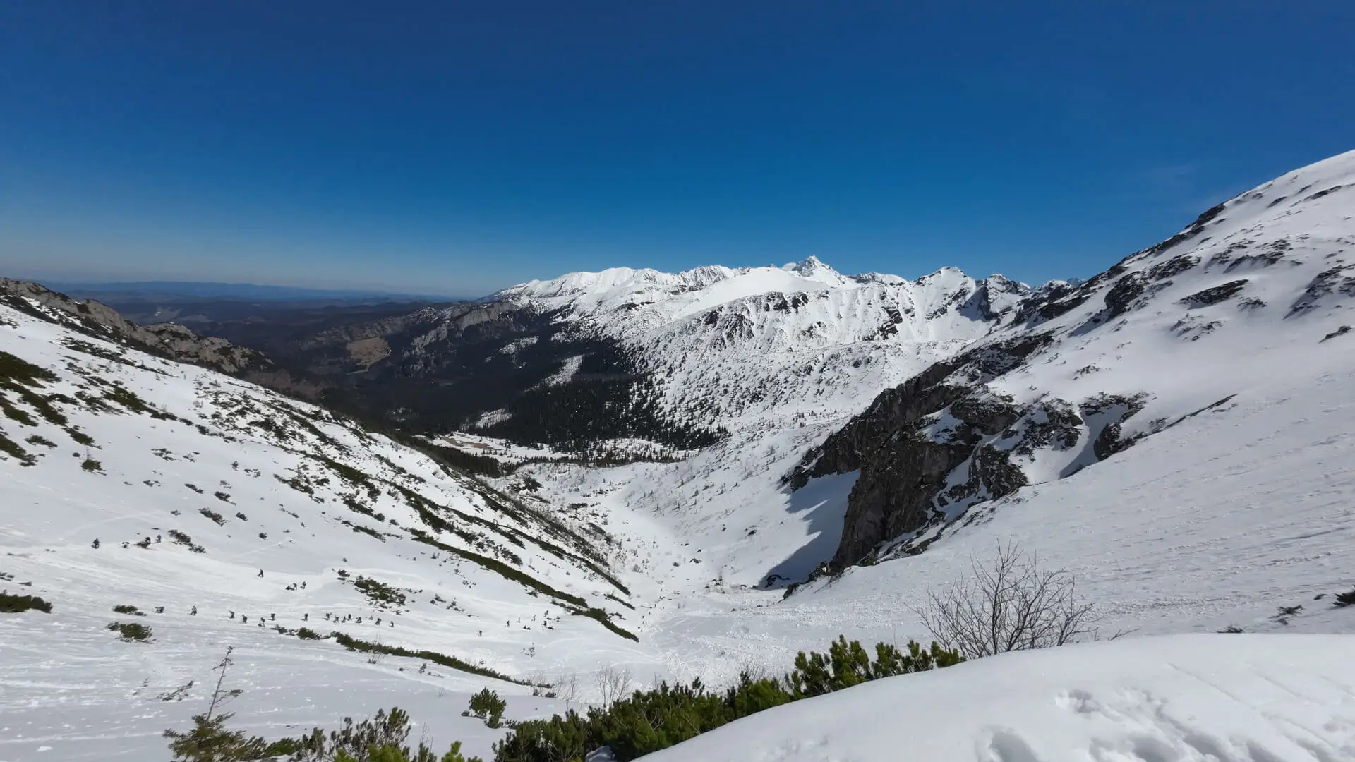
The reward at the summit is worth the effort. Giewont offers a unique perspective:
- North: Zakopane lies literally at our feet (more than 1,000 metres below).
- South: A magnificent panorama of the High and Western Tatras, with the nearby Czerwone Wierchy within reach.
Warnings (read this!)
- Deadly storms: The metal cross acts like a giant lightning rod. Giewont is the most dangerous place in the Tatras during a storm. If you see dark clouds - turn back immediately. Do not take any risks.
- Queues: In summer (July-August) and on clear weekends, huge queues form before the chains. Waiting times can range from 30 minutes to even 2 hours. To avoid this, set off at dawn (start at 6:00 a.m.).
- Slippery rocks: The limestone on the summit is so polished by millions of boots that it resembles an ice rink - even on a dry day. Good hiking boots are essential (trainers can slip).
Practical information
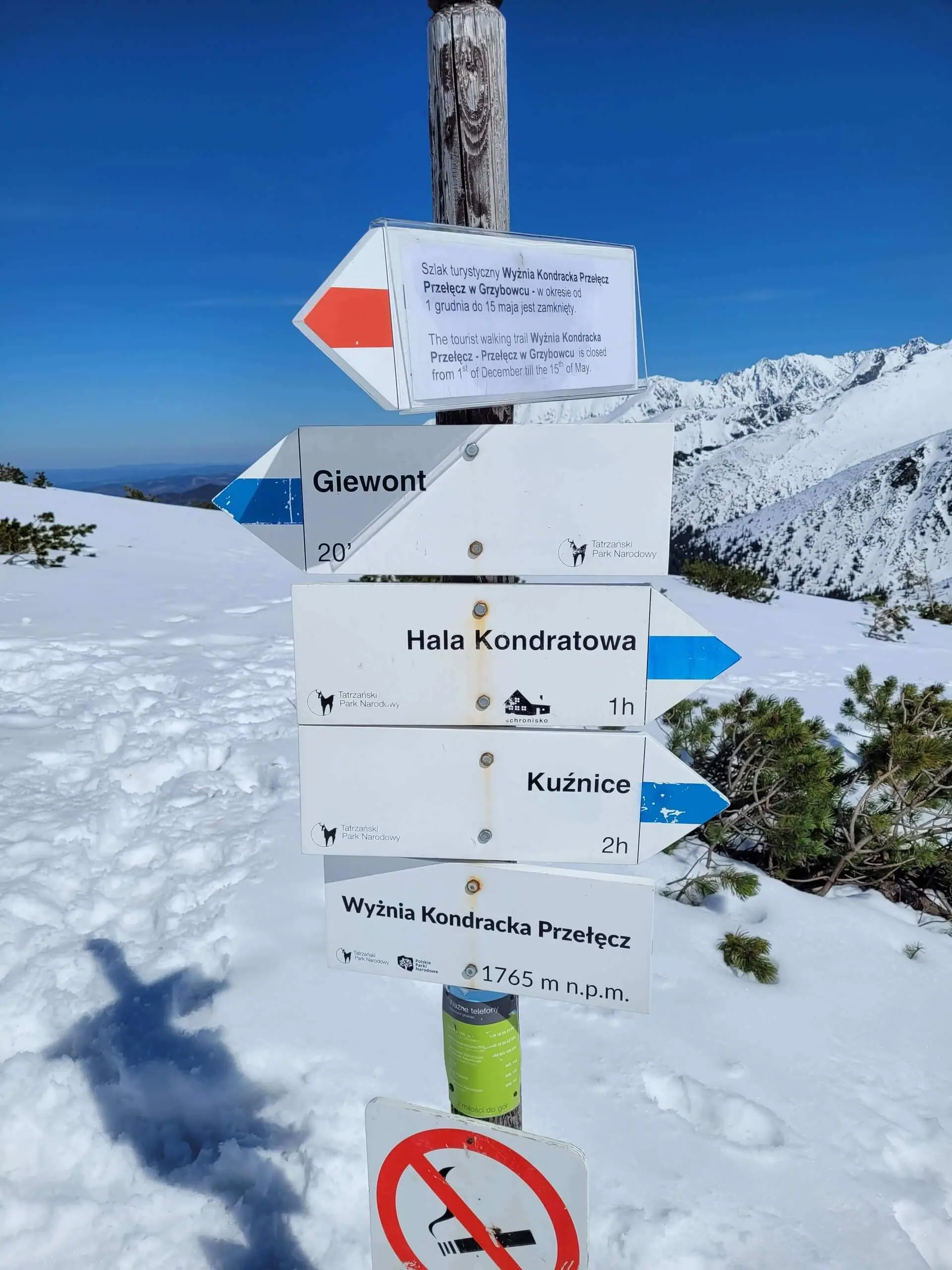
- Return: Do not go back up against the flow! Descend by the dedicated return route (loop), which joins the ascent trail at the pass.
- Alternative: An interesting descent option is the red trail via Grzybowiec to Dolina Strążyska (note: steeper and closed in winter).
What to see
Map - Map and trail profile
Pytania i odpowiedzi - Questions and answers
Are there chains on Giewont?
Is Giewont difficult?
What should I do during a storm?
Photo gallery
Similar trails
- Difficulty: 21.4 km Duration: 10 h 10 min
Banówka (Baníkov)
Difficulty: difficult (high exposure, climbing, chains!)
#slovakia #western tatras #západné tatry +3View trail - Difficulty: 23.9 km Duration: 9 h 34 min
Szpiglasowy Wierch (via Ceprostrada)
Difficulty: medium / difficult
#high tatras #panorama #chains +2View trail - Difficulty: 14.4 km Duration: 7 h 27 min
Małołączniak
Difficulty: medium / difficult (chains!)
#western tatras #chains #ridge +1View trail
Tags - Tags
Before you head to the mountains
- Check the weather forecast, mountain weather changes dynamically
- Match the trail to your abilities, don't overestimate your strength
- Take appropriate equipment: comfortable hiking boots, rain jacket, warm clothing, map, charged phone, first aid kit, power bank, food and water
- Inform someone about your plans, provide the route and expected return time
- Save the emergency number GOPR/TOPR, 601 100 300 or 985
- Buy a ticket to the Tatra National Park
Recent blog posts
 2026-07-27
Heat at the bottom, a fridge at the summit. How should you dress for the Tatras so you do not ruin the trip?
A sunny morning in Zakopane is the worst advisor when you are packing your backpack. See how the layering system works and why one clothing mistake can turn a summit hike into a nightmare.
#affiliate #gear #tips +5View post 2026-07-20
I betrayed the Tatras for the Pieniny. We did Sokolica and Trzy Korony in one day (with bikes!)
What to do when you are tired of the crowds under Giewont? Head to Szczawnica. Here is our plan for the perfect loop: hike up to the most famous peaks and cycle back along the Dunajec Gorge.
#pieniny #bikes #beyond the tatras +3View post 2026-07-13
I ate, I paid, and I didn’t go broke. Where to eat after hiking in Zakopane?
You hiked for 10 hours and you could eat a horse with hooves? Here’s what to try in Podhale without falling for tourist traps on Krupówki — and what’s actually worth paying for.
#food #tips #zakopane +1View post 2026-07-05
Mountain backpacks: Why your old school backpack will ruin your holiday
A gym sack on Rysy? A cube backpack from high school in the Kościeliska Valley? See why a good backpack matters as much as boots — and how to choose one without wasting money.
#gear #tips #backpack +1View post 2026-06-28
Want the High Tatras but scared of chains? The easiest rocky summits
Do you dream of “real”, sharp, rocky mountains, but the thought of exposure and chains makes your legs shake? Here’s a list of summits you’ll reach like climbing stairs — without climbing gear.
#easy routes #tips #high tatras +2View post 2026-06-21
Mountain gear: What you can save on and what’s worth paying extra for
A 2,000 zł jacket for a walk in the Kościeliska Valley? Overkill. But market boots on Świnica? That’s asking for trouble. Here’s what to cut costs on — and what to splurge on.
#gear #tips #boots +2View post
Did you find the information here useful? I spent quite a bit of time compiling it. If it helped you plan your trip, buy me a virtual coffee! ☕
Buy me a