Dolina Pięciu Stawów Polskich (The Valley of the Five Polish Lakes)
- Trail color
- Elevation
- 1671 m a.s.l.
- Total ascent
- 850 m
- Distance
- 16.5 km
- Difficulty
- average
- Duration
- 6 h
- Start
- Palenica Białczańska
- Finish
- Palenica Białczańska
- Family friendly
- No
- Dog friendly
- No
The Valley of the Five Polish Lakes is the very heart of the High Tatras. It is a rugged, rocky and breathtaking place, completely different from the forested western valleys. Here you will find Poland’s highest waterfall, deepest lakes and highest-altitude mountain hut.
This is a full-day hike that requires a good level of fitness, but presents no technical difficulties (there are no chains on the approach trail).
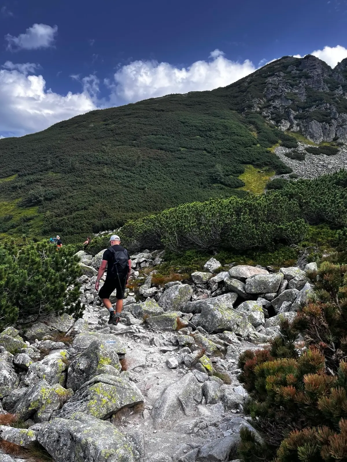
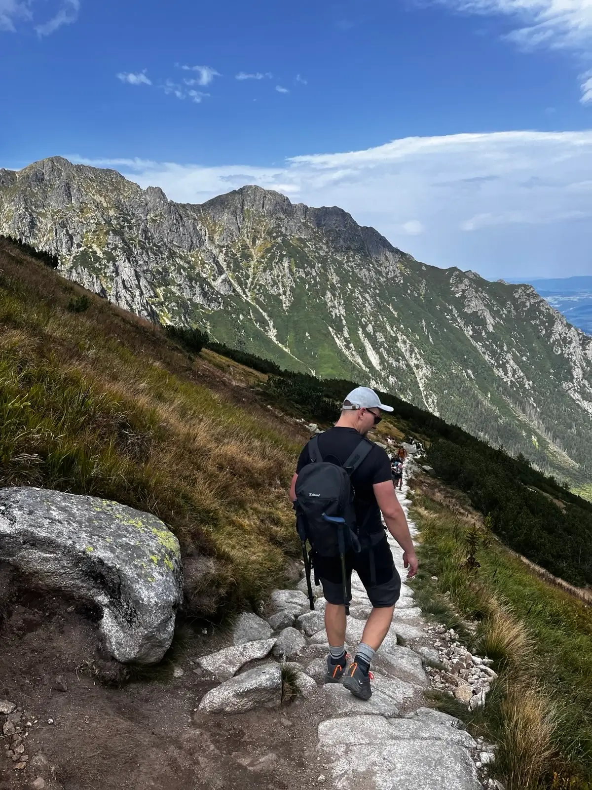
Stage 1: Through the Roztoka Valley
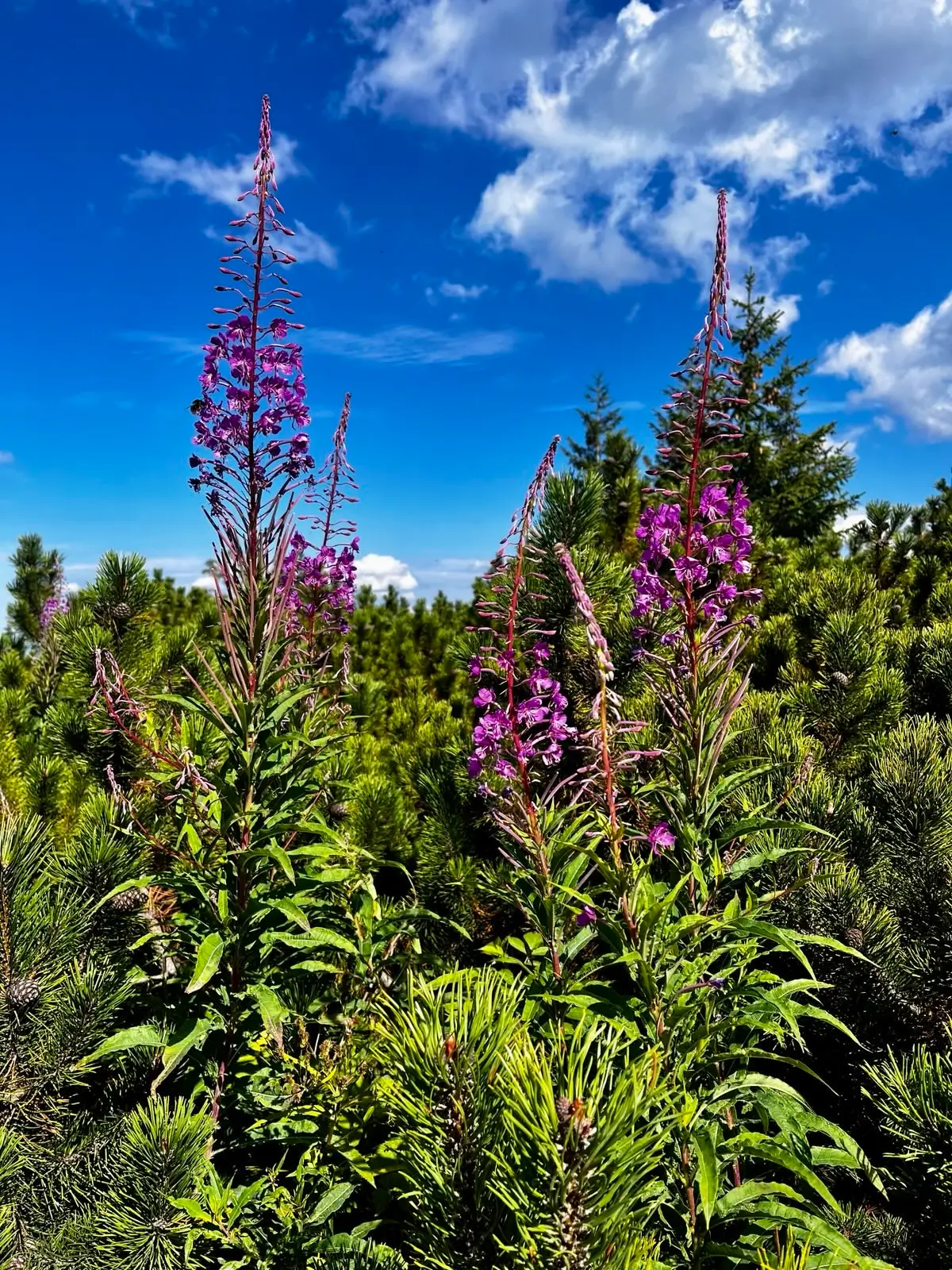
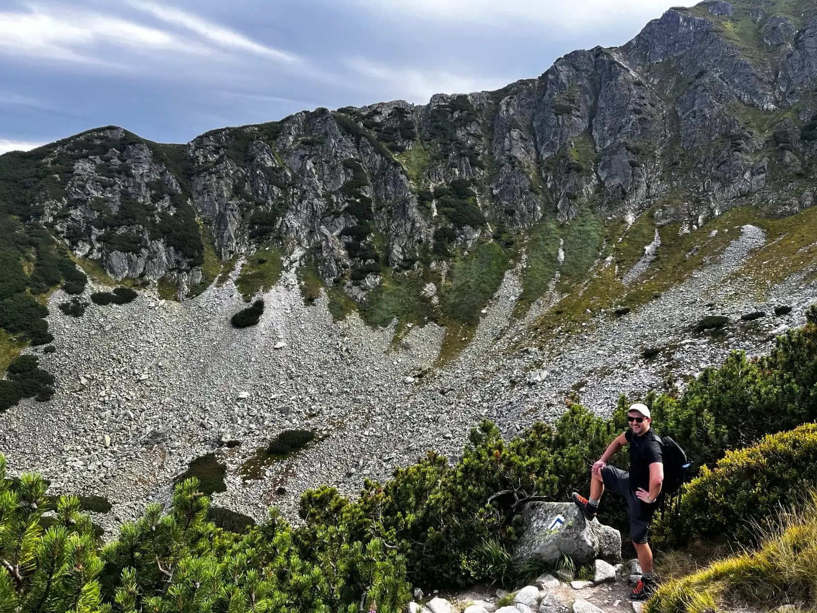
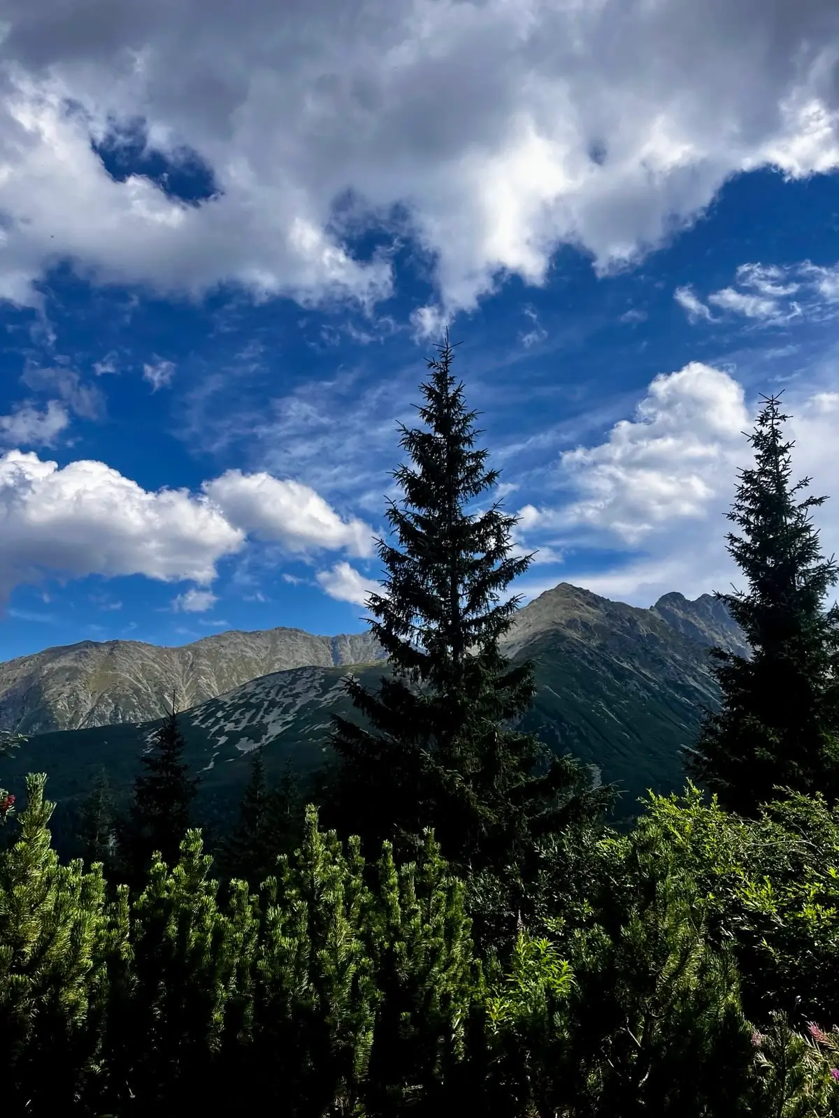
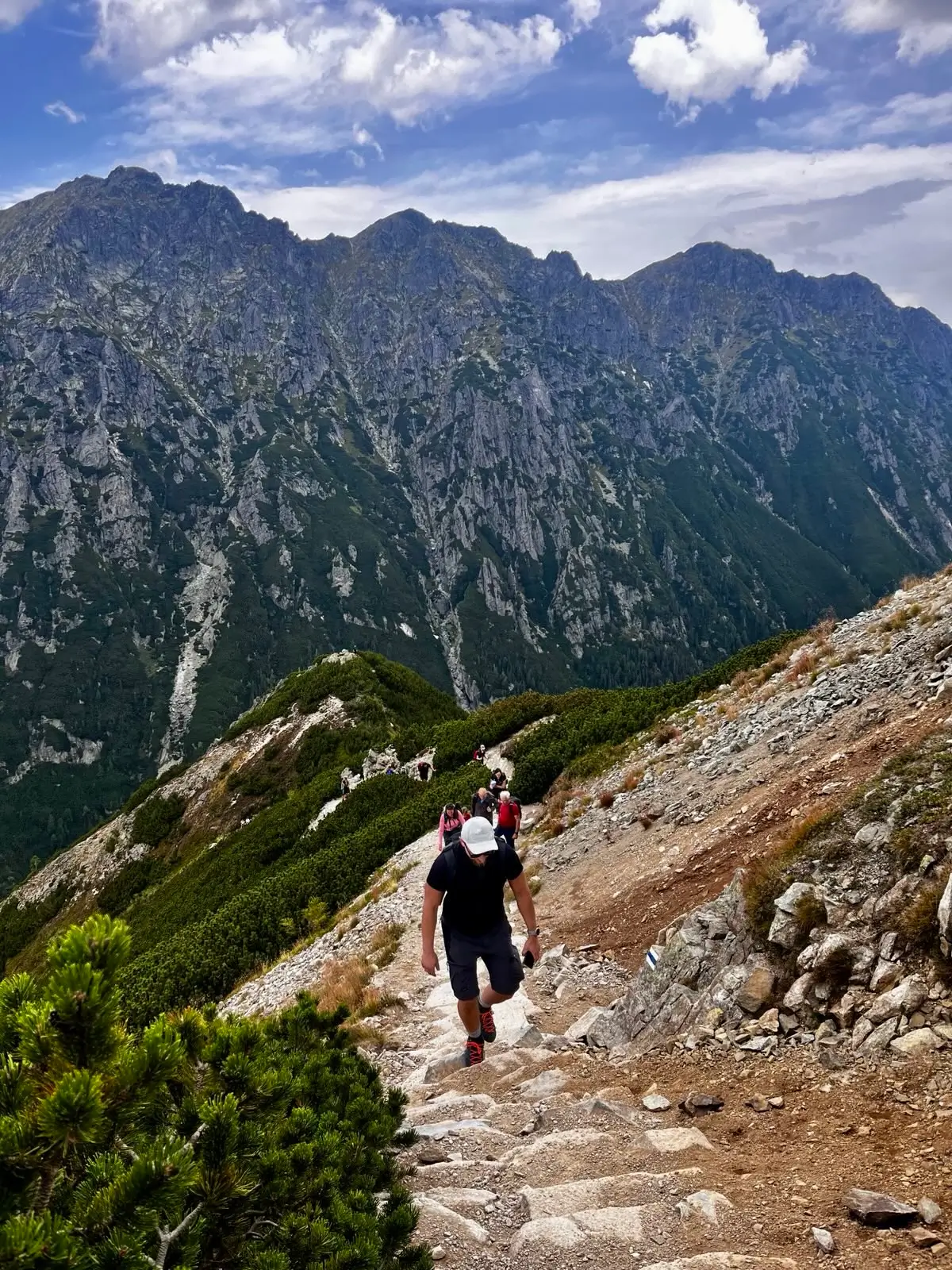
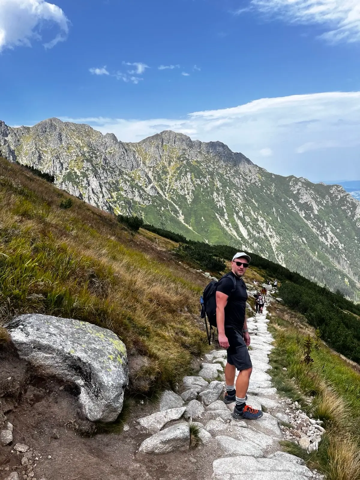
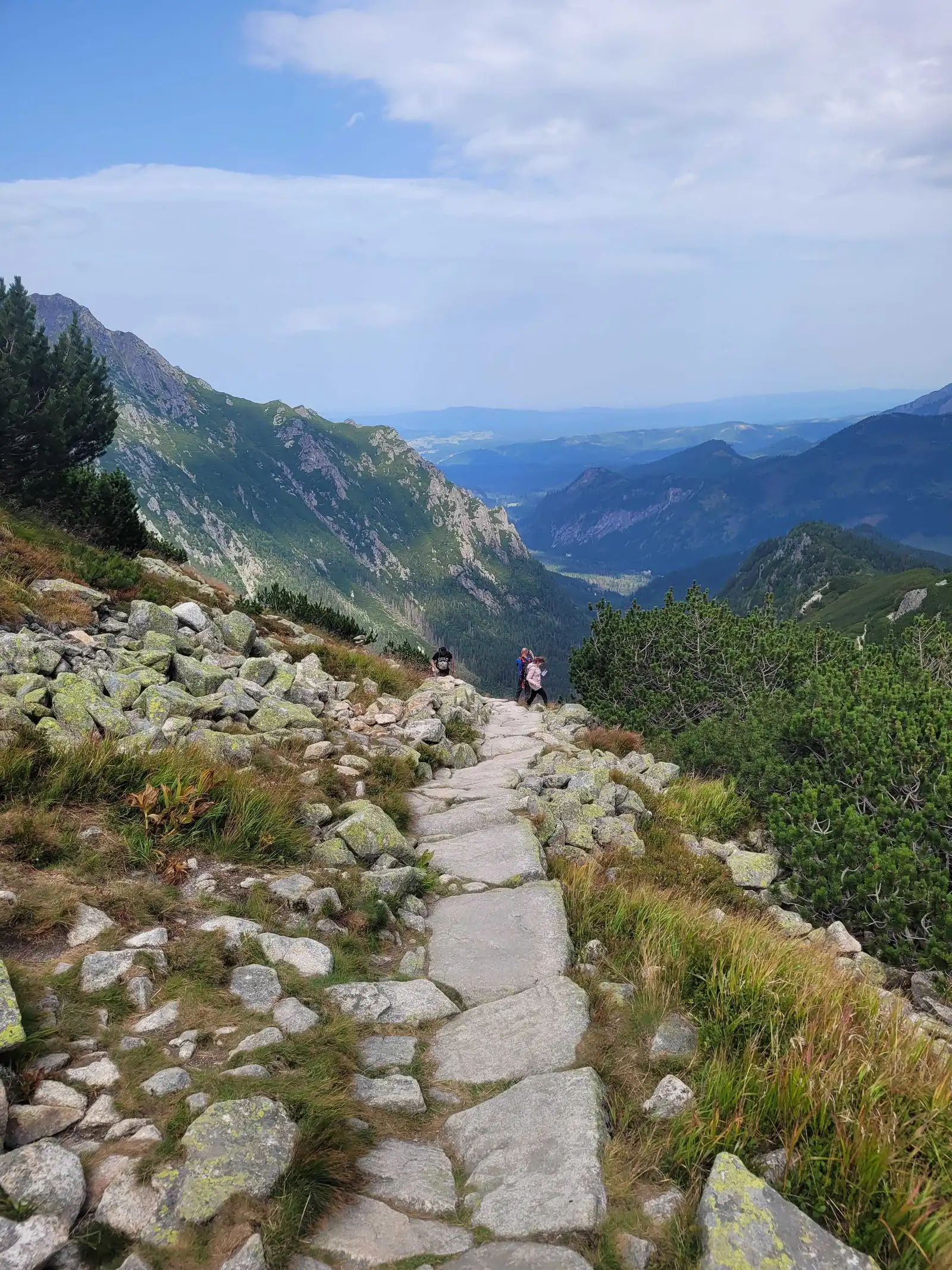
We set off from Palenica Białczańska. The first 40 minutes involve walking along a tarmac road amidst the crowds heading for Morskie Oko. Just past Wodogrzmoty Mickiewicza (the roaring waterfalls on the right), we turn right onto the green trail. This is where the real mountain adventure begins. The trail leads along the bottom of the Roztoka Valley, beside the stream. It is quieter here, and the forest gradually gives way to mountain pine, revealing views of Wołoszyn and Kozi Wierch.
Stage 2: Siklawa or Zakosy? (An important choice)
At the end of the valley, the trail forks. You have two options for reaching the mountain hut:
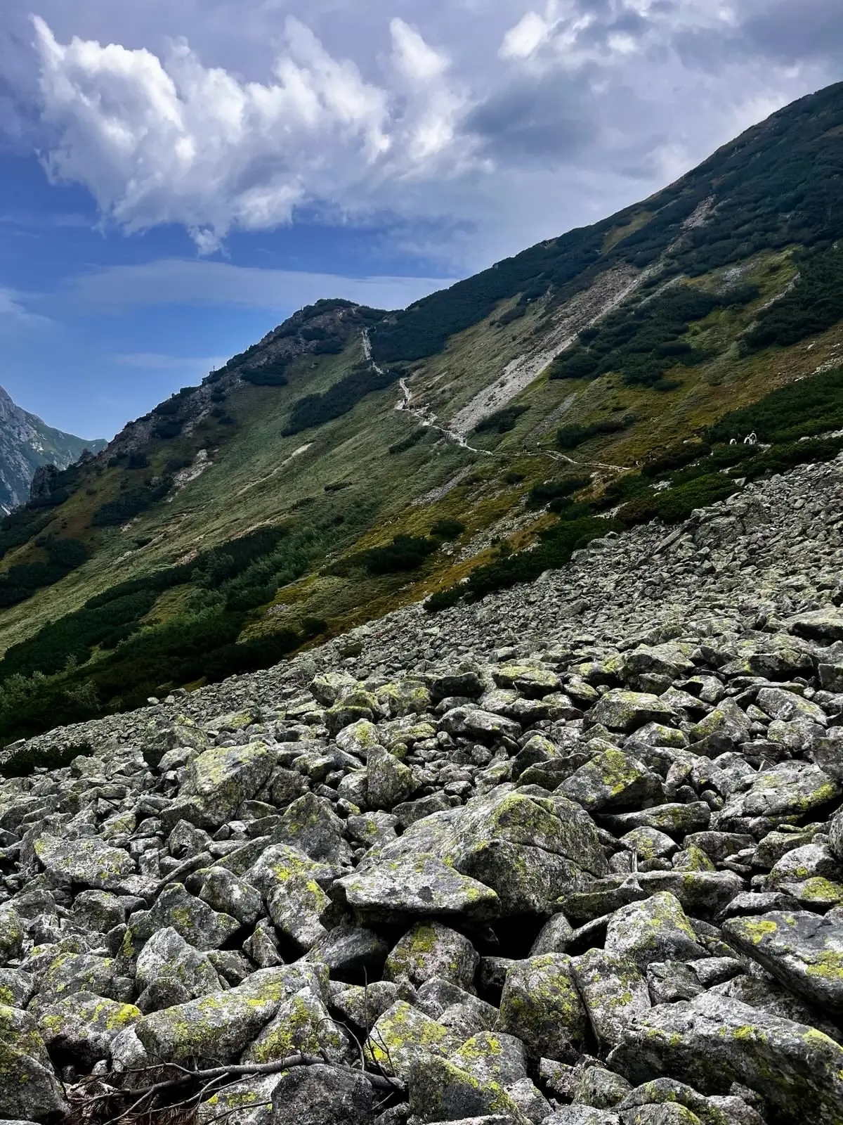
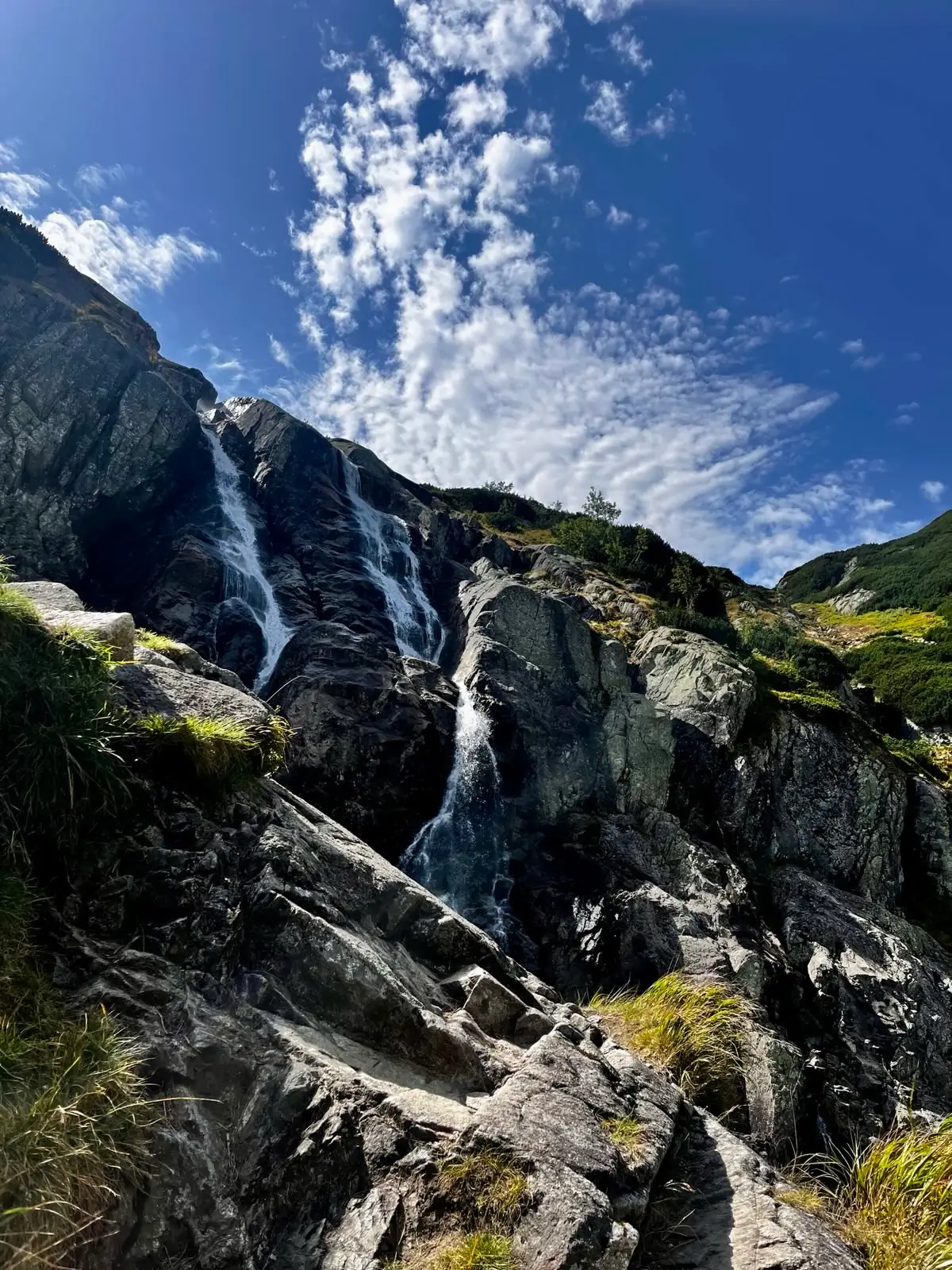
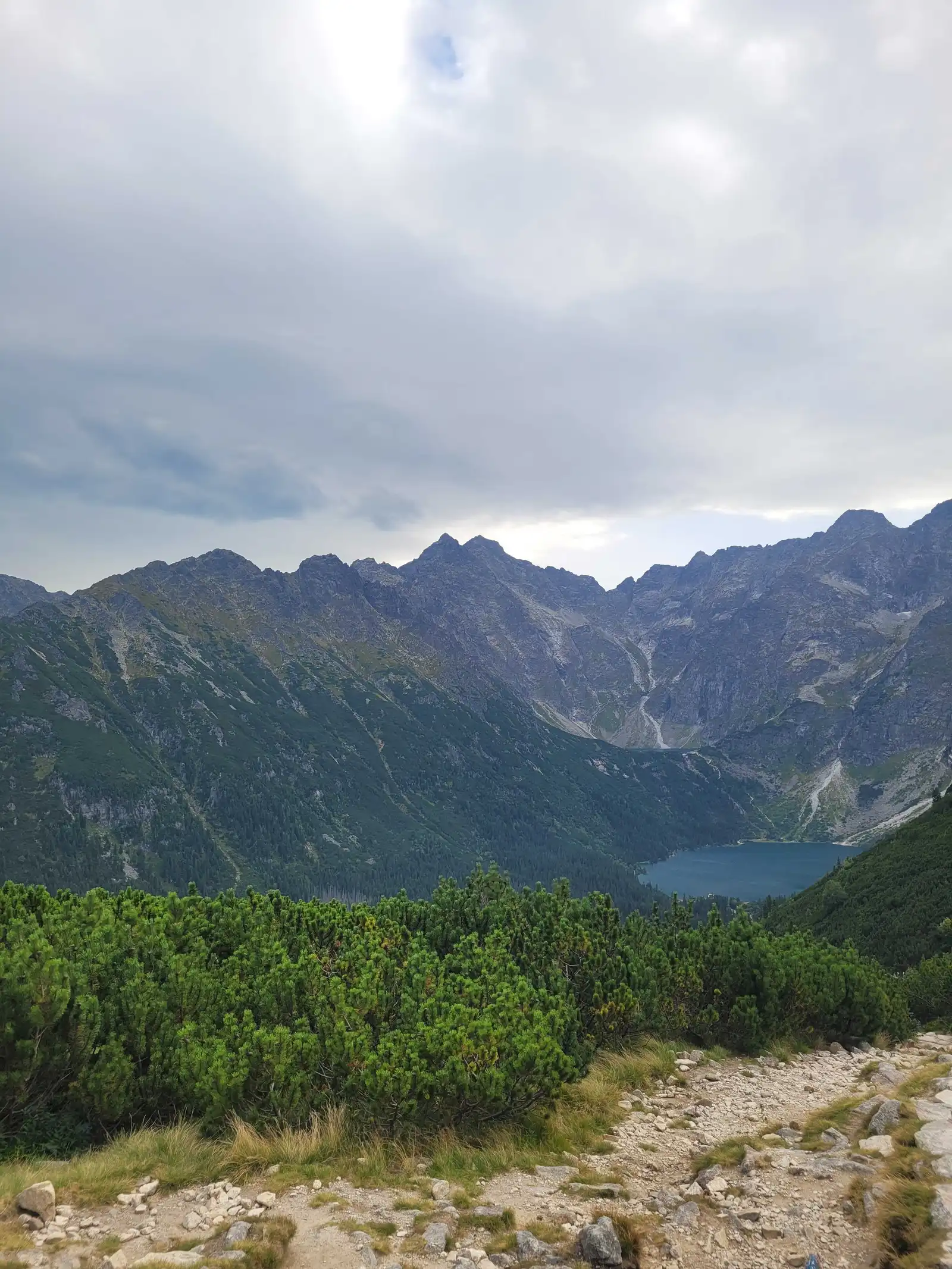
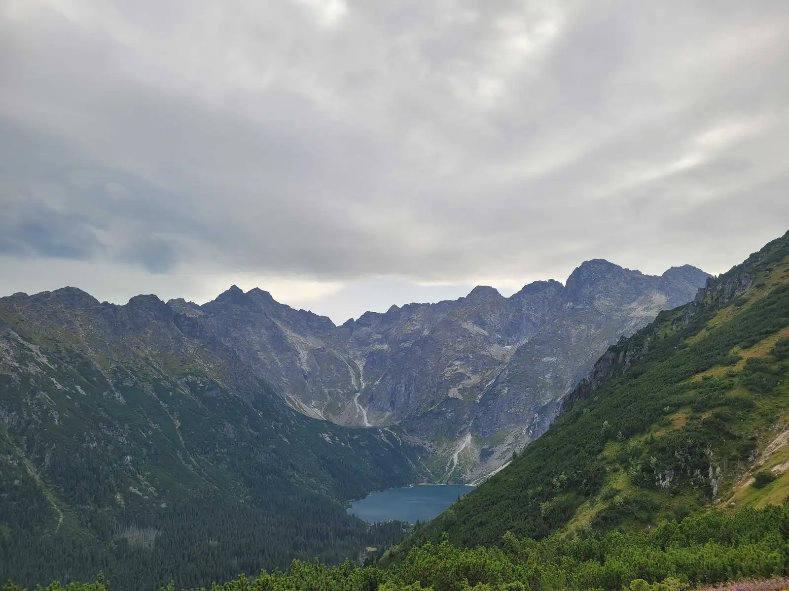
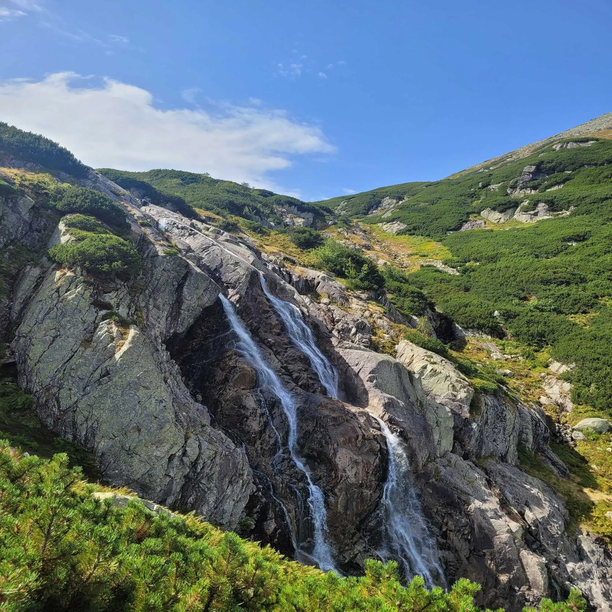
- Green Trail (Siklawa Route): Recommended in summer. It passes by Siklawa Waterfall (the largest waterfall in Poland, 70m high). The path runs over rock slabs, which are comfortable when dry but very slippery after rain.
- Black Trail (Zigzags): It bypasses the waterfall, winding its way through mountain pine straight to the mountain hut. It is shorter (about 10 minutes’ difference) and safer in winter or in the rain.
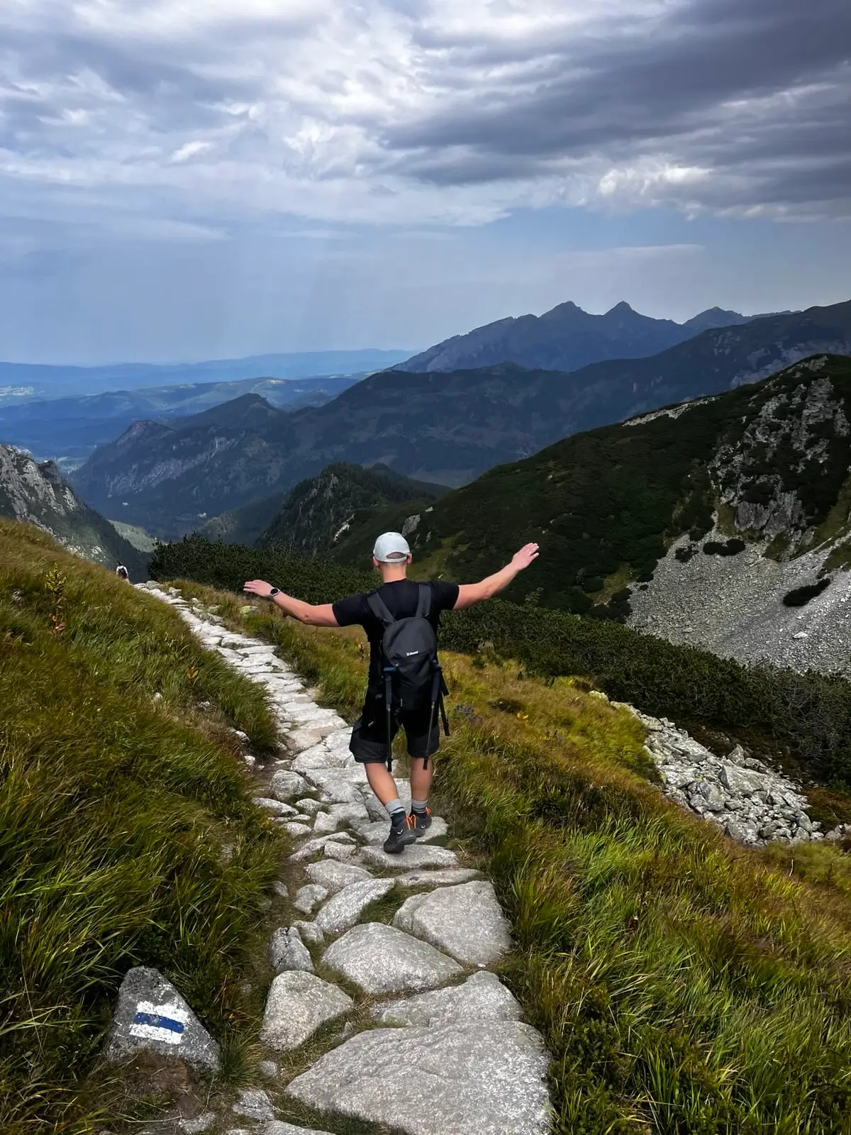
The Heart of the Valley
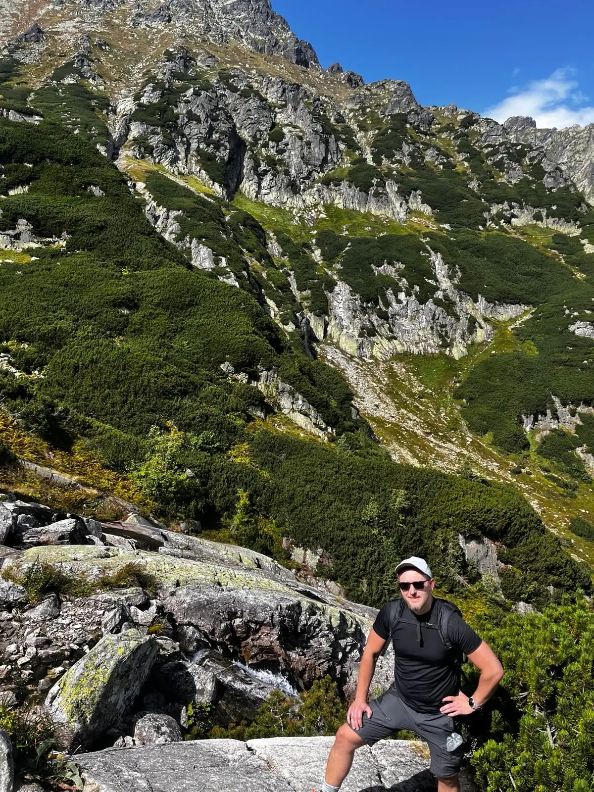
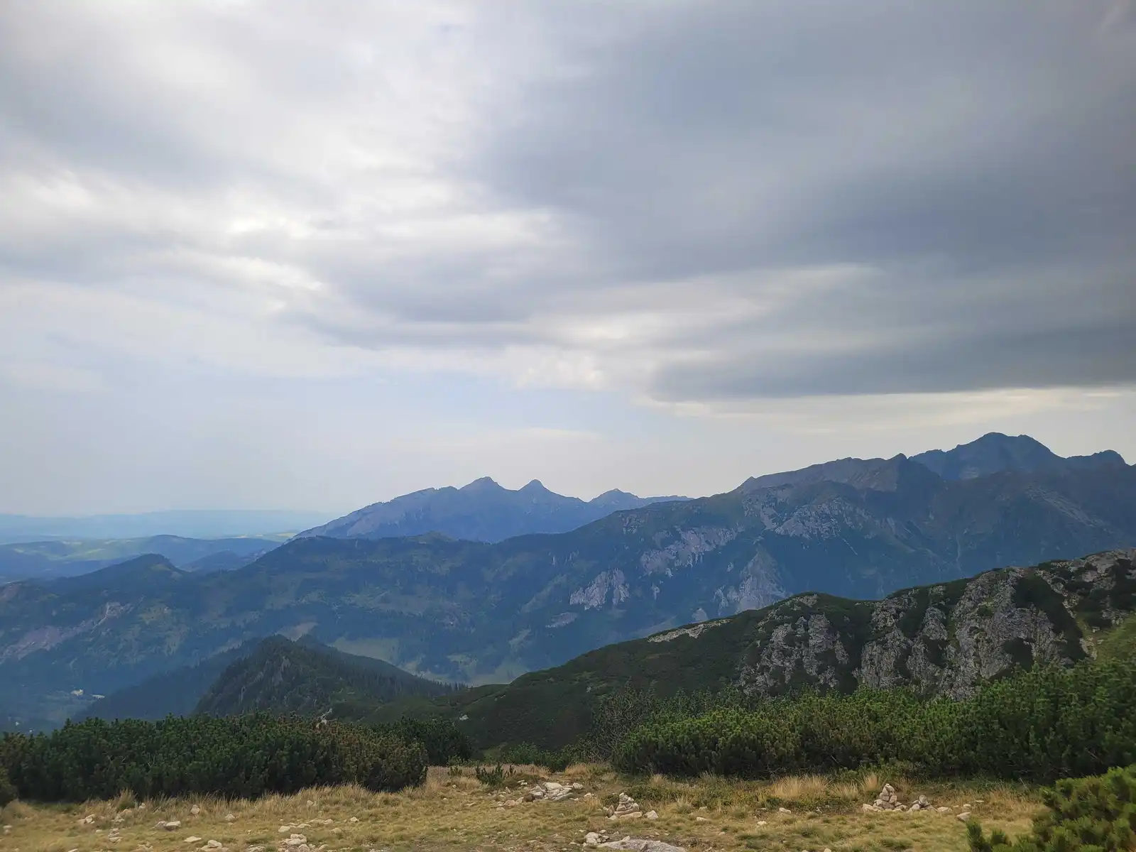
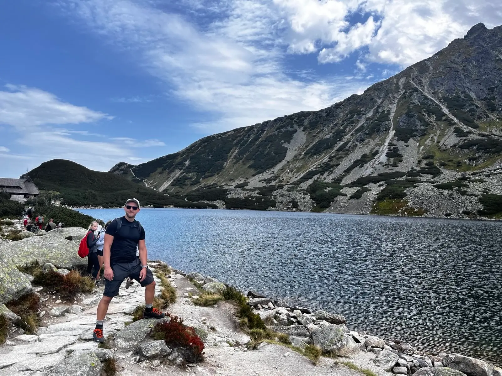
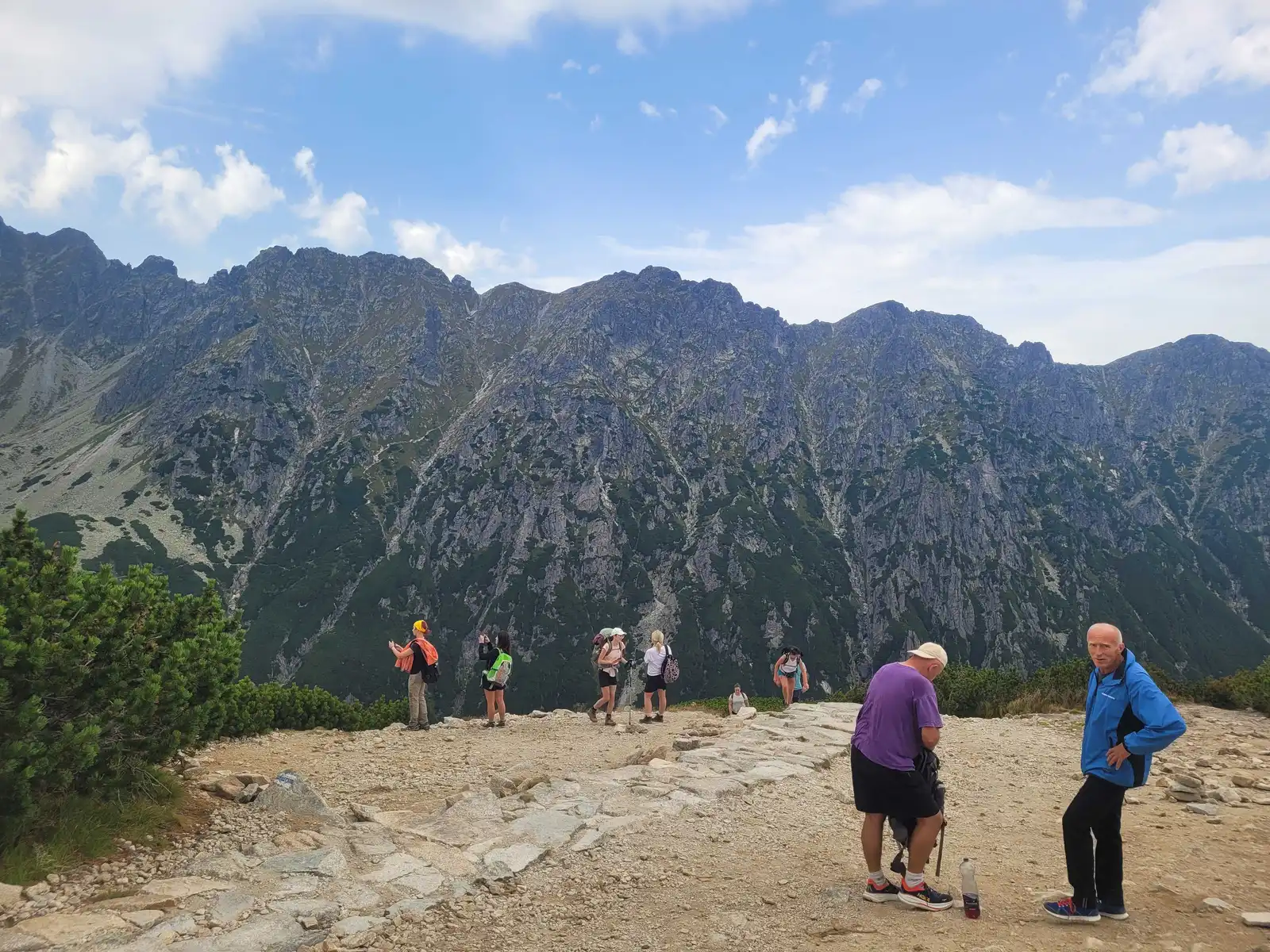
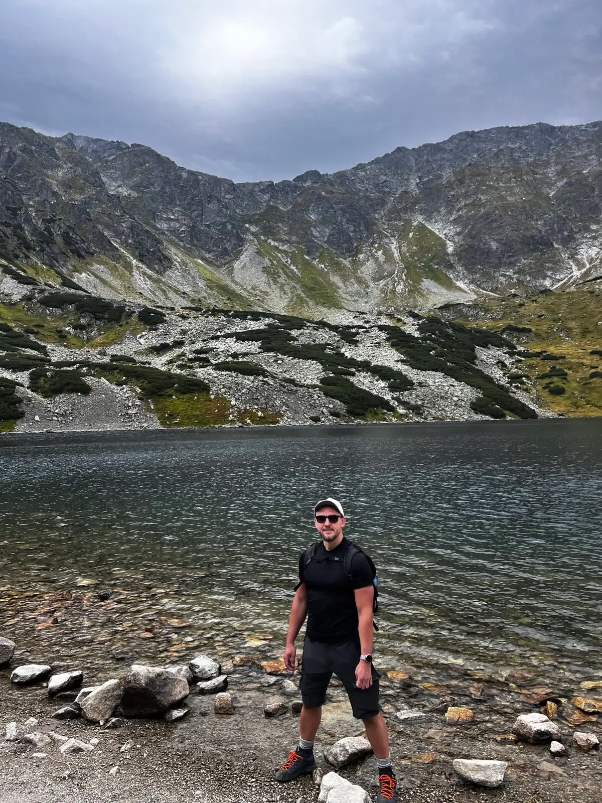
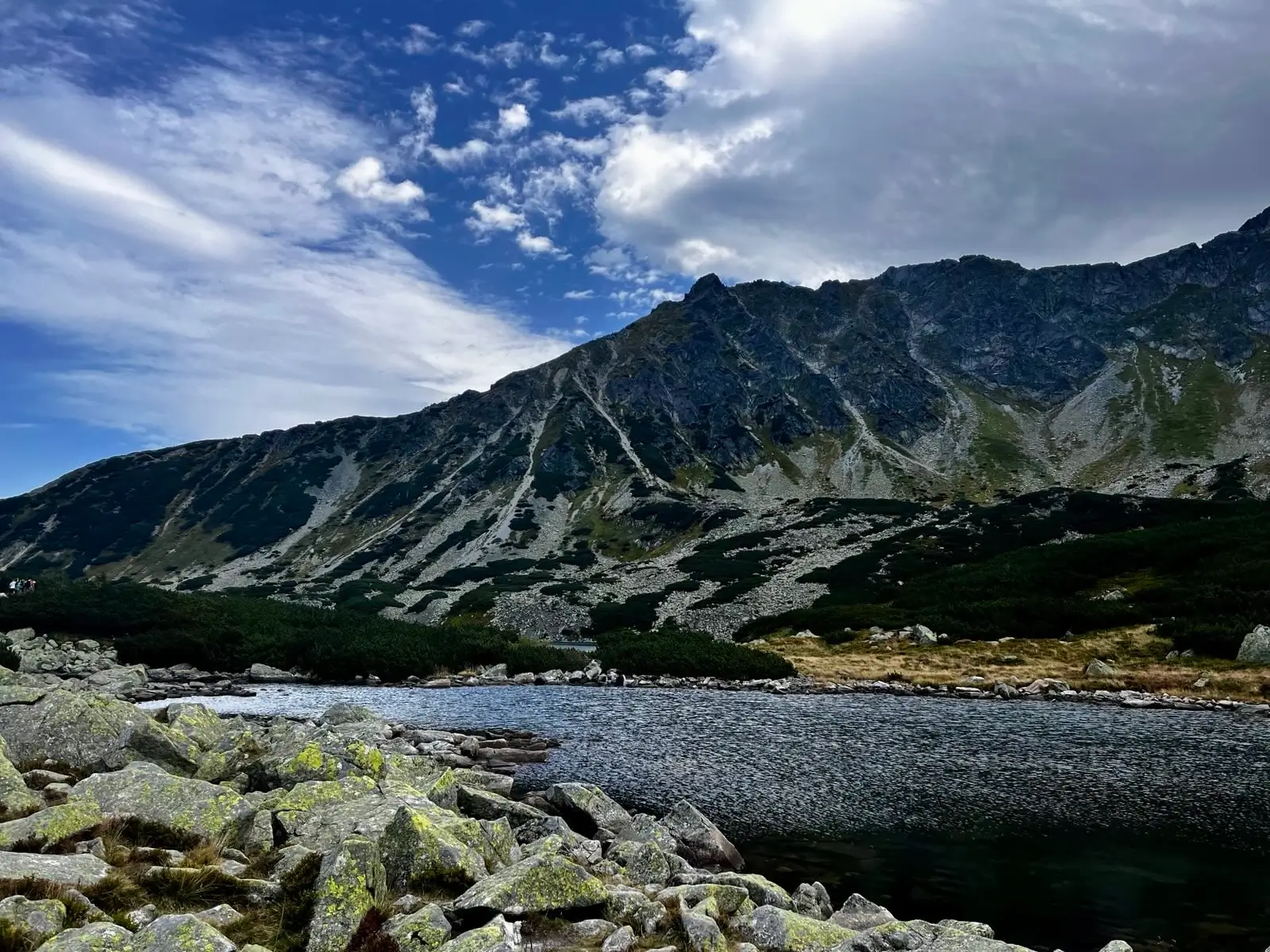
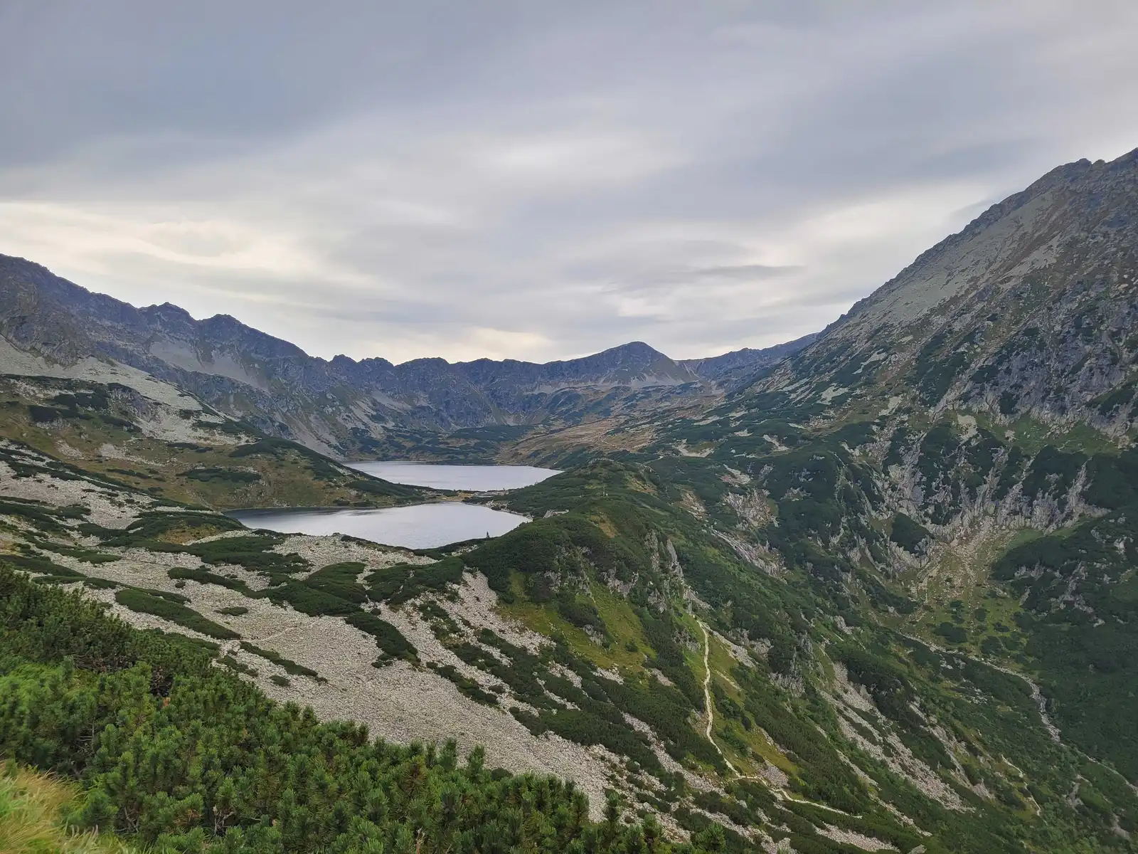
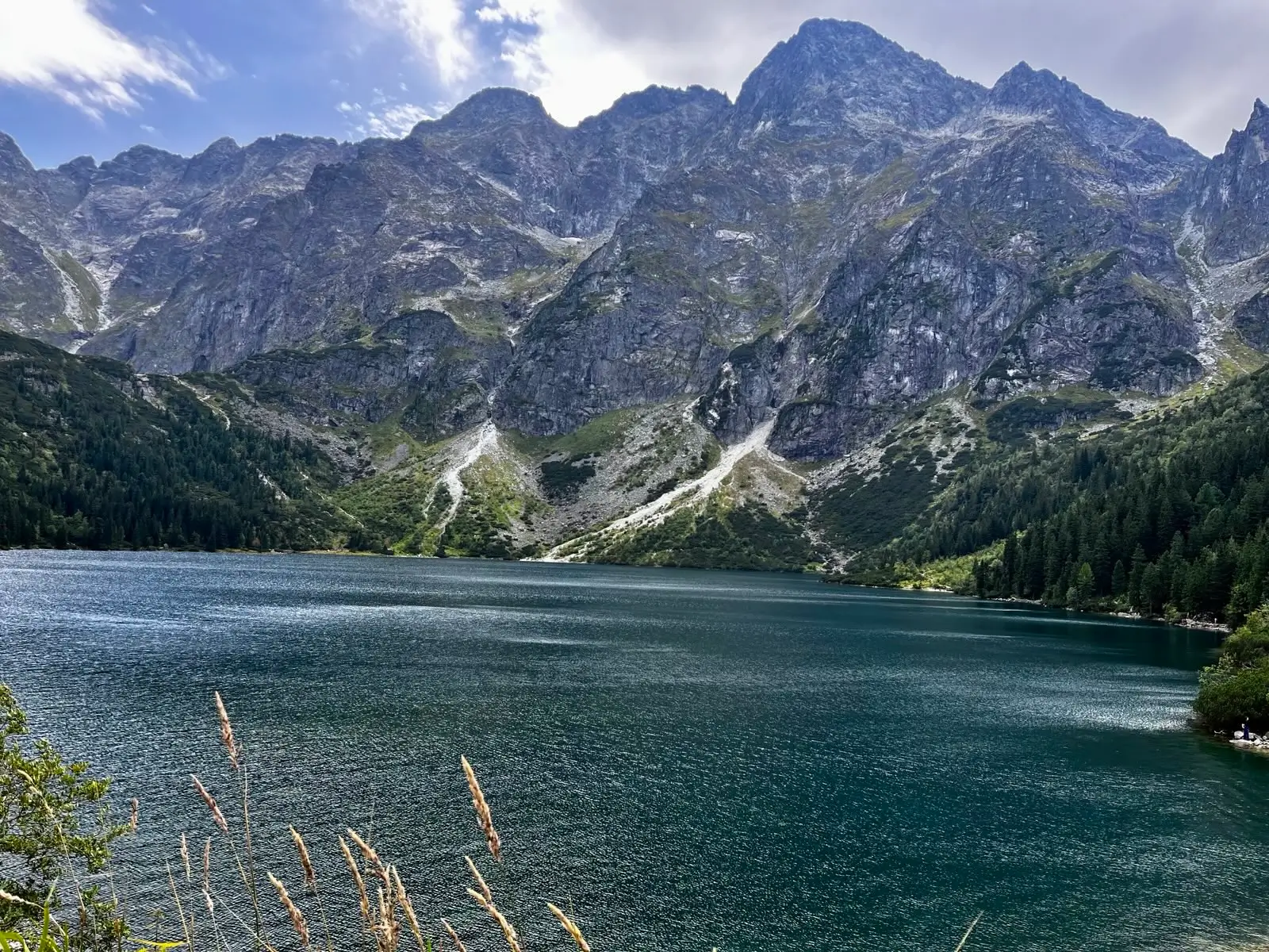
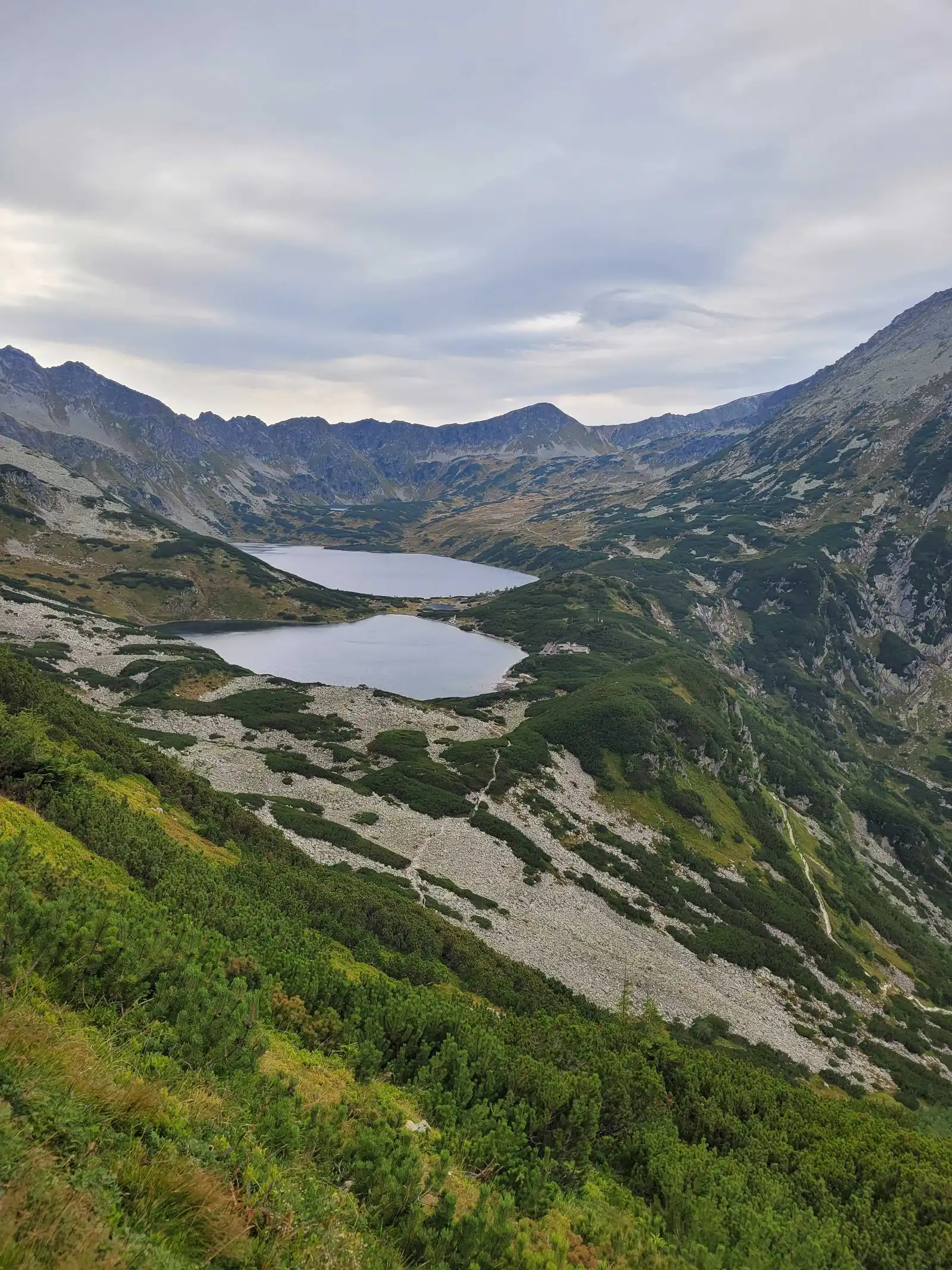
Once you’ve crossed the valley threshold, a breathtaking view unfolds: the surface of Wielki Staw Polski (the deepest and longest lake in the Tatra Mountains) against the backdrop of the mighty peaks of Orla Perć. A few hundred metres further on, above Przedni Staw, stands the famous PTTK Mountain Hut in the Valley of Five Lakes. It is the only mountain hut in the Polish Tatra Mountains that cannot be reached by car (not even the staff can get there), which creates a unique, truly mountainous atmosphere. A must-do is to try the local apple pie.
How to get back? (Options)
- Return via the same route: The safest option for those who are tired.
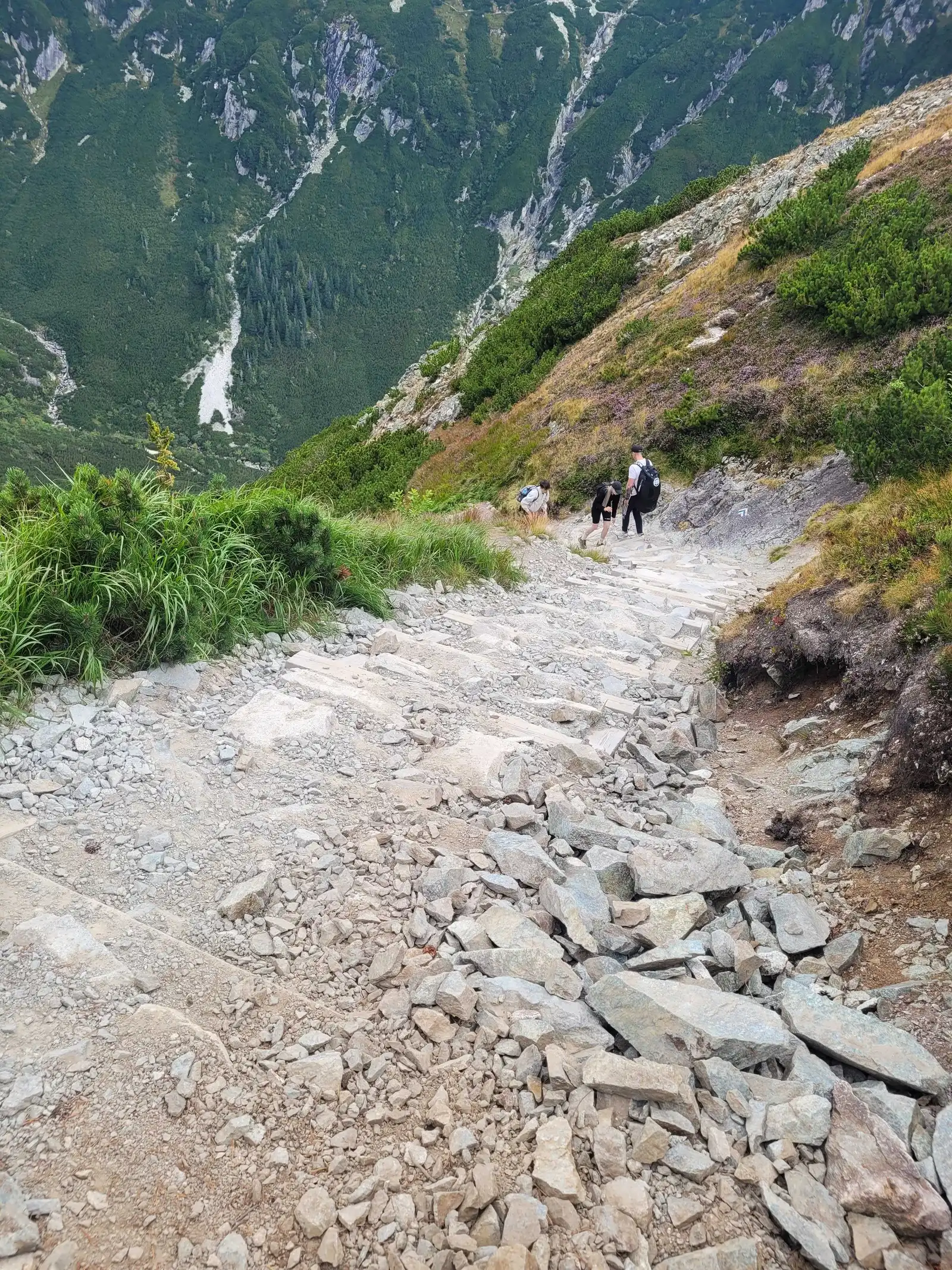
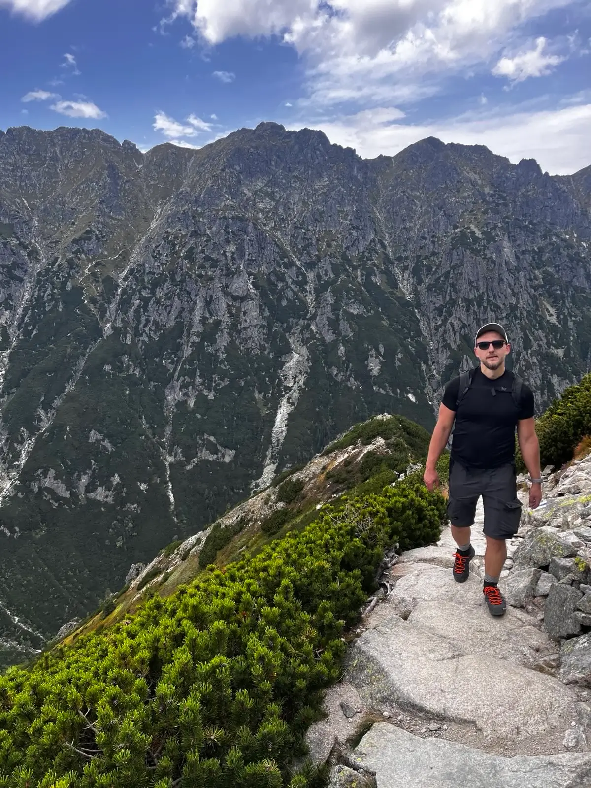
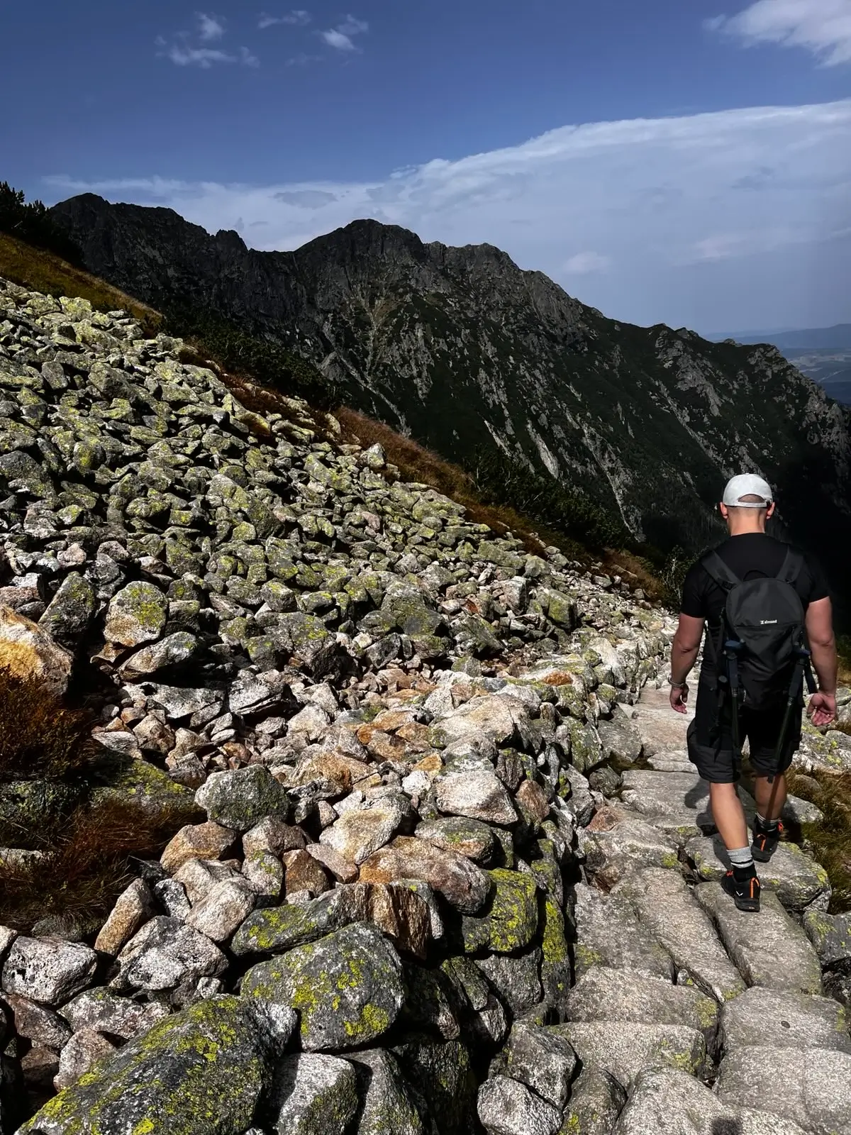
- Via Świstówka to Morskie Oko (Blue Trail): If you still have the energy, we recommend doing a loop. The trail via Świstówka Roztocka offers stunning views of both lakes (Morskie Oko and Pięć Stawów) from above. The descent leads straight down to the tarmac road to Morskie Oko. Note: This trail is closed in winter (1 December – 15 May)!
Practical information
- Winter: The Valley of Five Lakes is an area at high risk of avalanches. In winter, the green trail next to Siklawa is extremely dangerous – you must only follow the marked winter route (marked with poles).
- Wind: Due to the open terrain, very strong winds often blow in the valley. Even in summer, it is advisable to bring a hat and a jacket.
- Parking: Online booking is required for the car park in Palenica Białczańska (as at Morskie Oko).
What to see
Map - Map and trail profile
Pytania i odpowiedzi - Questions and answers
“Is the trail difficult?”
Which way should I go: the green trail or the black trail?
Photo gallery


Similar trails
- Difficulty: 15.5 km Duration: 4 h 14 min
Morskie Oko
Difficulty: easy
#high tatras #lake #family-friendly +4View trail - Difficulty: 15.6 km Duration: 8 h 27 min
Czerwone Wierchy (Red Peaks)
Difficulty: average
#western tatras #ridge #fitness +2View trail - Difficulty: 20.6 km Duration: 10 h 23 min
Jagnięcy Szczyt (Jahňací štít)
Difficulty: difficult (very long + chain section)
#slovakia #high tatras #chains +2View trail
Tags - Tags
Before you head to the mountains
- Check the weather forecast, mountain weather changes dynamically
- Match the trail to your abilities, don't overestimate your strength
- Take appropriate equipment: comfortable hiking boots, rain jacket, warm clothing, map, charged phone, first aid kit, power bank, food and water
- Inform someone about your plans, provide the route and expected return time
- Save the emergency number GOPR/TOPR, 601 100 300 or 985
- Buy a ticket to the Tatra National Park
Recent blog posts
 2026-07-27
Heat at the bottom, a fridge at the summit. How should you dress for the Tatras so you do not ruin the trip?
A sunny morning in Zakopane is the worst advisor when you are packing your backpack. See how the layering system works and why one clothing mistake can turn a summit hike into a nightmare.
#affiliate #gear #tips +5View post 2026-07-20
I betrayed the Tatras for the Pieniny. We did Sokolica and Trzy Korony in one day (with bikes!)
What to do when you are tired of the crowds under Giewont? Head to Szczawnica. Here is our plan for the perfect loop: hike up to the most famous peaks and cycle back along the Dunajec Gorge.
#pieniny #bikes #beyond the tatras +3View post 2026-07-13
I ate, I paid, and I didn’t go broke. Where to eat after hiking in Zakopane?
You hiked for 10 hours and you could eat a horse with hooves? Here’s what to try in Podhale without falling for tourist traps on Krupówki — and what’s actually worth paying for.
#food #tips #zakopane +1View post 2026-07-05
Mountain backpacks: Why your old school backpack will ruin your holiday
A gym sack on Rysy? A cube backpack from high school in the Kościeliska Valley? See why a good backpack matters as much as boots — and how to choose one without wasting money.
#gear #tips #backpack +1View post 2026-06-28
Want the High Tatras but scared of chains? The easiest rocky summits
Do you dream of “real”, sharp, rocky mountains, but the thought of exposure and chains makes your legs shake? Here’s a list of summits you’ll reach like climbing stairs — without climbing gear.
#easy routes #tips #high tatras +2View post 2026-06-21
Mountain gear: What you can save on and what’s worth paying extra for
A 2,000 zł jacket for a walk in the Kościeliska Valley? Overkill. But market boots on Świnica? That’s asking for trouble. Here’s what to cut costs on — and what to splurge on.
#gear #tips #boots +2View post
Did you find the information here useful? I spent quite a bit of time compiling it. If it helped you plan your trip, buy me a virtual coffee! ☕
Buy me a