Lake — Tatra trails and posts
Found 17 results for lake
Trails (17)
 Distance: 19.1 kmDuration: 5 h 54 min
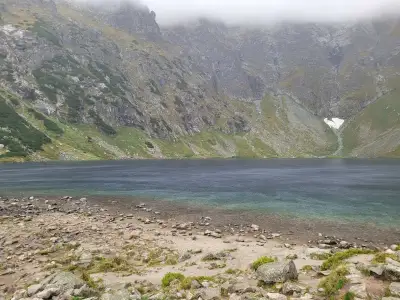
Czarny Staw pod Rysami
Czarny Staw pod Rysami, the lake above Morskie Oko: 19.1 km, 5 h 54 min from Palenica Białczańska, no chains. Tarmac road, then stone steps above Morskie Oko.
Difficulty: medium
#high tatras#lake#views+2View trail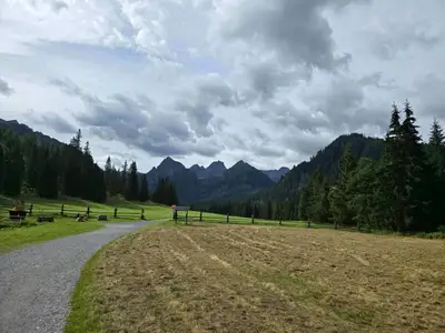 Distance: 24.7 kmDuration: 7 h 38 min
Dolina Białej Wody (Bielovodská dolina)
Bielovodská Valley (Dolina Białej Wody) from Łysa Polana to Litworowy Staw: 24.7 km, 7 h 38 min, no chains. Times to each meadow, closures 1 Nov – 31 May.
Difficulty: moderate (long)
#slovakia#high tatras#quiet+2View trail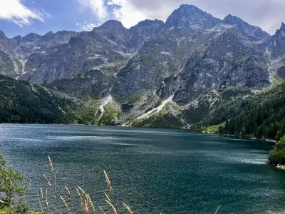 Distance: 16.5 kmDuration: 5 h 45 min
Dolina Pięciu Stawów Polskich (The Valley of the Five Polish Lakes)
Dolina Pięciu Stawów (Five Polish Lakes Valley) from Palenica via Wielka Siklawa, Poland's highest waterfall: 16.5 km, 5 h 45 min, no chains. Parking, ways back.
Difficulty: average
#high tatras#lake#waterfall+2View trailNo photo Distance: 20.6 kmDuration: 10 h 25 minJagnięcy Szczyt (Jahňací štít)
Jahňací štít (Jagnięcy Szczyt, 2230 m) from Biela Voda via Zelené pleso: 20.6 km, 10 h 25 min, chains below the summit. A long day. Closed 1 Nov – 31 May.
Difficulty: difficult (chains + long)
#slovakia#high tatras#chains+2View trailNo photo Distance: 20.9 kmDuration: 8 h 37 minKoprowy Wierch (Kôprovský štít)
Kôprovský štít (Koprowy Wierch, 2363 m) from Štrbské Pleso via Popradské pleso: 20.9 km, 8 h 37 min, no chains, hands on the ridge. Closed 1 Nov – 31 May.
Difficulty: difficult (physically)
#slovakia#high tatras#lake+2View trailNo photo Distance: 20.9 kmDuration: 9 h 25 minPrzełęcz Krzyżne
Krzyżne Pass from Palenica via the Five Lakes Valley, down the Pańszczyca Valley to Kuźnice: 20.9 km, 9 h 25 min, no chains. A famous High Tatras panorama.
Difficulty: difficult (physically)
#high tatras#fitness#lake+2View trailNo photo Distance: 23.2 kmDuration: 10 h 49 minMięguszowiecka Pass below Chłopek
Mięguszowiecka Przełęcz pod Chłopkiem from Palenica via Morskie Oko and Czarny Staw: 23.2 km, 10 h 49 min, no chains but exposure and scrambling on rock.
Difficulty: very difficult
#high tatras#exposure#fitness+2View trail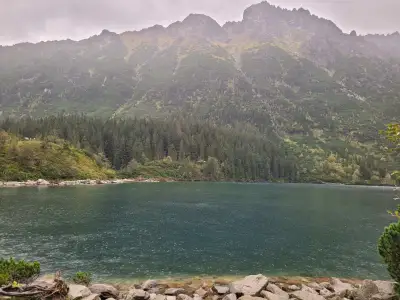 Distance: 15.5 kmDuration: 4 h 14 min
Morskie Oko
Morskie Oko from Palenica Białczańska on the tarmac road: 15.5 km, 4 h 14 min, easy, pushchair-friendly. Parking reservation, buses from Zakopane, horse carts.
Difficulty: easy
#high tatras#lake#for family+2View trailNo photo Distance: 9.6 kmDuration: 3 hPopradské pleso and the Symbolic Cemetery
Popradské pleso from the Tatra electric railway stop and the Symbolic Cemetery under Ostrva: 9.6 km, 3 h, +280 m, easy. A simple walk in the Slovak High Tatras.
Difficulty: easy
#slovakia#high tatras#lake+2View trailNo photo Distance: 13 kmDuration: 5 h 50 minRoháčske plesá (Rohackie Stawy)
Roháčske plesá (Rohackie Stawy): a waterfall, four lakes and Ťatliakova chata. 13 km, 5 h 50 min, no chains. Trail closed from 1 Nov to 15 Jun.
Difficulty: moderate
#slovakia#western tatras#lake+2View trail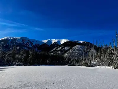 Distance: 13.5 kmDuration: 3 h 52 min
Smreczyński Staw
Smreczyński Staw from Kiry via the Kościeliska Valley and the Ornak hut: 13.5 km, 3 h 52 min, easy, no chains. A quiet lake in a spruce forest near Zakopane.
Difficulty: easy
#western tatras#lake#for family+2View trail- Distance: 20.3 kmDuration: 7 h 15 min
Świstówka Roztocka
Loop from Palenica via the Roztoka Valley, the Five Polish Lakes and Świstówka to Morskie Oko: 20.3 km, 7 h 15 min, no chains. Closed 1 Dec – 15 May.
Difficulty: moderate (long, exposed descent)
#high tatras#lake#loop+2View trail - Distance: 24.2 kmDuration: 9 h 22 min
Szpiglasowy Wierch from Five Lakes
Szpiglasowy Wierch from Palenica via the Five Polish Lakes Valley, chains on the way up, down the Ceprostrada to Morskie Oko: 24.2 km, 9 h 22 min.
Difficulty: medium / difficult
#high tatras#chains#panorama+2View trail No photo Distance: 21.5 kmDuration: 8 h 41 minWielka Świstówka (Veľká Svišťovka)
Veľká Svišťovka from Biela Voda via Zelené pleso and Skalnaté pleso: 21.5 km, 8 h 41 min, chains. Cable car option down. Closed 1 Nov – 31 May.
Difficulty: difficult (chains)
#slovakia#high tatras#chains+2View trailNo photo Distance: 22.9 kmDuration: 8 h 39 minWrota Chałubińskiego
Wrota Chałubińskiego (2022 m) from Palenica via Morskie Oko and the valley behind Mnich: 22.9 km, 8 h 39 min, no chains. A dead-end pass, return the same way.
Difficulty: difficult (physically)
#high tatras#lake#quiet+1View trail- Distance: 11.3 kmDuration: 4 h 45 min
Zawrat from Five Lakes
Zawrat Pass (2158 m) from Palenica via the Five Polish Lakes Valley: 11.3 km, 4 h 45 min up, no chains. The easier side of the pass. When not to go on to Orla Perć.
Difficulty: medium
#high tatras#panorama#lake+1View trail No photo Distance: 15.4 kmDuration: 6 h 14 minZelené pleso (Chata pri Zelenom plese)
Zelené pleso (Zielony Staw Kieżmarski) from Biela Voda to the lakeside hut: 15.4 km, 6 h 14 min, no chains. Hut open all year, peaks above closed in winter.
Difficulty: moderate
#slovakia#high tatras#lake+2View trail