High Tatras trails
The High Tatras start gently at Morskie Oko and go vertical fast. The Valley of Five Lakes still has no chains, but the slabs under Siklawa after rain are worse than some “hard” summits. Kościelec and Rysy are a different conversation: exposure, queues, and the decision to turn around. Do not mix a first mountain day with an attack on Poland’s high point.
Found 41 results for high tatras
Trails (39)
No photo Distance: 16 kmDuration: 7 h 51 minBystrá lávka (Bystra Ławka)
Bystrá lávka (2300 m) from Štrbské Pleso via the Mlynická Valley and Skok waterfall, down the Furkotská Valley: 16 km, 7 h 51 min, chains. Closed 1 Nov – 31 May.
Difficulty: difficult (chains)
#slovakia#high tatras#chains+2View trail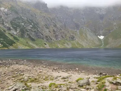 Distance: 19.1 kmDuration: 5 h 54 min
Czarny Staw pod Rysami
Czarny Staw pod Rysami, the lake above Morskie Oko: 19.1 km, 5 h 54 min from Palenica Białczańska, no chains. Tarmac road, then stone steps above Morskie Oko.
Difficulty: medium
#high tatras#lake#views+2View trailNo photo Distance: 17.9 kmDuration: 8 h 11 minPriečne sedlo (Czerwona Ławka)
Priečne sedlo (2352 m) from Hrebienok via Téryho chata to Zbojnícka chata: 17.9 km, 8 h 11 min, chains, rungs and exposure. Closed 1 Nov – 31 May.
Difficulty: very difficult (chains, exposure)
#slovakia#high tatras#chains+2View trail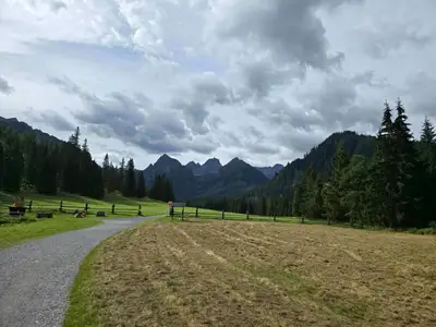 Distance: 24.7 kmDuration: 7 h 38 min
Dolina Białej Wody (Bielovodská dolina)
Bielovodská Valley (Dolina Białej Wody) from Łysa Polana to Litworowy Staw: 24.7 km, 7 h 38 min, no chains. Times to each meadow, closures 1 Nov – 31 May.
Difficulty: moderate (long)
#slovakia#high tatras#quiet+2View trail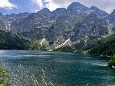 Distance: 16.5 kmDuration: 5 h 45 min
Dolina Pięciu Stawów Polskich (The Valley of the Five Polish Lakes)
Dolina Pięciu Stawów (Five Polish Lakes Valley) from Palenica via Wielka Siklawa, Poland's highest waterfall: 16.5 km, 5 h 45 min, no chains. Parking, ways back.
Difficulty: average
#high tatras#lake#waterfall+2View trailNo photo Distance: 13 kmDuration: 8–10 hGerlach (Gerlachovský štít)
Gerlachovský štít (2655 m), the highest peak of the Tatras and Carpathians, only with a licensed guide: chains and rungs, 13 km, 8–10 h, no marked trail.
Difficulty: climbing (UIAA I/II)
#slovakia#high tatras#highest peak+2View trail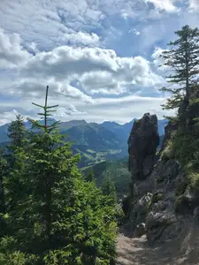 Distance: 9 kmDuration: 2 h 55 min
Gęsia Szyja
Gęsia Szyja (1489 m) from Wierch Poroniec via Rusinowa Polana: 9 km, 2 h 55 min, easy but hundreds of steps. One of the best High Tatras panoramas near Zakopane.
Difficulty: easy
#high tatras#panorama#for family+1View trailNo photo Distance: 17.5 kmDuration: 8 h 30 minGranaty
Granaty from Kuźnice: Skrajny, Pośredni and Zadni Granat, down Żleb Kulczyńskiego. 17.5 km, 8 h 30 min, chains and exposure. A section of Orla Perć, not a stroll.
Difficulty: very difficult
#high tatras#orla perć#chains+2View trailNo photo Distance: 12.6 kmDuration: 5 h 13 minHala Gąsienicowa and Czarny Staw Gąsienicowy
Hala Gąsienicowa and Czarny Staw Gąsienicowy from Kuźnice in Zakopane: 12.6 km, 5 h 13 min, no chains. Murowaniec hut and views of Kościelec and Orla Perć.
Difficulty: medium
#high tatras#mountain huts#classic+2View trailNo photo Distance: 20.6 kmDuration: 10 h 25 minJagnięcy Szczyt (Jahňací štít)
Jahňací štít (Jagnięcy Szczyt, 2230 m) from Biela Voda via Zelené pleso: 20.6 km, 10 h 25 min, chains below the summit. A long day. Closed 1 Nov – 31 May.
Difficulty: difficult (chains + long)
#slovakia#high tatras#chains+2View trail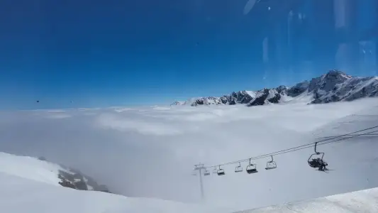 Distance: 7.6 kmDuration: 4 h 01 min
Kasprowy Wierch via Gąsienicowa
Kasprowy Wierch from Kuźnice via Hala Gąsienicowa and Sucha Pass: 7.6 km, 4 h 01 min up, no chains. Prettier than the green trail. Down on foot or by cable car.
Difficulty: medium
#high tatras#western tatras#panorama+1View trailNo photo Distance: 20.9 kmDuration: 8 h 37 minKoprowy Wierch (Kôprovský štít)
Kôprovský štít (Koprowy Wierch, 2363 m) from Štrbské Pleso via Popradské pleso: 20.9 km, 8 h 37 min, no chains, hands on the ridge. Closed 1 Nov – 31 May.
Difficulty: difficult (physically)
#slovakia#high tatras#lake+2View trailNo photo Distance: 16 kmDuration: 7 h 29 minKościelec (The Polish Matterhorn)
Kościelec (2155 m), the 'Polish Matterhorn', from Kuźnice via Hala Gąsienicowa and Karb: 16 km, 7 h 29 min. No chains, but steep slabs and exposure.
Difficulty: very difficult (no chains!)
#high tatras#exposure#fitnessView trailNo photo Distance: 19.8 kmDuration: 8 h 55 minKozi Wierch
Kozi Wierch (2291 m), the highest peak fully in Poland, from Palenica via the Five Lakes Valley: 19.8 km, 8 h 55 min, a steep gully without chains, helmet advised.
Difficulty: difficult (fitness-wise)
#high tatras#orla perć#highest peak+1View trailNo photo Distance: 14.2 kmDuration: 7 h 20 minKozia Przełęcz
Kozia Przełęcz (2137 m) from Kuźnice via Czarny Staw and Kozia Dolinka: 14.2 km, 7 h 20 min, chains and rungs. A link to Orla Perć, not Kozi Wierch.
Difficulty: very difficult (chains, rungs)
#high tatras#orla perć#chains+1View trailNo photo Distance: 19.8 kmDuration: 8 h 55 minKrywań (Kriváň)
Kriváň (Krywań, 2495 m) from Štrbské Pleso via Jamské pleso: 19.8 km, 8 h 55 min, no chains but hands on granite blocks. Closed 1 Nov – 31 May.
Difficulty: difficult (physically)
#slovakia#high tatras#fitness+2View trailNo photo Distance: 20.9 kmDuration: 9 h 25 minPrzełęcz Krzyżne
Krzyżne Pass from Palenica via the Five Lakes Valley, down the Pańszczyca Valley to Kuźnice: 20.9 km, 9 h 25 min, no chains. A famous High Tatras panorama.
Difficulty: difficult (physically)
#high tatras#fitness#lake+2View trailNo photo Distance: 0 kmDuration: 3 hLomnica (Lomnický štít)
Lomnický štít (2634 m) by cable car from Tatranská Lomnica via Skalnaté pleso: how long the ride takes, booking tickets ahead and your time at the top.
Difficulty: very easy (cable car)
#slovakia#high tatras#cable car+2View trailNo photo Distance: 7.4 kmDuration: 4 h 45 minMała Wysoka (Východná Vysoká)
Východná Vysoká (Mała Wysoka, 2429 m) from Sliezsky dom via Polish Ridge pass: 7.4 km, 4 h 45 min, chains at the pass and summit. Closed 1 Nov – 31 May.
Difficulty: difficult (chains)
#slovakia#high tatras#chains+2View trailNo photo Distance: 23.2 kmDuration: 10 h 49 minMięguszowiecka Pass below Chłopek
Mięguszowiecka Przełęcz pod Chłopkiem from Palenica via Morskie Oko and Czarny Staw: 23.2 km, 10 h 49 min, no chains but exposure and scrambling on rock.
Difficulty: very difficult
#high tatras#exposure#fitness+2View trail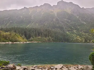 Distance: 15.5 kmDuration: 4 h 14 min
Morskie Oko
Morskie Oko from Palenica Białczańska on the tarmac road: 15.5 km, 4 h 14 min, easy, pushchair-friendly. Parking reservation, buses from Zakopane, horse carts.
Difficulty: easy
#high tatras#lake#for family+2View trailNo photo Distance: 4.3 kmDuration: 6 h 25 minOrla Perć (Zawrat - Krzyżne)
Orla Perć from Zawrat to Krzyżne: 4.3 km of ridge in 6 h 25 min, chains, rungs, a ladder and one-way traffic to Kozi Wierch. How to split it into stages.
Difficulty: very difficult (for advanced hikers only)
#high tatras#orla perć#chains+1View trailNo photo Distance: 9.6 kmDuration: 3 hPopradské pleso and the Symbolic Cemetery
Popradské pleso from the Tatra electric railway stop and the Symbolic Cemetery under Ostrva: 9.6 km, 3 h, +280 m, easy. A simple walk in the Slovak High Tatras.
Difficulty: easy
#slovakia#high tatras#lake+2View trail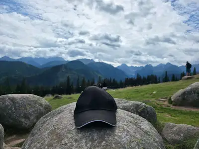 Distance: 7.5 kmDuration: 2 h 19 min
Rusinowa Polana and Wiktorówki
Rusinowa Polana and Wiktorówki from Wierch Poroniec: 7.5 km, 2 h 19 min, very easy, pushchair-friendly. A High Tatras panorama for little effort. Parking.
Difficulty: very easy
#high tatras#panorama#for family+2View trailNo photo Distance: 25.5 kmDuration: 11 h 44 minRysy (from the Polish side)
Rysy (2499 m), Poland's highest peak, from Palenica via Morskie Oko and Czarny Staw: 25.5 km, 11 h 44 min, chains, snow even in July. When to start and turn back.
Difficulty: very difficult
#high tatras#highest peak#chains+2View trailNo photo Distance: 21.9 kmDuration: 9 h 12 minRysy (from the Slovak side)
Rysy (2503 m) from the Slovak side via Popradské pleso and Chata pod Rysmi: 21.9 km, 9 h 12 min. Easier than from Poland, chains below the summit.
Difficulty: difficult (fitness-wise)
#slovakia#high tatras#highest peak+2View trailNo photo Distance: 10 kmDuration: 4 h 27 minSkrajne Solisko (Predné Solisko)
Predné Solisko (2117 m) on foot from Štrbské Pleso: 10 km, 4 h 27 min, +855 m, no chains. The chairlift option is in the table. Closed 1 Nov – 31 May.
Difficulty: moderate (steep red)
#slovakia#high tatras#mountain huts+2View trailNo photo Distance: 12.5 kmDuration: 7 h 27 minSławkowski Szczyt (Slavkovský štít)
Slavkovský štít (2452 m) from Hrebienok: 12.5 km, 7 h 27 min, +1256 m, no chains, but long and steep over loose stones. Closed 1 Nov – 31 May.
Difficulty: difficult (physically)
#slovakia#high tatras#fitness+2View trailNo photo Distance: 18.6 kmDuration: 9 h 32 minŚwinica
Świnica (2301 m) from Kuźnice via Kasprowy Wierch: 18.6 km, 9 h 32 min, chains and exposure. The cable car shortens the climb, not the difficulty. Zawrat variants.
Difficulty: difficult
#high tatras#chains#exposure+1View trail- Distance: 20.3 kmDuration: 7 h 15 min
Świstówka Roztocka
Loop from Palenica via the Roztoka Valley, the Five Polish Lakes and Świstówka to Morskie Oko: 20.3 km, 7 h 15 min, no chains. Closed 1 Dec – 15 May.
Difficulty: moderate (long, exposed descent)
#high tatras#lake#loop+2View trail - Distance: 24.2 kmDuration: 9 h 22 min
Szpiglasowy Wierch from Five Lakes
Szpiglasowy Wierch from Palenica via the Five Polish Lakes Valley, chains on the way up, down the Ceprostrada to Morskie Oko: 24.2 km, 9 h 22 min.
Difficulty: medium / difficult
#high tatras#chains#panorama+2View trail No photo Distance: 24.9 kmDuration: 9 h 03 minSzpiglasowy Wierch (via Ceprostrada)
Szpiglasowy Wierch (2172 m) from Palenica via Morskie Oko and the Ceprostrada: 24.9 km, 9 h 03 min there and back, no chains. The Five Lakes loop is separate.
Difficulty: medium
#high tatras#panorama#fitnessView trailNo photo Distance: 15.4 kmDuration: 5 h 25 minWielka Siklawa
Wielka Siklawa, Poland's highest waterfall, from Palenica via Mickiewicz Waterfalls and the Roztoka Valley: 15.4 km, 5 h 25 min. Green trail closed in winter.
Difficulty: medium (slippery rock)
#high tatras#waterfall#valley+2View trailNo photo Distance: 21.5 kmDuration: 8 h 41 minWielka Świstówka (Veľká Svišťovka)
Veľká Svišťovka from Biela Voda via Zelené pleso and Skalnaté pleso: 21.5 km, 8 h 41 min, chains. Cable car option down. Closed 1 Nov – 31 May.
Difficulty: difficult (chains)
#slovakia#high tatras#chains+2View trailNo photo Distance: 22.9 kmDuration: 8 h 39 minWrota Chałubińskiego
Wrota Chałubińskiego (2022 m) from Palenica via Morskie Oko and the valley behind Mnich: 22.9 km, 8 h 39 min, no chains. A dead-end pass, return the same way.
Difficulty: difficult (physically)
#high tatras#lake#quiet+1View trailNo photo Distance: 19.9 kmDuration: 8 h 34 minZawrat Pass (from Hala Gąsienicowa)
Zawrat Pass (2158 m) from Kuźnice via Hala Gąsienicowa: 19.9 km, 8 h 34 min, chains in the gully and snow into summer. The easier Five Lakes side is separate.
Difficulty: difficult
#high tatras#orla perć#chains+1View trail- Distance: 11.3 kmDuration: 4 h 45 min
Zawrat from Five Lakes
Zawrat Pass (2158 m) from Palenica via the Five Polish Lakes Valley: 11.3 km, 4 h 45 min up, no chains. The easier side of the pass. When not to go on to Orla Perć.
Difficulty: medium
#high tatras#panorama#lake+1View trail No photo Distance: 15.4 kmDuration: 6 h 14 minZelené pleso (Chata pri Zelenom plese)
Zelené pleso (Zielony Staw Kieżmarski) from Biela Voda to the lakeside hut: 15.4 km, 6 h 14 min, no chains. Hut open all year, peaks above closed in winter.
Difficulty: moderate
#slovakia#high tatras#lake+2View trailNo photo Distance: 18.6 kmDuration: 9 h 24 minŻleb Kulczyńskiego
Żleb Kulczyńskiego from Kuźnice via Hala Gąsienicowa and Zmarzły Staw: 18.6 km, 9 h 24 min, chains in the gully, loose rock, helmet advised. Approach to Orla Perć.
Difficulty: very difficult
#high tatras#orla perć#chains+2View trail
Blog (2)
 2026-10-19
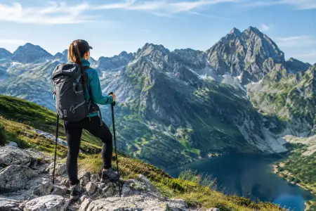
How to plan a trip up Rysy without stupid mistakes
How to plan a trip up Rysy: the route, the weather, the kit, the fitness and the decisions that let you enjoy the summit without needless risk in the Polish Tatras.
#planning#tips#high tatras+1View post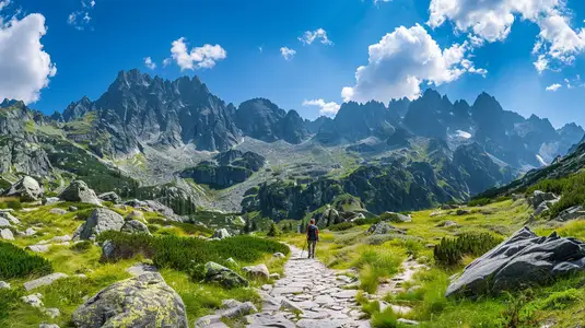 2026-06-28
Want the High Tatras but scared of chains? The easiest rocky summits
Do you dream of “real”, sharp, rocky mountains, but the thought of exposure and chains makes your legs shake? Here’s a list of summits you’ll reach like climbing stairs — without climbing gear.
#easy routes#tips#high tatras+2View post