Czarny Staw pod Rysami
- Trail color
- Elevation
- 1583 m a.s.l.
- Total ascent
- 819 m
- Distance
- 19.1 km
- Difficulty
- moderate
- Duration
- 5 h 54 min
- Start
- Palenica Białczańska
- Finish
- Palenica Białczańska
- Location
- High Tatras
- Family friendly
- Yes
- Dog friendly
- No
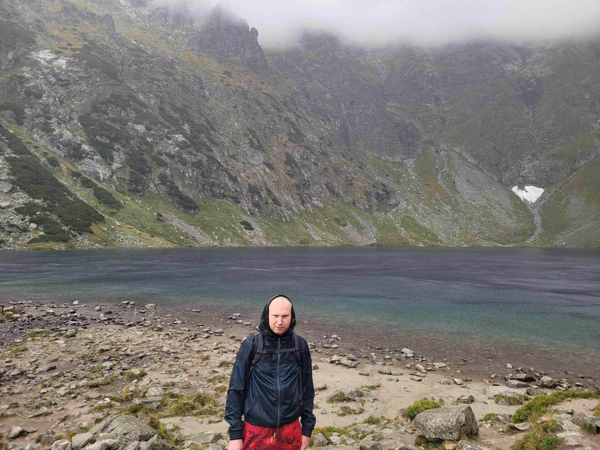
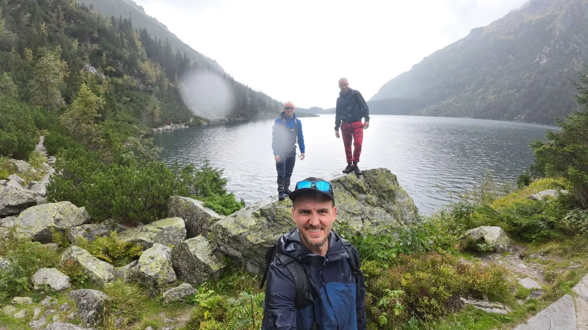
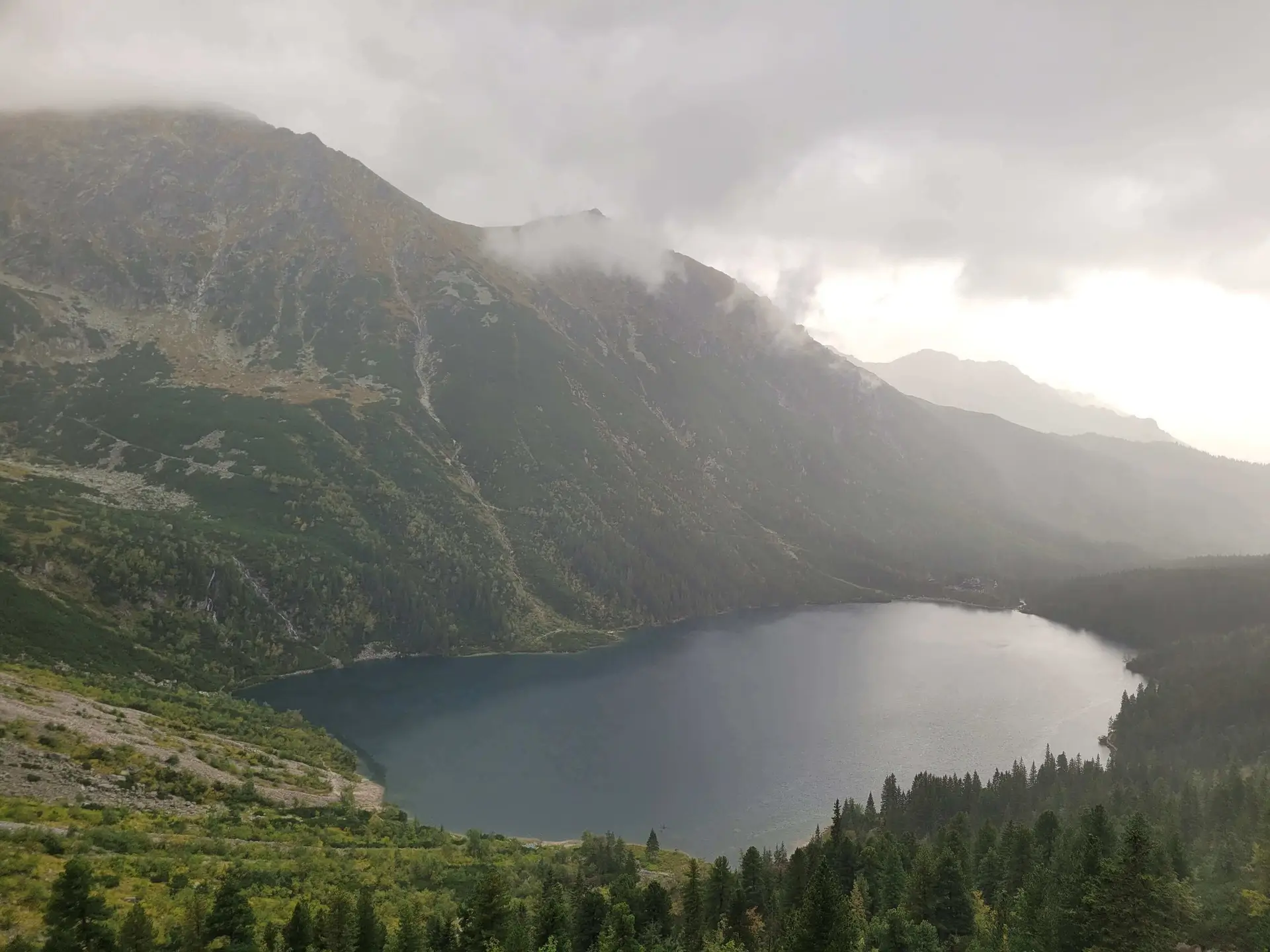
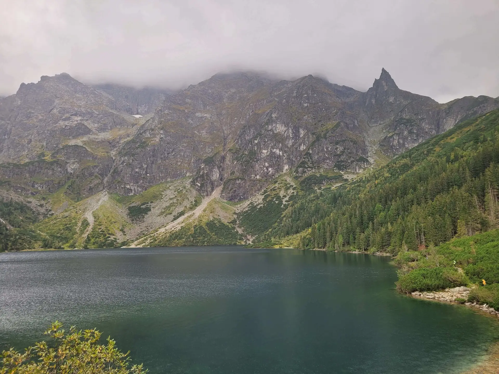
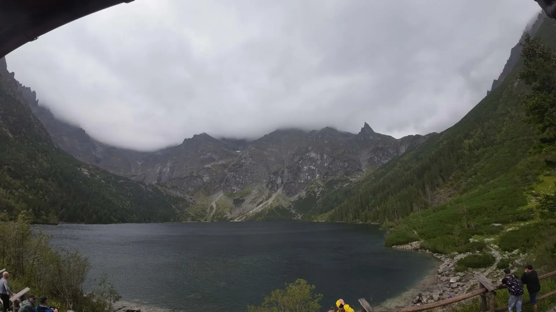
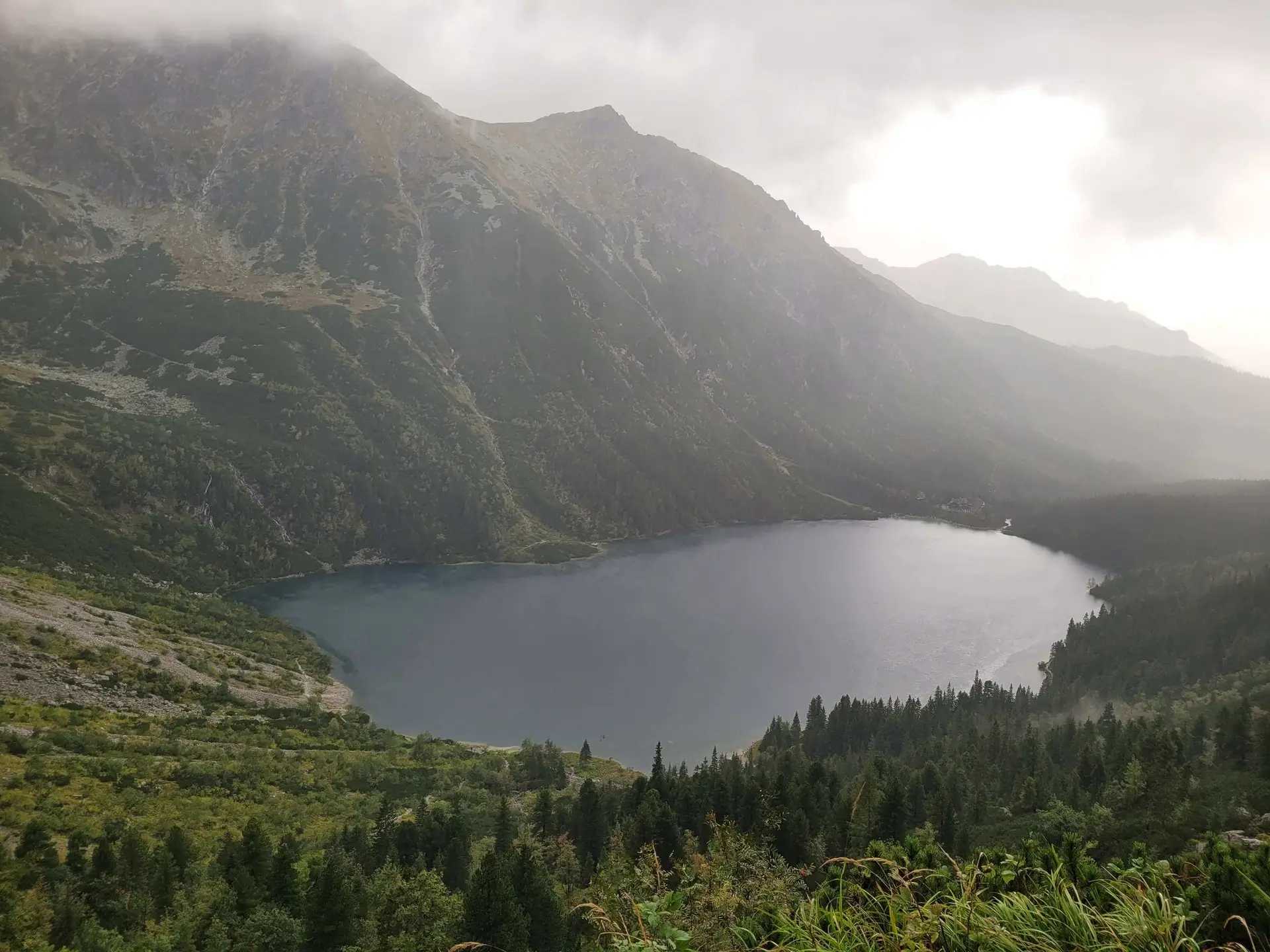
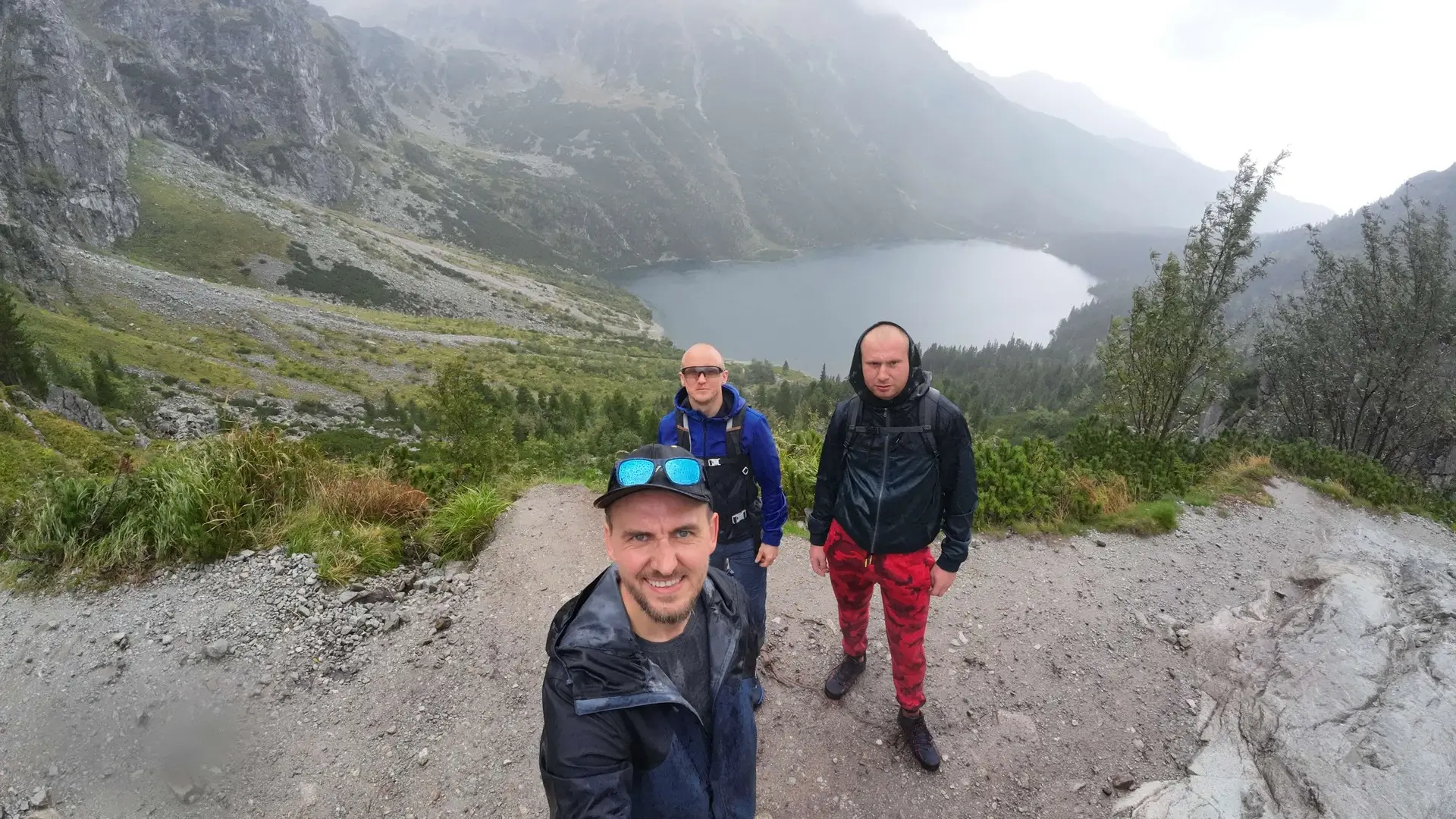
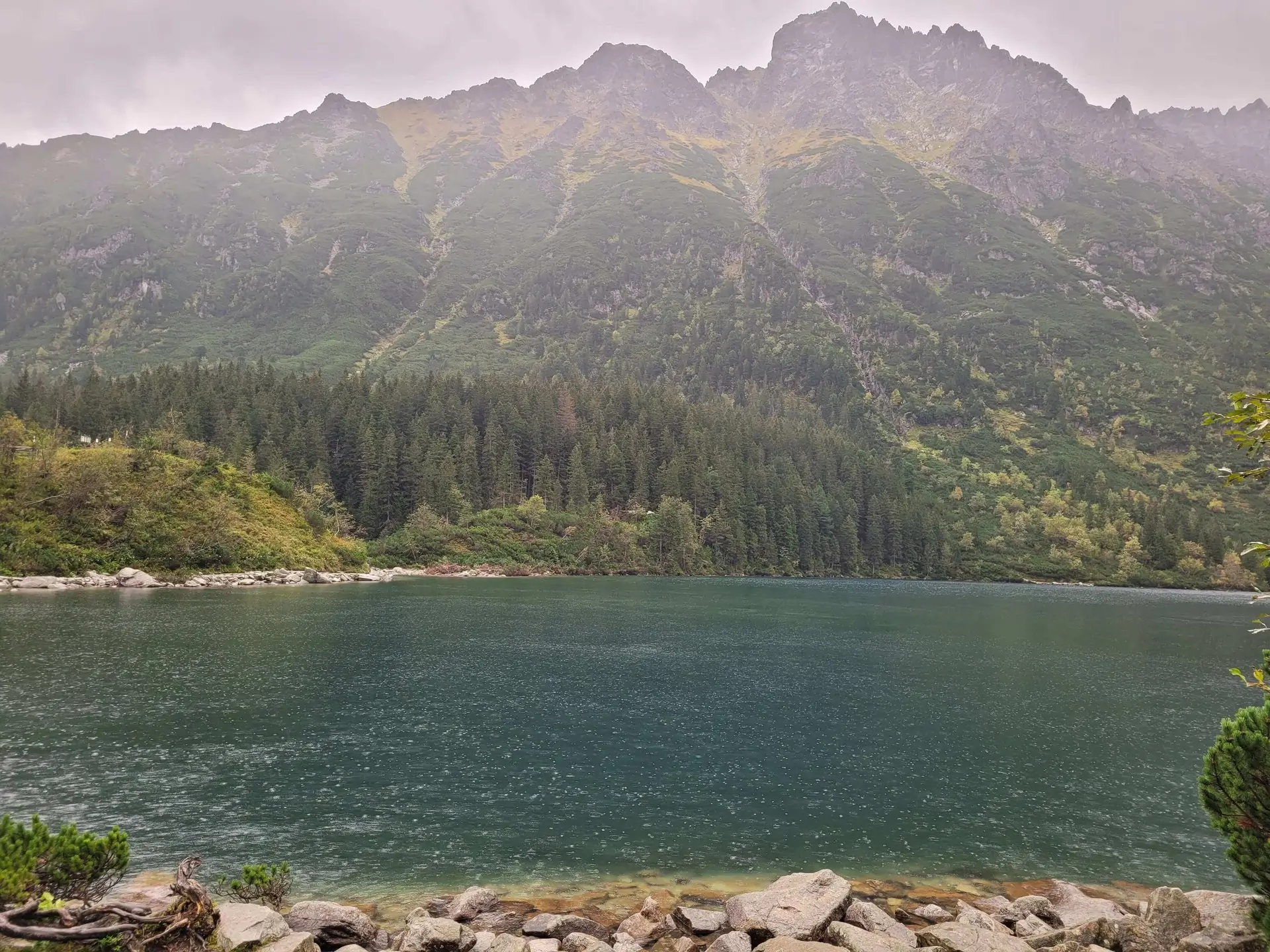
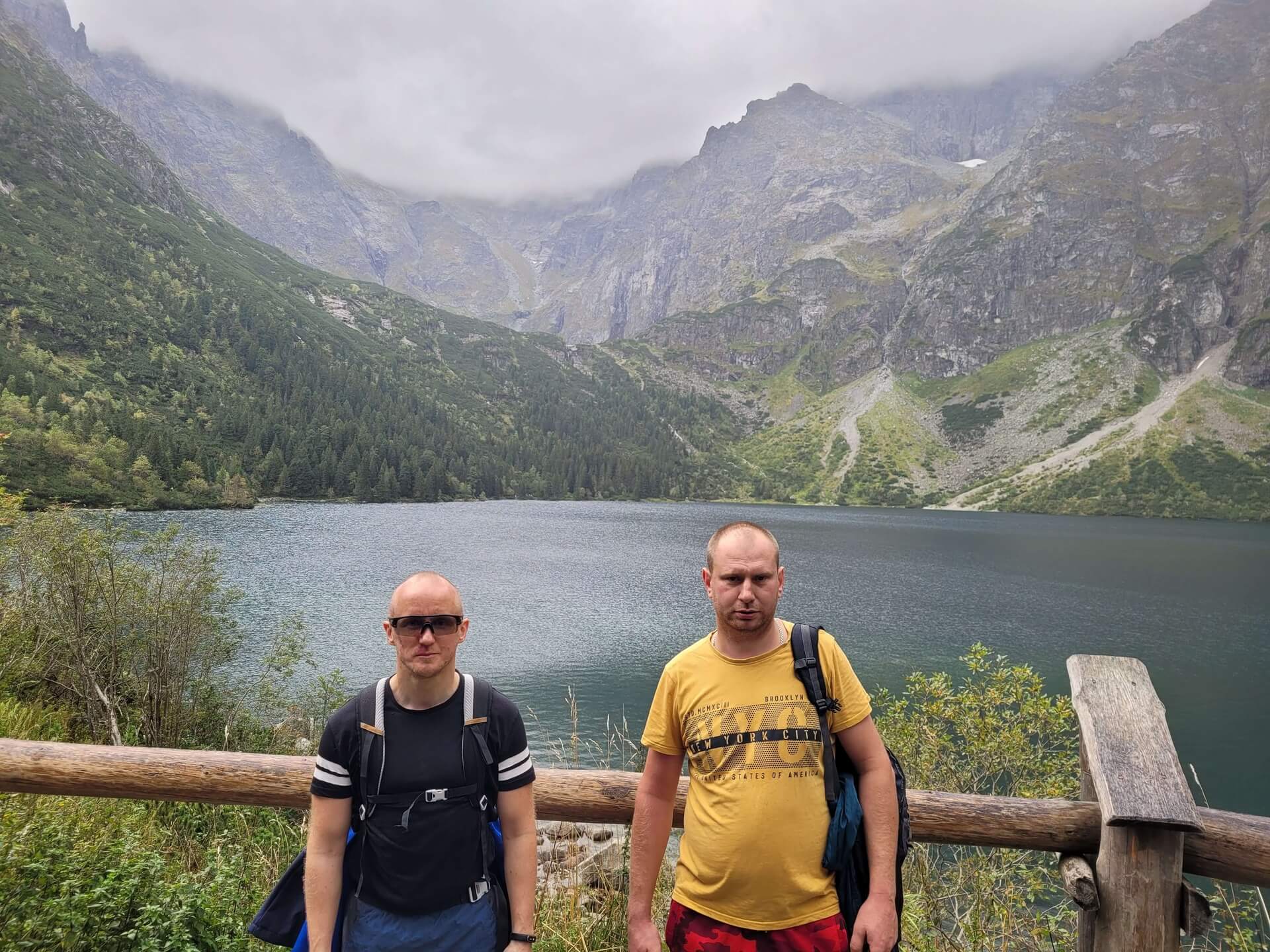
Czarny Staw pod Rysami (1,583 m above sea level) is Morskie Oko’s wilder brother. Almost 200 metres higher, hidden in a deep glacial cirque, it offers scenery straight out of Alaska.
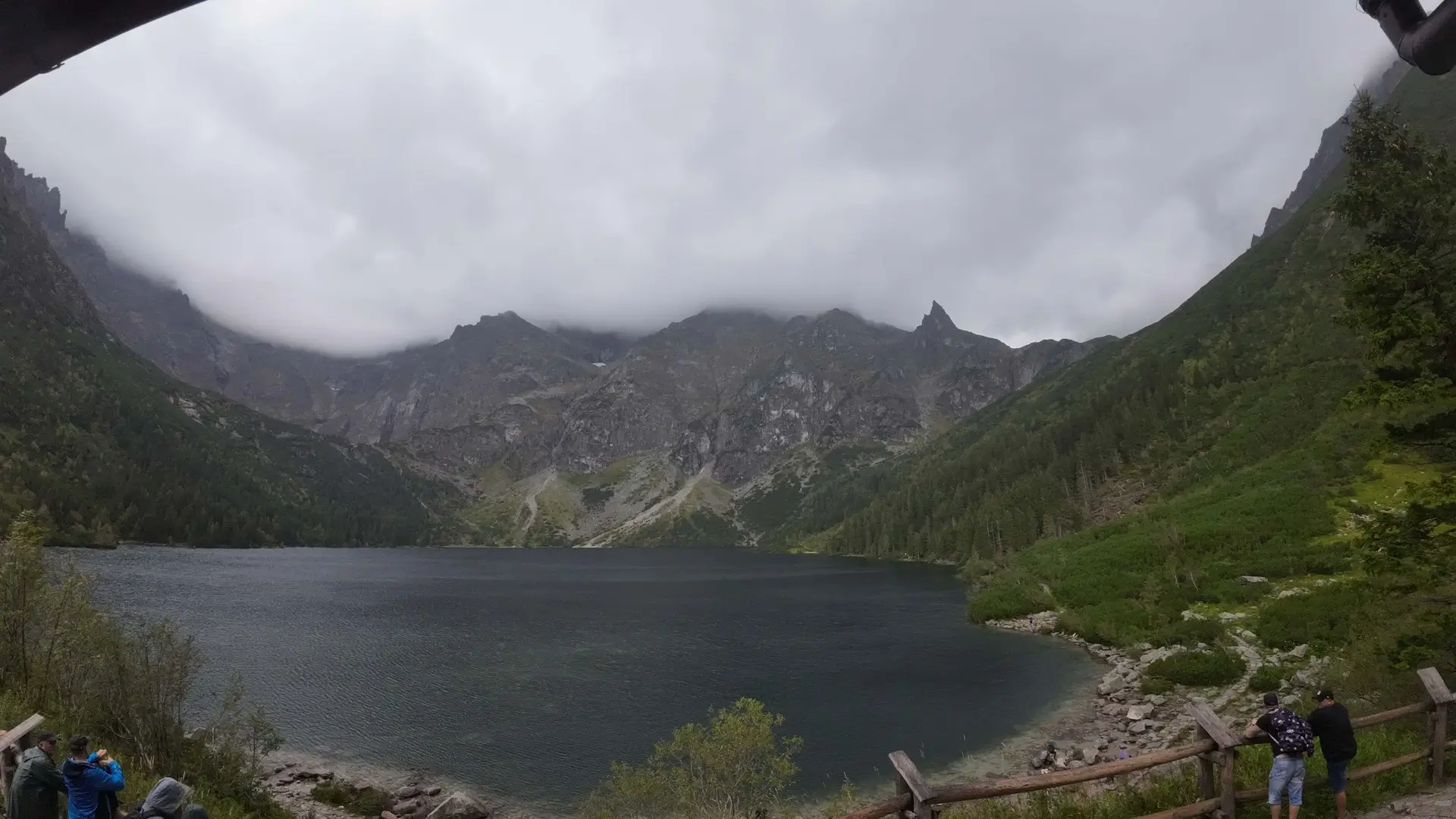
If you reach Morskie Oko and wonder, “Is it worth going any further?”, the answer is: Absolutely yes. This is where you will take the most famous Tatra photo (Morskie Oko seen from above) and feel the chill coming from the highest walls in Poland.
Trail description: a step into the high mountains
We split the hike into two stages: the approach to the mountain hut (on tarmac) and the actual mountain ascent.
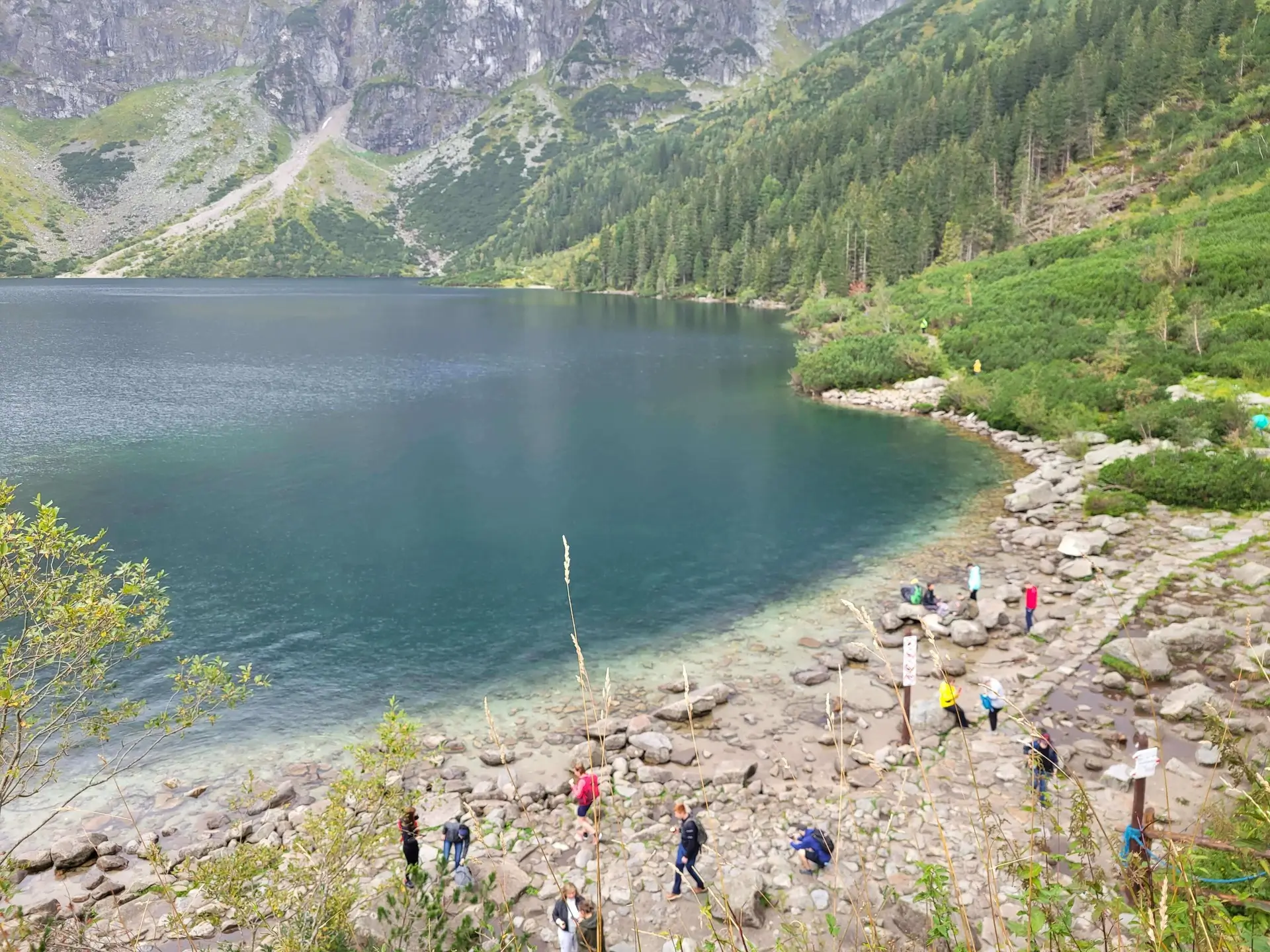
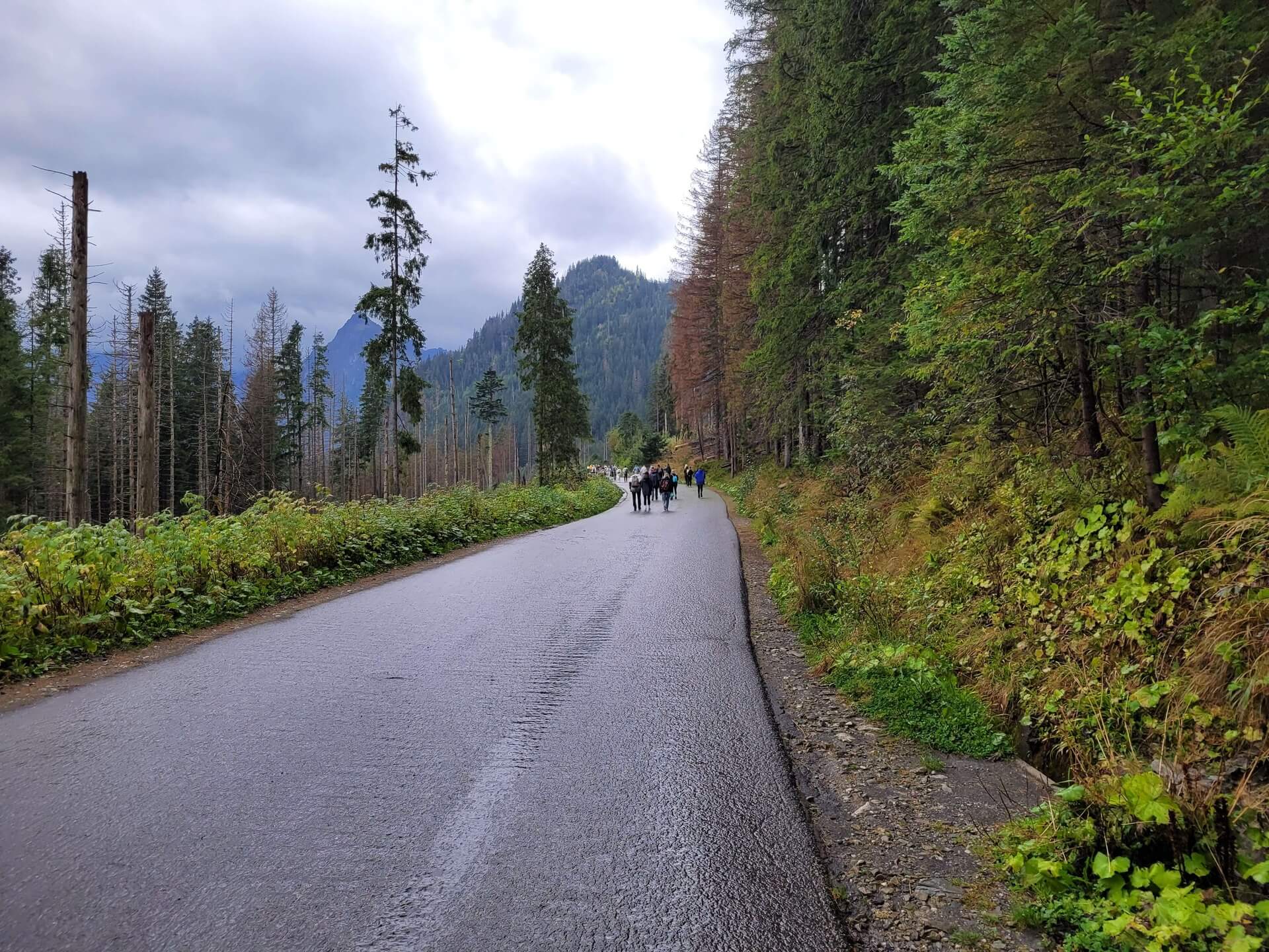
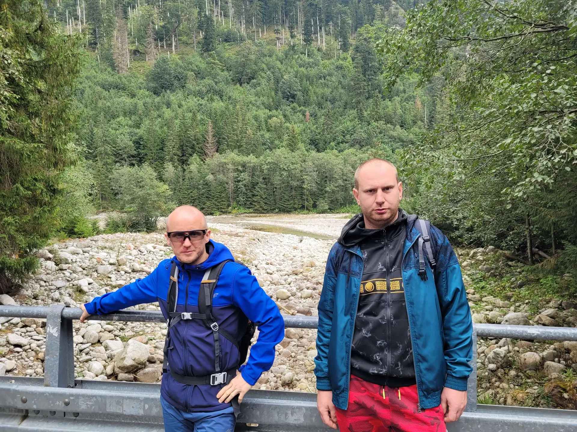
- Stage 1: Warm-up (Morskie Oko): From Palenica Białczańska we reach the mountain hut. We bypass the crowd eating apple pie and set off along the left side of the lake (following the red trail). It is a pleasant walk along the shore, lasting about 20 minutes, until we reach “Szeroki Piarg”.
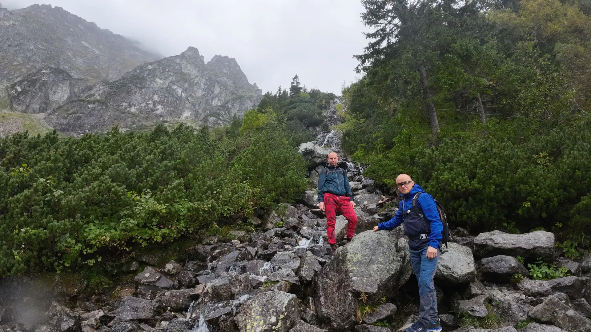
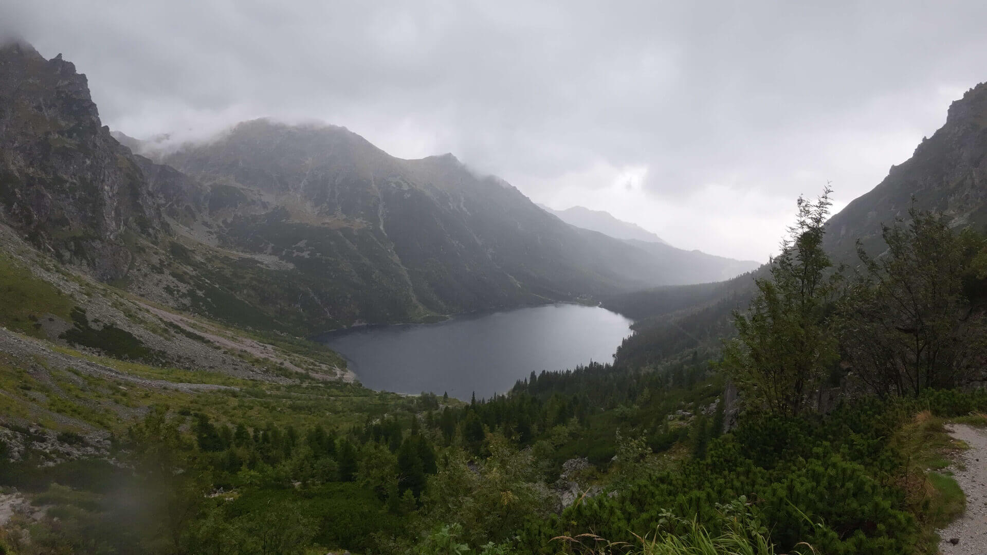
- Stage 2: Ascent (stone steps): At the end of the lake, the trail begins to climb.
- This ascent has an elevation gain of around 190 metres.
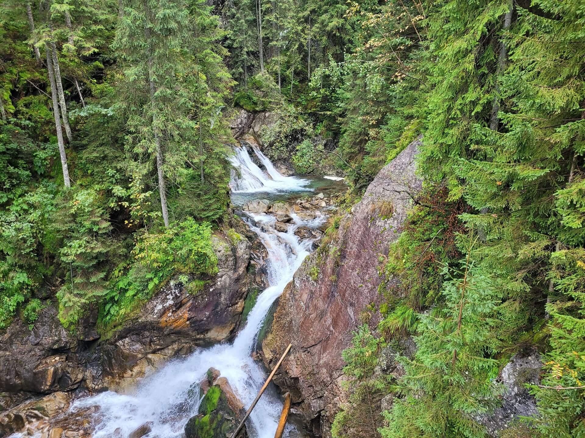
- We walk up comfortable stone steps. A stream rushes beside us, forming small cascades (Czarnostawiańska Siklawa).
- Tip: Look back every few minutes! With every step, Morskie Oko changes from a vast lake into a small, turquoise “puddle”. It is the best motivation.
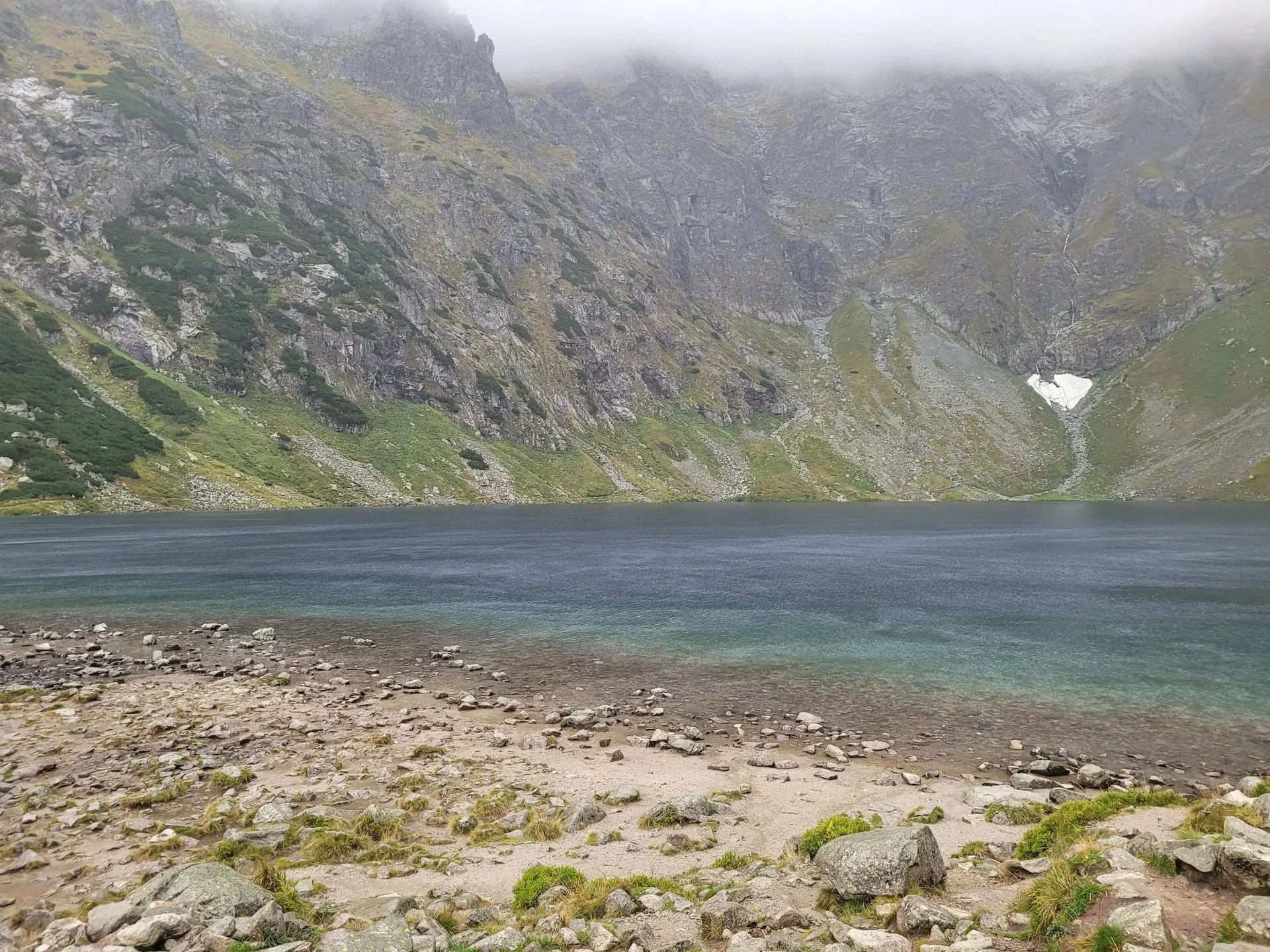
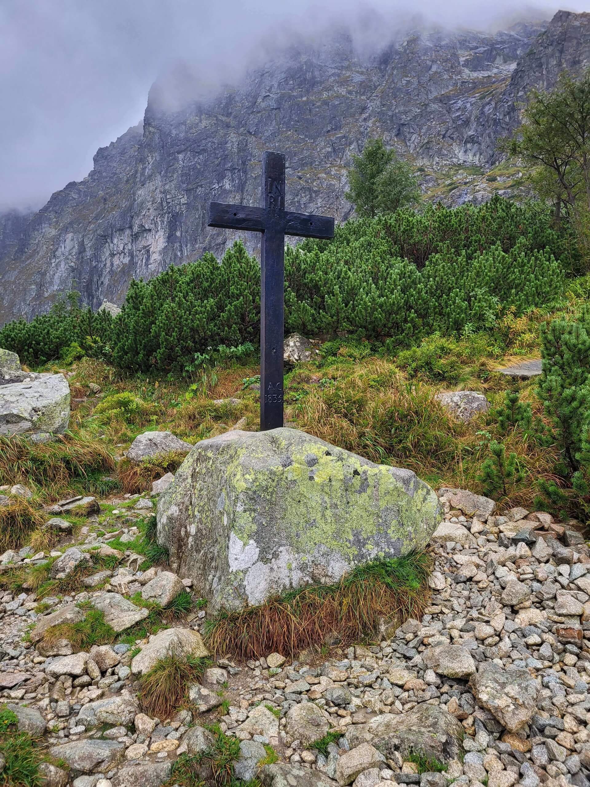
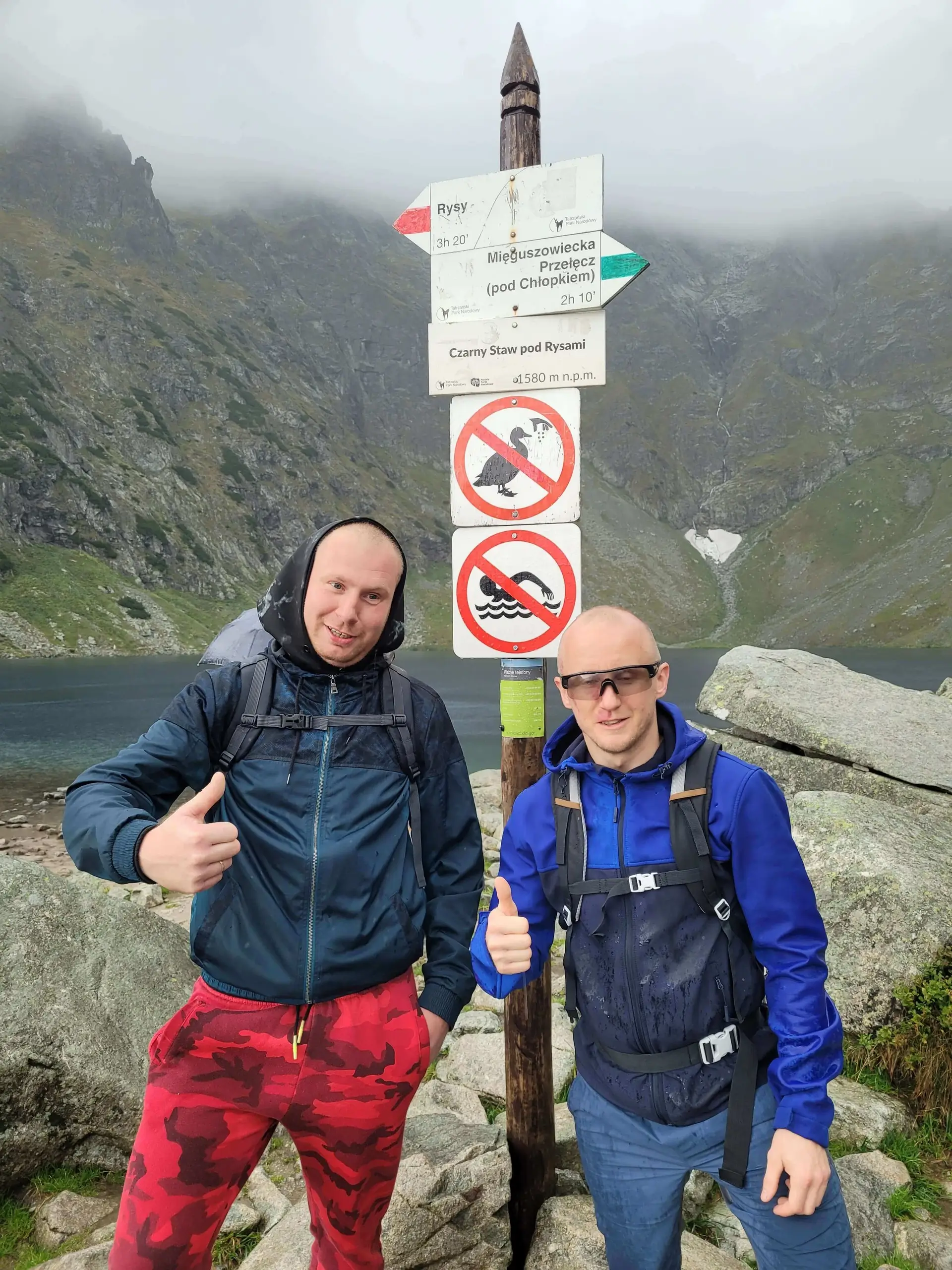
- Finale: Czarny Staw: After about 30-40 minutes of climbing, we emerge at the rim of the cirque. We stand on the shore of the second-deepest lake in the Tatra Mountains (over 76 metres deep!).
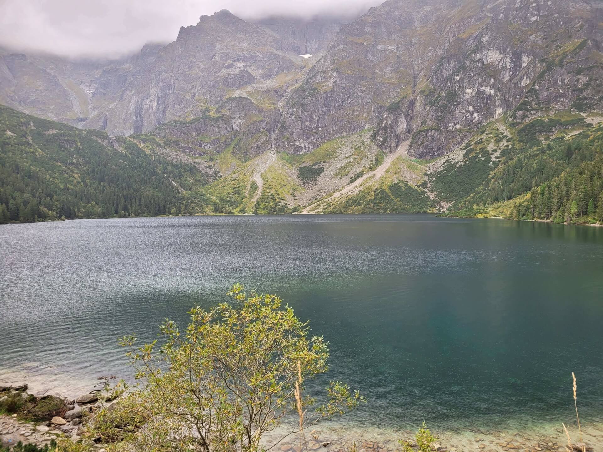
Why “Black”?
The name is no coincidence. The water in the lake appears deep blue, or even black. This is due to two factors:
- Shade: The lake is surrounded by the vertical, 500-metre-high walls of Kazalnica and the Mięguszowieckie Peaks, which cast a shadow for most of the day.
- Cyanobacteria: The stones in the water are covered in a dark sediment (pleurocapsa), which enhances the sombre effect.
Where next?
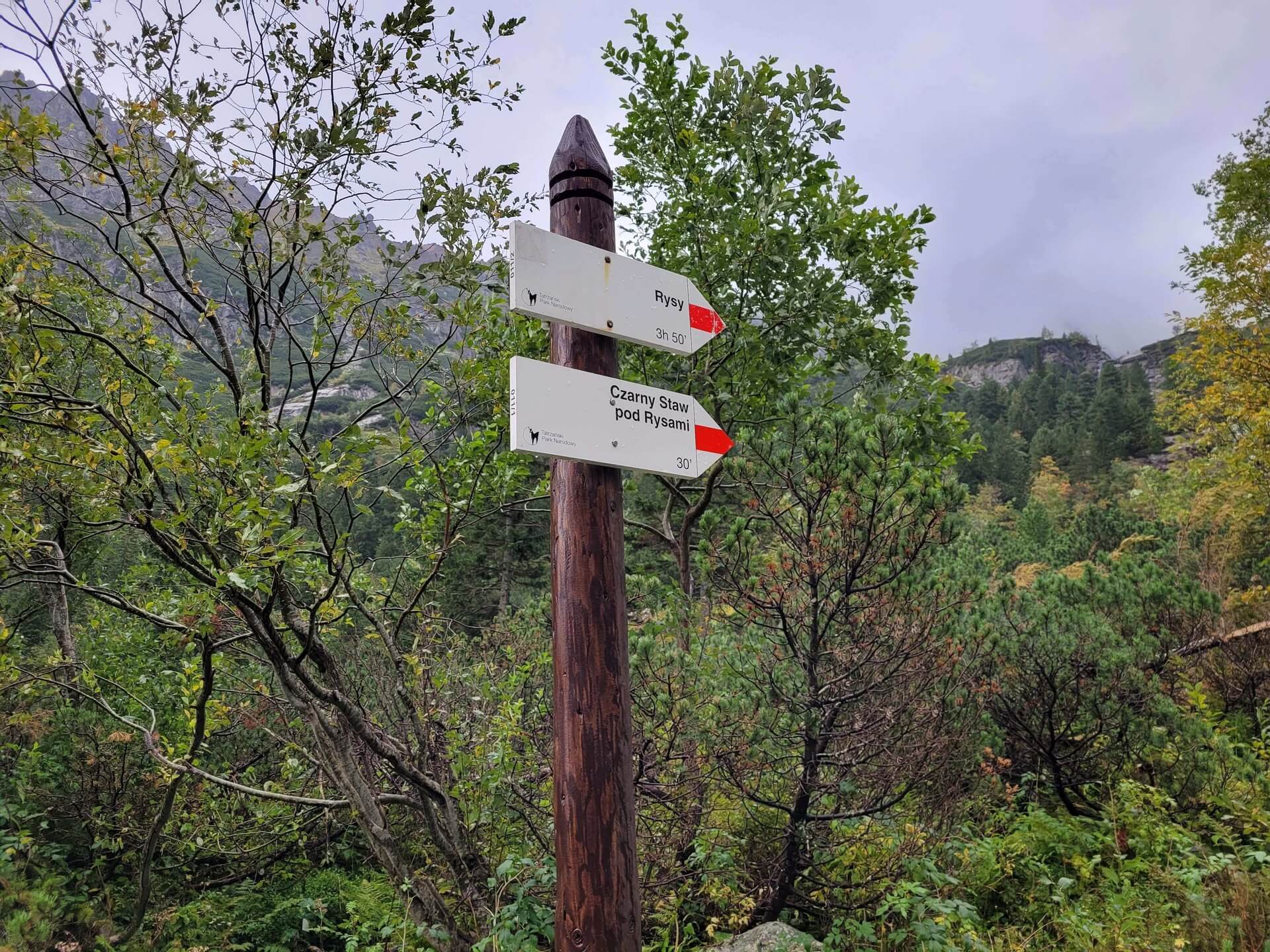
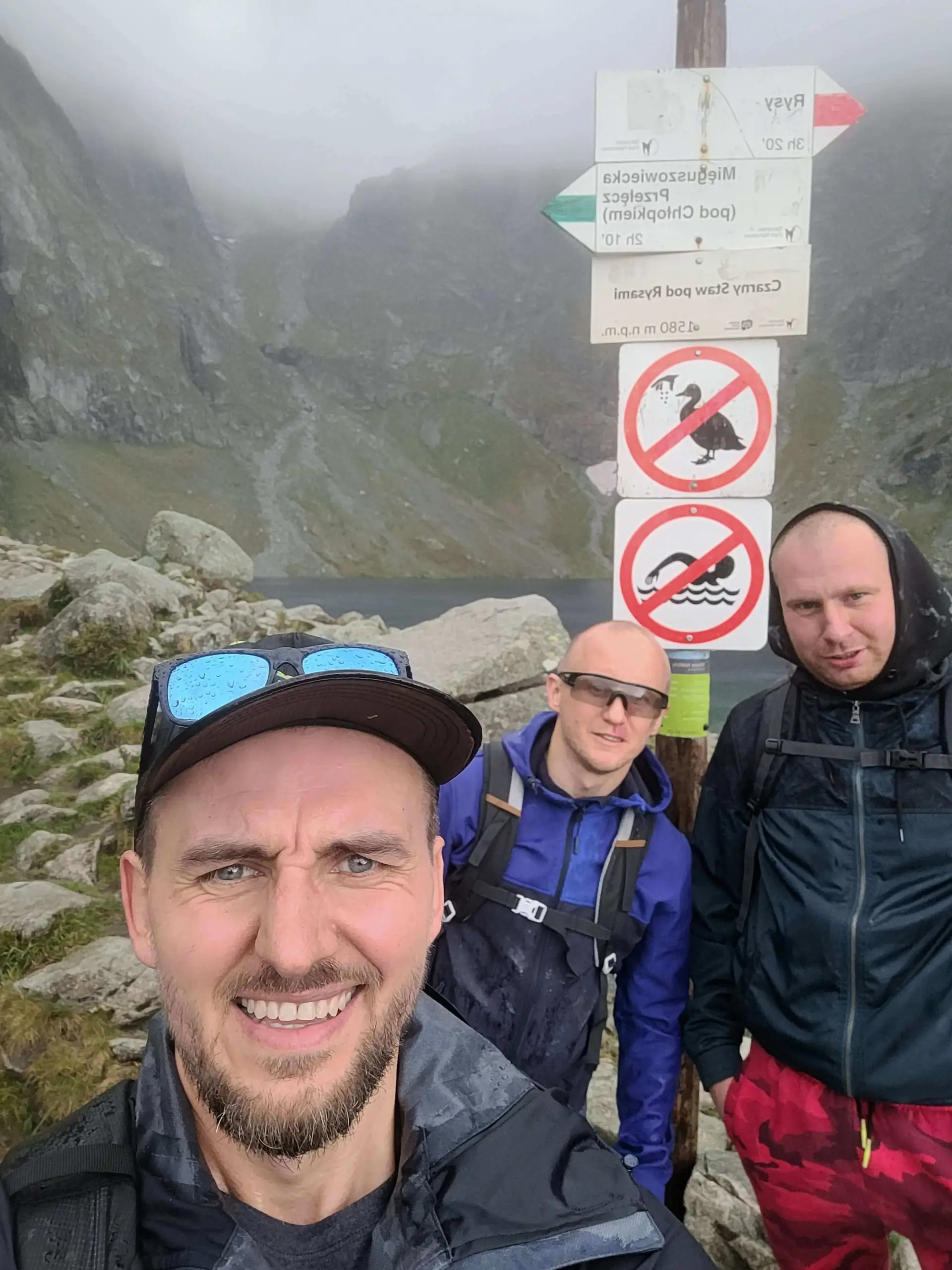
Czarny Staw is a junction for the ambitious:
- Left: Trail to Rysy (for experienced hikers only!).
- Right: Trail to Mięguszowiecka Pass below Chłopek (very difficult!).
Practical information
- Temperature: There is a fridge-like microclimate here. Even if it is hot at Morskie Oko, a cool breeze blows in from Rysy at Czarny Staw. Bring a warm layer!
- For families: Older children (7-8 years old) will easily manage the ascent. You will need to leave your pushchair at the mountain hut (or secure it by the trail at the bottom of the ascent), as the stone steps are impassable.
- Descent: Remember that descending on slippery rocks can be more difficult than the ascent. Watch your knees and watch out for loose stones.
What to see
Map - Map and trail profile
Photo gallery

Similar trails
- Difficulty: 20.9 km Duration: 8 h 37 min
Koprowy Wierch (Kôprovský štít)
Difficulty: difficult (fitness + exposure)
#slovakia #high tatras #lake +2View trail - Difficulty: 21.5 km Duration: 8 h 41 min
Wielka Świstówka (Veľká Svišťovka)
Difficulty: medium / difficult (chain section)
#slovakia #high tatras #lake +2View trail - Difficulty: 16.5 km Duration: 6 h
Dolina Pięciu Stawów Polskich (The Valley of the Five Polish Lakes)
Difficulty: average
#high tatras #lake #waterfall +3View trail
Tags - Tags
Before you head to the mountains
- Check the weather forecast, mountain weather changes dynamically
- Match the trail to your abilities, don't overestimate your strength
- Take appropriate equipment: comfortable hiking boots, rain jacket, warm clothing, map, charged phone, first aid kit, power bank, food and water
- Inform someone about your plans, provide the route and expected return time
- Save the emergency number GOPR/TOPR, 601 100 300 or 985
- Buy a ticket to the Tatra National Park
Recent blog posts
 2026-07-27
Heat at the bottom, a fridge at the summit. How should you dress for the Tatras so you do not ruin the trip?
A sunny morning in Zakopane is the worst advisor when you are packing your backpack. See how the layering system works and why one clothing mistake can turn a summit hike into a nightmare.
#affiliate #gear #tips +5View post 2026-07-20
I betrayed the Tatras for the Pieniny. We did Sokolica and Trzy Korony in one day (with bikes!)
What to do when you are tired of the crowds under Giewont? Head to Szczawnica. Here is our plan for the perfect loop: hike up to the most famous peaks and cycle back along the Dunajec Gorge.
#pieniny #bikes #beyond the tatras +3View post 2026-07-13
I ate, I paid, and I didn’t go broke. Where to eat after hiking in Zakopane?
You hiked for 10 hours and you could eat a horse with hooves? Here’s what to try in Podhale without falling for tourist traps on Krupówki — and what’s actually worth paying for.
#food #tips #zakopane +1View post 2026-07-05
Mountain backpacks: Why your old school backpack will ruin your holiday
A gym sack on Rysy? A cube backpack from high school in the Kościeliska Valley? See why a good backpack matters as much as boots — and how to choose one without wasting money.
#gear #tips #backpack +1View post 2026-06-28
Want the High Tatras but scared of chains? The easiest rocky summits
Do you dream of “real”, sharp, rocky mountains, but the thought of exposure and chains makes your legs shake? Here’s a list of summits you’ll reach like climbing stairs — without climbing gear.
#easy routes #tips #high tatras +2View post 2026-06-21
Mountain gear: What you can save on and what’s worth paying extra for
A 2,000 zł jacket for a walk in the Kościeliska Valley? Overkill. But market boots on Świnica? That’s asking for trouble. Here’s what to cut costs on — and what to splurge on.
#gear #tips #boots +2View post
Did you find the information here useful? I spent quite a bit of time compiling it. If it helped you plan your trip, buy me a virtual coffee! ☕
Buy me a