0

Granaty

High-altitude conditionsBulletin as of 6 października 2026
Official TPN bulletin

Snow and ice reported in upper Tatras. Crampons, ice axe, helmet and winter mountaineering experience required.

Bulletin details

UWAGA: TRUDNE WARUNKI W WYŻSZYCH PARTIACH TATR

RecommendedSkrajny – Zadni – the gully

Pace

8 h 30 minEstimate from the published time, without queues or breaks.

  • very difficult
    • yellow
    • blue
    • red
    • black
  • High Tatras
  • Family friendly: No
  • Dog friendly: No

Approach variants

The recommended route is on this page. A different start has its own page — description and map.

Approach variants
VariantStartDurationChainsTrail color
Skrajny – Zadni – the gullyRecommended

Over the meadow to Czarny Staw, yellow to Skrajny, red to Zadni, down the gully. The tiles above show this loop.

Kuźnice8 h 30 minYesChains on the ridge and in the gully. Loose rock.
  • yellow
  • blue
  • red
  • black
Skrajny Granat only

There and back on yellow. No Pośredni, no gully. Still Orla on the summit.

Kuźnice8 hYesYellow has chains and exposure. This is not the meadow.
  • yellow
  • blue
Ascent via Żleb Kulczyńskiego

The other direction. Separate card with a map: Żleb Kulczyńskiego.

View this trail →
Kuźnice9 h 24 minYesA chute with chains, against falling stones.
  • yellow
  • blue
  • black
  • red

Recommended

Skrajny – Zadni – the gully

Over the meadow to Czarny Staw, yellow to Skrajny, red to Zadni, down the gully. The tiles above show this loop.

Map and trail profile

Skrajny – Zadni – the gully

Getting there, parking & buses

Trailhead logistics – reach the start smoothly without parking hassle.

Trailhead:Kuźnice

Parking & car access

No private car access – bus or walk only

Kuźnice / car parks on the road to Kuźnice

Parking fee: paid, full early in season

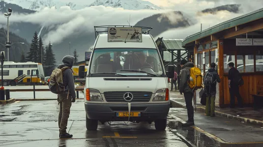
From Rondo Jana Pawła II, private cars are strictly prohibited. Reach Kuźnice only by local bus (5 min) or on foot via Aleja Przewodników Tatrzańskich (20–25 min).

Bus & transit access

Buses from Main Station & Rondo JP2 to Kuźnice

Route & bus stop: Main Station (Transport Hub) ➔ Rondo Jana Pawła II ➔ Kuźnice (cableway station)

Fare: ~5–6 PLN (cash payment to driver)

Buses shuttle every 5–10 minutes from dawn till dusk. Prepare exact change.

Local buses and transit help bypass morning traffic and parking hassles.

Transport guide in the Tips section

Complete guide to Tatra car parks, buses, and TPN reservations.

Read the guide in Tips

The Granaty are three summits above Czarny Staw Gąsienicowy: Skrajny (2,225 m), Pośredni (2,234 m) and Zadni (2,240 m a.s.l.). The red across them is a section of Orla Perć. People take this loop because there is no Kozia ladder — and they confuse that with “easy Orla”.

💡 In a nutshell – Granaty:

  1. For whom: After Kościelec and Zawrat, with a helmet, without fear of height.
  2. Direction: Yellow to Skrajny, red to Zadni, down Żleb Kulczyńskiego. The gully sheds rock onto people coming the other way.
  3. Difficulties: Chains, loose rock, exposure. There is no “Orla for beginners” here.
  4. Start: Kuźnice. The tiles count the full loop, not the ridge alone.

Trail description: Yellow up, gully down

Stage 1: Kuźnice – Czarny Staw

Boczań or Jaworzynka, Murowaniec, blue to Czarny Staw Gąsienicowy. That is 2 h 50 min before the ridge starts.

Stage 2: Yellow to Skrajny Granat

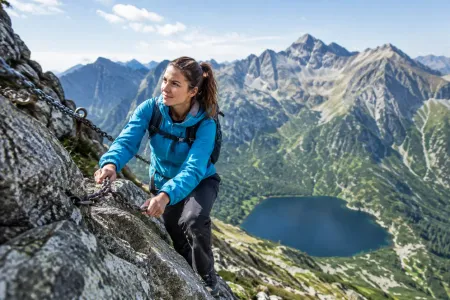
From the tarn yellow climbs steeply. Chains, slabs, exposure. On the summit you are on Orla. Turning around here is legal and sensible.

Stage 3: Red across Pośredni to Zadni

Short, loose, over empty air. Between Skrajny and Pośredni Granat you cross the famous rock cleft secured by chains (a step over the drop). Zadni Granat is the highest (2,240 m a.s.l.). The view takes in Kościelec, Świnica and the Five Lakes.

Stage 4: Żleb Kulczyńskiego

Descent on the black trail down the steep, rocky chute of Żleb Kulczyńskiego. Chains, loose stones, people above you. The helmet is not decoration. Then via Kozia Dolinka, Zmarzły Staw, Czarny Staw, and Kuźnice.

Logistics and warnings

  • One-way rules: On Orla toward Kozi you walk from Zawrat. On the Granaty, yellow and the gully are two-way — which is why they jam.
  • Weather: A storm on the ridge = you descend the gully or yellow. You do not wait on Skrajny.
  • Winter: That is mountaineering, not a card with tiles.
  • The whole Orla: Zawrat – Krzyżne has its own card. The Granaty are not a “same-day add-on”.

Who is this absolutely NOT for?

Not after Hala Gąsienicowa as your only experience. Not without a helmet. Not with someone who held the grass on Kościelec. If you want the chute from below, take the Żleb card. If you want the ladder — that is Kozia Przełęcz.

Tool

🎒 What to pack? Interactive checklist

Check off items as you pack, switch between summer/winter and clear the list before your next trip. Progress is saved automatically.

Open checklist →

What to see

  • Skrajny, Pośredni and Zadni Granat
  • The famous cleft on Granaty (a step over the drop)
  • Czarny Staw Gąsienicowy from above
  • Żleb Kulczyńskiego
  • The easier section of Orla Perć

Questions and answers

Are the Granaty already Orla Perć?

Yes. The red across the three Granaty is Orla. Yellow to Skrajny and Żleb Kulczyńskiego are connectors. There is no Kozia ladder here.

Do I have to do all three?

No. Skrajny yellow and back is in the table. The tiles count the loop with Zadni and the gully.

Is a helmet needed?

Yes. The gully sheds rock. On the ridge someone else kicks stones too. This is not Kasprowy.

How is this different from the Żleb Kulczyńskiego card?

That card’s tiles go up the gully to Zadni. Here you climb yellow to Skrajny and descend the gully. The same area, the other direction, another card.

Next trail in this area

Planning your next hike? From the same starting point and area, we recommend:

📍 Kuźnice
No photo
#high tatras#orla perć#chains

Żleb Kulczyńskiego

Żleb Kulczyńskiego from Kuźnice: the pasture, Zmarzły, black into the gully, chains in the chute, Zadni Granat. The tiles are 18.6 km / 9 h 24 min. Loose rock. A helmet. This is access to Orla, not a postcard.


⏱️ 9 h 24 min📏 18.6 km🎯 very difficult
View trail

Read next

Plan your trip

These are affiliate links. If you book a stay or a ticket through them, we earn a small commission, for coffee :), at no extra cost to you.

Before you head to the mountains

  1. Check the weather forecast, mountain weather changes dynamically
  2. Match the trail to your abilities, don't overestimate your strength
  3. Take appropriate equipment: comfortable hiking boots, rain jacket, warm clothing, map, charged phone, first aid kit, power bank, food and water
  4. Inform someone about your plans, provide the route and expected return time
  5. Save the emergency number GOPR/TOPR, 601 100 300 or 985
  6. Buy a ticket to the Tatra National Park

Recent blog posts

Did you find the information here useful? I spent quite a bit of time compiling it. If it helped you plan your trip, buy me a virtual coffee! ☕

Buy me a