YesFrom the pass on red, one-way toward Kozi Wierch.
yellow
red
black
Recommended
Kuźnice – Kozia Przełęcz – Kuźnice
Over the meadow to Czarny Staw, yellow through the Dolinka to the pass and back. The tiles above show this route.
The longer description below is about the recommended variant.
🗺️
Map and trail profile
Kuźnice – Kozia Przełęcz – Kuźnice
🚗
Getting there, parking & buses
Trailhead logistics – reach the start smoothly without parking hassle.
📍Trailhead:Kuźnice
🅿️
Parking & car access
🚫🚗No private car access – bus or walk only
Kuźnice / car parks on the road to Kuźnice
Parking fee: paid, full early in season
💡From Rondo Jana Pawła II, private cars are strictly prohibited. Reach Kuźnice only by local bus (5 min) or on foot via Aleja Przewodników Tatrzańskich (20–25 min).
Kozia Przełęcz (2,137 m a.s.l.) is a narrow, deeply notched rock notch between Zamarła Turnia and Kozie Czuby. From Hala Gąsienicowa, a yellow connector comes through Kozia Dolinka — equipped with chains, rungs and notable exposure. On the saddle itself, it intersects with Orla Perć, where the famous 8-metre vertical ladder drops from the rock wall of Zamarła Turnia.
💡 In a nutshell – Kozia Przełęcz:
For whom: After the chains on Giewont and Zawrat, with a helmet and a head for heights.
Difficulties: Steep couloir, rungs and chains on the yellow trail. Very steep. Wet rock = turn around.
The ladder: The famous ladder is on the red Orla Perć route (descending from Zamarła Turnia to the saddle), not on the yellow approach path.
Tiles: Kuźnice there and back. The crossing to the Five Lakes is in the variants table.
Traffic: Strictly one-way on the ridge of Orla Perć from Zawrat to Kozi Wierch. The yellow connector from Kozia Dolinka is two-way.
Trail description: The Dolinka, then vertical
Stage 1: Kuźnice – Czarny Staw
As for the meadow and Kościelec: Boczań or Jaworzynka, Murowaniec, blue to Czarny Staw Gąsienicowy.
Stage 2: Kozia Dolinka
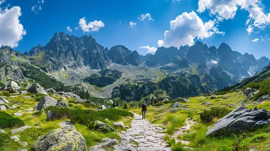
Yellow past Zmarzły Staw, then into the rugged amphitheatre of Kozia Dolinka. Giant boulders, stark cliffs and vertical walls all around.
Stage 3: Chains and the saddle
The final stretch is a steep rocky couloir equipped with chains and metal rungs. It demands careful foot placement and hands on the rock. On the saddle there is barely a few metres of space — with the vertical ladder of Orla Perć hanging right above your head.
Stage 4: Back or the other side
The tiles return through the Dolinka to Kuźnice. The far side of the yellow trail drops down exposed rock through Dolinka Pusta to the Five Lakes. Red to the right climbs toward Kozi Wierch.
Logistics and warnings
Helmet and gloves: Stones are easily dislodged by other hikers in the couloir. A helmet is essential.
Storm: You descend into the Dolinka immediately, you do not linger on the saddle.
One-way rule on Orla Perć: You cannot walk from Kozia Przełęcz toward Zawrat (climbing up the ladder against the flow). Movement on Orla between Zawrat and Kozi Wierch is strictly one-way.
Winter: Demanding mixed terrain and high avalanche danger in the couloirs. Strictly for seasoned mountaineers.
Who is this absolutely NOT for?
Not a first chain in the Tatras. Not for anyone with vertigo. If you want a gentler introduction to this area, take Granaty (from Skrajny) or end your hike at Czarny Staw or on Hala Gąsienicowa.
Where is the famous ladder on Kozia Przełęcz located?
The iconic 8-metre vertical ladder is part of Orla Perć (red trail), on the descent from Zamarła Turnia to the pass (one-way from Zawrat). Coming via the yellow trail from Kuźnice through Kozia Dolinka, you climb steep couloirs with chains and rungs, and view the ladder from the saddle below.
Is this the same as Kozi Wierch?
No. Kozi Wierch is higher and has its own card. From here you can climb it on red, but that is already Orla and one-way from Zawrat.
Which way across the pass?
On Orla itself from Zawrat to Kozi you walk one-way. The connector from the Dolinka is two-way. Do not join the ridge against the flow.
Is a helmet needed?
Yes. Stones fall in the chute from people above you. Gloves for the chains are highly recommended.
🗺️
Next trail in this area
Planning your next hike? From the same starting point and area, we recommend:
Granaty from Kuźnice: yellow to Skrajny, red across Pośredni and Zadni, down Żleb Kulczyńskiego. The tiles are 17.5 km / 8 h 30 min / 1,400 m. This is a section of Orla Perć, not a walk to the meadow.


 2026-06-28
 2026-10-10
 2026-10-09
 2026-10-08
 2026-10-07
 2026-10-06
 2026-10-05
 2026-10-04
 2026-10-04