0

Świstówka Roztocka

Trail openBulletin as of 3 października 2026
Official TPN bulletin

No reported closures or obstacles on this trail according to the official TPN bulletin (3 października 2026).

RecommendedRoztoka – Świstówka – Morskie Oko

Pace

7 h 15 minEstimate from the published time, without queues or breaks.

  • moderate (long, exposed descent)
    • green
    • blue
    • red
  • High Tatras
  • Family friendly: No
  • Dog friendly: No

Approach variants

The recommended route is on this page. A different start has its own page — description and map.

Approach variants
VariantStartDurationChainsTrail color
Roztoka – Świstówka – Morskie OkoRecommended

Green past Siklawa, blue over Opalony, red asphalt from Morskie Oko. No chains. The tiles show this loop.

Palenica Białczańska7 h 15 minNo
  • green
  • blue
  • red
Five Lakes only

No Świstówka, no 1 Dec–15 May closure. Separate card: Dolina Pięciu Stawów.

View this trail →
Palenica Białczańska5 h 45 minNo
  • green
Morskie Oko only

Asphalt there and back. No ridge, no Five Lakes. Separate card: Morskie Oko.

View this trail →
Palenica Białczańska4 h 44 minNo
  • red

Recommended

Roztoka – Świstówka – Morskie Oko

Green past Siklawa, blue over Opalony, red asphalt from Morskie Oko. No chains. The tiles show this loop.

Map and trail profile

Roztoka – Świstówka – Morskie Oko

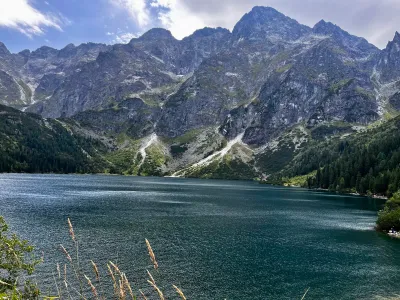
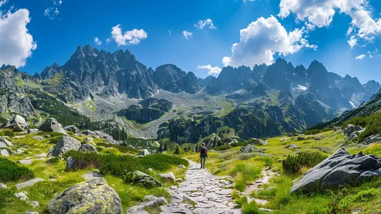
Świstówka Roztocka is the blue trail along the ridge of Opalony Wierch that joins the Five Polish Lakes with Morskie Oko. From above you see both cirques at once. In winter TPN closes this section, because avalanches do not ask about your holiday plan.

💡 In a nutshell – Świstówka:

  1. For whom: A long day when you already know both valleys separately and want to join them.
  2. No chains. There is exposure on the descent and 20 km in the legs.
  3. Closure: 1 December – 15 May. Do not improvise “because there is little snow”.
  4. Direction: Five Lakes → Morskie Oko. You walk the asphalt down, not up.

The tiles count the full loop from Palenica. They do not count Szpiglas or Rysy.

Trail description: Two valleys, one ridge

Stage 1: Palenica – Five Lakes

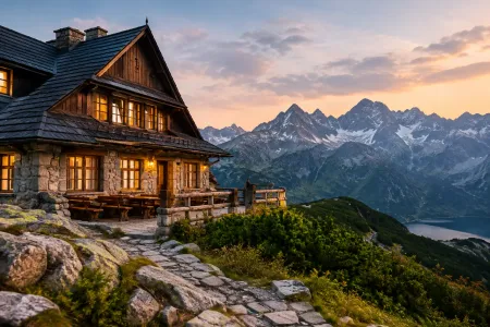
Red asphalt to Wodogrzmoty, green up Dolina Roztoki past Wielka Siklawa. The hut at 1,671 m. You eat here, not on Świstówka.

Stage 2: Blue over Opalony

Behind the hut blue climbs the ridge (about 1,855 m). The Five Lakes behind you, Morskie Oko in front. Wind here is often the first reason to turn around.

Stage 3: Descent to the eye and asphalt

Steep, stony, narrow. Then 8 km of red asphalt to Palenica. The knees will notice this stage more than the climb.

Logistics and warnings

  • Parking: Palenica e-ticket only. Without a ticket you do not drive in, and you will not “work it out”.
  • Winter / spring: Closed 1 Dec–15 May. In summer after a storm: stones and mud.
  • Shortcut: If someone is done at the hut, you return down Roztoka. The loop is not mandatory.
  • Dog: TPN ban.

Who is this absolutely NOT for?

Not a first day in the Tatras. Not with a pushchair. Not on 1 April “because the calendar says spring”. If you want only one valley, take its card. If you want chains between these valleys — that is Szpiglas from the Five Lakes or Zawrat.

Tool

🎒 What to pack? Interactive checklist

Check off items as you pack, switch between summer/winter and clear the list before your next trip. Progress is saved automatically.

Open checklist →

What to see

  • Two valleys from the Opalony ridge
  • Wielka Siklawa on the way
  • Morskie Oko from above
  • The Five Lakes hut

Questions and answers

Are there chains on Świstówka?

No. It is narrow, steep and exposed on the descent to Morskie Oko. This is not Szpiglas and not Zawrat.

When is the trail closed?

From 1 December to 15 May. Avalanches. TPN closes this section every year, not “when snow falls”.

Which way should I walk?

Roztoka to the Five Lakes, Świstówka to Morskie Oko, asphalt down. The stone descent to the eye then has the view, not your knees going up.

Do I have to use Świstówka to see both valleys?

No. Each valley has its own card. The tiles above are the loop. If the group is done at the hut, you go back down Roztoka.

Next trail in this area

Planning your next hike? From the same starting point and area, we recommend:

📍 Palenica Białczańska
No photo
#high tatras#fitness#lake

Przełęcz Krzyżne

Krzyżne from Palenica: Roztoka, Siklawa, Five Lakes, yellow to the pass, Pańszczyca to Kuźnice. The tiles are 20.9 km / 9 h 25 min. No chains. This is not Orla. Two car parks or a bus.


⏱️ 9 h 25 min📏 20.9 km🎯 difficult (physically)
View trail

Read next

Plan your trip

These are affiliate links. If you book a stay or a ticket through them, we earn a small commission, for coffee :), at no extra cost to you.

Before you head to the mountains

  1. Check the weather forecast, mountain weather changes dynamically
  2. Match the trail to your abilities, don't overestimate your strength
  3. Take appropriate equipment: comfortable hiking boots, rain jacket, warm clothing, map, charged phone, first aid kit, power bank, food and water
  4. Inform someone about your plans, provide the route and expected return time
  5. Save the emergency number GOPR/TOPR, 601 100 300 or 985
  6. Buy a ticket to the Tatra National Park

Recent blog posts

Did you find the information here useful? I spent quite a bit of time compiling it. If it helped you plan your trip, buy me a virtual coffee! ☕

Buy me a