Did Your Phone Battery Die on the Trail? How to Survive With Your Phone in the Mountains
Imagine: you’re standing on Kopa Kondracka. The weather is turning, the wind picks up, and the sun is slipping toward the horizon. You want to check whether the descent into Dolina Kościeliska takes 2 or 3 hours. You pull out your phone and… black screen. “What?! I had 100% this morning!”
We’ve packed our smartphones with everything: our Tourist Map, the Ratunek app, the camera, and even the TPN ticket. When the phone dies on the trail, you suddenly rewind back to the Stone Age.
Mountains drain your battery 3x faster than a couch at home. Here’s why it happens and how to prevent it.
Why the mountains hate your battery
It’s not magic—it’s physics and technology.
- The fight for signal: In deep valleys (for example Dolina Pięciu Stawów Polskich (The Valley of the Five Polish Lakes)), your phone can lose reception. Instead of giving up, the antenna starts working at 200% power, frantically searching for any tower. It burns through power right before your eyes.
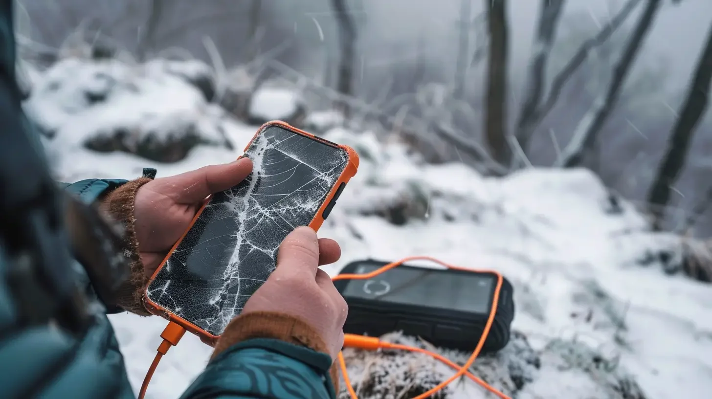
- Cold (even in summer!): Li-ion cells hate low temperatures. At 2000 m above sea level, with strong wind, the phone in your jacket’s outer pocket freezes, and the system sharply lowers the displayed battery level to protect the device.
- GPS nonstop: If you keep a map open that constantly tracks your position on the trail, the phone never gets a break.
How to survive? 4 iron rules
1. Airplane Mode is your best friend
This is the biggest mountain “life hack.” If you’re walking the valley floor where you don’t have signal anyway, why should your phone keep searching for it? Turn on Airplane Mode. Your GPS (location) in offline maps will still work! The camera will, too. And instead of dropping from 50%, the battery may only fall by about 2% over two hours. Use normal mode only when you take a break at the summit and want to post a story on Instagram.
2. Hide your phone like treasure
Never keep your phone in the outer pocket of your backpack (the mesh one) or in the side pocket of your trousers, where icy wind hits it. Keep it in the inner pocket of your fleece or jacket, close to your body. Your own body heat warms the battery. This matters especially if you’re planning an autumn hike to Czerwone Wierchy (Red Peaks) or going in winter.
3. Power bank: what does “enough” look like?
That 15 zł power bank from Action, the one the size of a lipstick, can stay at home. In the mountains you need a solid “canister of power.”
- Aim for at least 10,000 mAh. That should let you recharge a modern smartphone 2–3 times.
- Important: Test your cable at home (and make sure it doesn’t start/stop charging with every movement). A short, thick cable is best—it won’t tangle in your backpack. Keep the power bank and cable in a zip bag (so they don’t get soaked in rain).
4. Downloaded offline maps (don’t count on the network)
Do you have the Tourist Map installed? Great. But did you download the Tatras maps to your phone storage? If you didn’t, the app will try to “load” map images from the internet every time you swipe on the screen. And as you probably know—there’s often no internet. Then instead of the trail on Orla Perć, you’ll just see a blank white grid.
And what if your phone still dies?
You’re left with no map, no flashlight, and no way to get in touch. That’s why you should always—yes, always—have two things in your backpack:
- A regular headlamp with charged batteries. An iPhone light reaches about 3 meters. A headlamp reaches 50 meters.
- A paper map of the Tatras. It costs 20 zł, weighs nothing, doesn’t drain, and it still works even after dropping it into a puddle (if it’s laminated).
A smartphone is an amazing life-saving tool—as long as you don’t treat it as the only guarantee that you’ll get back home.
Recent blog posts
 2026-07-20
I betrayed the Tatras for the Pieniny. We did Sokolica and Trzy Korony in one day (with bikes!)
What to do when you are tired of the crowds under Giewont? Head to Szczawnica. Here is our plan for the perfect loop: hike up to the most famous peaks and cycle back along the Dunajec Gorge.
#pieniny #bikes #beyond the tatras +3View post 2026-07-13
I ate, I paid, and I didn’t go broke. Where to eat after hiking in Zakopane?
You hiked for 10 hours and you could eat a horse with hooves? Here’s what to try in Podhale without falling for tourist traps on Krupówki — and what’s actually worth paying for.
#food #tips #zakopane +1View post 2026-07-05
Mountain backpacks: Why your old school backpack will ruin your holiday
A gym sack on Rysy? A cube backpack from high school in the Kościeliska Valley? See why a good backpack matters as much as boots — and how to choose one without wasting money.
#gear #tips #backpack +1View post 2026-06-28
Want the High Tatras but scared of chains? The easiest rocky summits
Do you dream of “real”, sharp, rocky mountains, but the thought of exposure and chains makes your legs shake? Here’s a list of summits you’ll reach like climbing stairs — without climbing gear.
#easy routes #tips #high tatras +2View post 2026-06-21
Mountain gear: What you can save on and what’s worth paying extra for
A 2,000 zł jacket for a walk in the Kościeliska Valley? Overkill. But market boots on Świnica? That’s asking for trouble. Here’s what to cut costs on — and what to splurge on.
#gear #tips #boots +2View post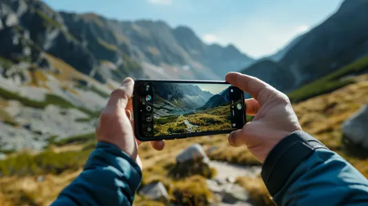 2026-06-14
Why are your Tatra photos boring? 5 simple smartphone photo tricks
You’re standing on Szpiglasowy Wierch, the view takes your breath away, you take a photo... and on your screen it’s a flat, grey blob. See how to take smartphone photos in the Tatras so your friends on Instagram drop their jaws.
#photography #tips #smartphone +1View post
Popular trails
- Difficulty: 21.4 km Duration: 10 h 10 min
Banówka (Baníkov)
Difficulty: difficult (high exposure, climbing, chains!)
#slovakia #western tatras #západné tatry +3View trail - Difficulty: 19.1 km Duration: 5 h 54 min
Czarny Staw pod Rysami
Difficulty: moderate
#high tatras #lake #views +1View trail - Difficulty: 15.6 km Duration: 8 h 27 min
Czerwone Wierchy (Red Peaks)
Difficulty: average
#western tatras #ridge #fitness +2View trail - Difficulty: 5.1 km Duration: 2 h 10 min
Dolina Białego (The Biały Valley)
Difficulty: easy
#western tatras #valley #walk +1View trail - Difficulty: 11.1 km Duration: 2 h 59 min
Dolina Kościeliska (The Kościeliska Valley)
Difficulty: easy
#western tatras #valley #family-friendly +4View trail - Difficulty: 4.2 km Duration: 1 h 47 min
Dolina Małej Łąki (The Mała Łąka Valley)
Difficulty: easy
#western tatras #valley #peace and quiet +2View trail
Did you find the information here useful? I spent quite a bit of time compiling it. If it helped you plan your trip, buy me a virtual coffee! ☕
Buy me a