Quiet — Tatra trails and posts
Found 10 results for quiet
Trails (10)
 Distance: 24.7 kmDuration: 7 h 38 min
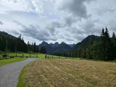
Dolina Białej Wody (Bielovodská dolina)
Bielovodská Valley (Dolina Białej Wody) from Łysa Polana to Litworowy Staw: 24.7 km, 7 h 38 min, no chains. Times to each meadow, closures 1 Nov – 31 May.
Difficulty: moderate (long)
#slovakia#high tatras#quiet+2View trailNo photo Distance: 4.2 kmDuration: 1 h 47 minDolina Małej Łąki (The Mała Łąka Valley)
Dolina Małej Łąki from Gronik to Wielka Polana with a view of Giewont: 4.2 km, 1 h 47 min, easy and quieter than the other valleys near Zakopane.
Difficulty: easy
#western tatras#valley#for family+2View trailNo photo Distance: 10.1 kmDuration: 3 h 26 minDolina Siedmich prameňov (Chata Plesnivec)
Dolina Siedmiu Źródeł from Tatranská Kotlina to Chata Plesnivec, the only hut in the Belianske Tatras: 10.1 km, 3 h 26 min, short and steep, no chains.
Difficulty: moderate (short, steep)
#slovakia#valley#mountain huts+2View trail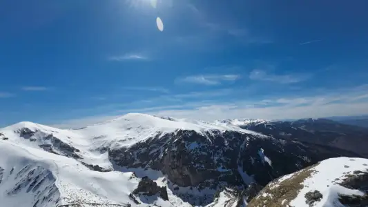 Distance: 6 kmDuration: 3 h 31 min
Giewont from Gronik
Giewont from Gronik via Dolina Małej Łąki and Kondracka Pass: 6 km, 3 h 31 min, +981 m, chains on the dome. Quieter than from Kuźnice, same queue at the cross.
Difficulty: medium / difficult
#western tatras#chains#exposure+1View trailNo photo Distance: 19.2 kmDuration: 7 h 49 minOrnak
Ornak (1854 m) from Kiry via the Ornak hut and Iwaniacka Pass: 19.2 km, 7 h 49 min, no chains. A quieter ridge than the Red Peaks (Czerwone Wierchy).
Difficulty: medium
#western tatras#ridge#quiet+2View trail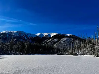 Distance: 13.5 kmDuration: 3 h 52 min
Smreczyński Staw
Smreczyński Staw from Kiry via the Kościeliska Valley and the Ornak hut: 13.5 km, 3 h 52 min, easy, no chains. A quiet lake in a spruce forest near Zakopane.
Difficulty: easy
#western tatras#lake#for family+2View trailNo photo Distance: 16 kmDuration: 7 h 30 minŠiroké sedlo (Szeroka Przełęcz Bielska)
Široké sedlo (Szeroka Przełęcz Bielska, 1826 m) from Ždiar via the Monkova Valley to Tatranská Kotlina: 16 km, 7 h 30 min. Few crowds. Closed 1 Nov – 31 May.
Difficulty: moderate / difficult (fitness)
#slovakia#quiet#panorama+2View trailNo photo Distance: 18.2 kmDuration: 6 h 55 minTrzydniowiański Wierch
Trzydniowiański Wierch (1758 m) from Siwa Polana, down the Jarząbcza Valley: 18.2 km, 6 h 55 min, no chains. Few people and views of the Western Tatras ridge.
Difficulty: medium
#western tatras#loop#quiet+2View trailNo photo Distance: 22.9 kmDuration: 8 h 39 minWrota Chałubińskiego
Wrota Chałubińskiego (2022 m) from Palenica via Morskie Oko and the valley behind Mnich: 22.9 km, 8 h 39 min, no chains. A dead-end pass, return the same way.
Difficulty: difficult (physically)
#high tatras#lake#quiet+1View trailNo photo Distance: 15.4 kmDuration: 6 h 14 minZelené pleso (Chata pri Zelenom plese)
Zelené pleso (Zielony Staw Kieżmarski) from Biela Voda to the lakeside hut: 15.4 km, 6 h 14 min, no chains. Hut open all year, peaks above closed in winter.
Difficulty: moderate
#slovakia#high tatras#lake+2View trail