Tatra trails with chains
A chain does not mean the trail is safe. It means someone decided the ground is steep or exposed enough that people fall without a handhold. On Giewont the problem is often the queue. On Rysy and Zawrat it is exposure and fatigue. Orla Perć is for people who have already done shorter chained sections and know how to descend when the weather drops.
Found 23 results for chains
Trails (23)
No photo Distance: 20.6 kmDuration: 9 h 50 minBanówka (Baníkov)
Banówka (2178 m) from the Žiarska Valley car park via Plačlivé and Hrubá kopa: 20.6 km, 9 h 50 min, chains and exposure. Trail closed 1 Nov – 31 May.
Difficulty: difficult (chains, exposure)
#slovakia#western tatras#chains+2View trailNo photo Distance: 16 kmDuration: 7 h 51 minBystrá lávka (Bystra Ławka)
Bystrá lávka (2300 m) from Štrbské Pleso via the Mlynická Valley and Skok waterfall, down the Furkotská Valley: 16 km, 7 h 51 min, chains. Closed 1 Nov – 31 May.
Difficulty: difficult (chains)
#slovakia#high tatras#chains+2View trailNo photo Distance: 17.9 kmDuration: 8 h 11 minPriečne sedlo (Czerwona Ławka)
Priečne sedlo (2352 m) from Hrebienok via Téryho chata to Zbojnícka chata: 17.9 km, 8 h 11 min, chains, rungs and exposure. Closed 1 Nov – 31 May.
Difficulty: very difficult (chains, exposure)
#slovakia#high tatras#chains+2View trailNo photo Distance: 13 kmDuration: 8–10 hGerlach (Gerlachovský štít)
Gerlachovský štít (2655 m), the highest peak of the Tatras and Carpathians, only with a licensed guide: chains and rungs, 13 km, 8–10 h, no marked trail.
Difficulty: climbing (UIAA I/II)
#slovakia#high tatras#highest peak+2View trail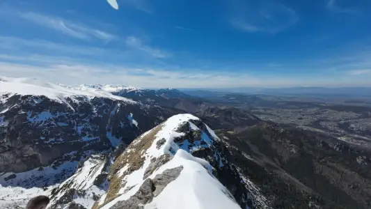 Distance: 11.8 kmDuration: 5 h 57 min
Giewont
Giewont is 1894 m high. The hike from Kuźnice in Zakopane: about 3 h up, an 11.8 km loop, chains on the summit dome and a queue to the cross. How hard and how dangerous it is.
Difficulty: medium / difficult
#western tatras#chains#exposure+1View trail- Distance: 6 kmDuration: 3 h 15 min
Giewont from Strążyska
Giewont from Dolina Strążyska in Zakopane via Grzybowiec Pass: 6 km, 3 h 15 min, +1014 m, chains on the summit dome. Parking on Strążyska street, winter closure.
Difficulty: medium / difficult
#western tatras#chains#exposure+1View trail 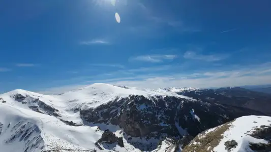 Distance: 6 kmDuration: 3 h 31 min
Giewont from Gronik
Giewont from Gronik via Dolina Małej Łąki and Kondracka Pass: 6 km, 3 h 31 min, +981 m, chains on the dome. Quieter than from Kuźnice, same queue at the cross.
Difficulty: medium / difficult
#western tatras#chains#exposure+1View trailNo photo Distance: 17.5 kmDuration: 8 h 30 minGranaty
Granaty from Kuźnice: Skrajny, Pośredni and Zadni Granat, down Żleb Kulczyńskiego. 17.5 km, 8 h 30 min, chains and exposure. A section of Orla Perć, not a stroll.
Difficulty: very difficult
#high tatras#orla perć#chains+2View trailNo photo Distance: 20.6 kmDuration: 10 h 25 minJagnięcy Szczyt (Jahňací štít)
Jahňací štít (Jagnięcy Szczyt, 2230 m) from Biela Voda via Zelené pleso: 20.6 km, 10 h 25 min, chains below the summit. A long day. Closed 1 Nov – 31 May.
Difficulty: difficult (chains + long)
#slovakia#high tatras#chains+2View trail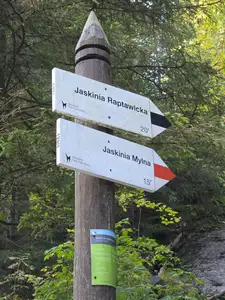 Distance: 1 kmDuration: 57 min
Jaskinia Mylna
Mylna Cave in the Kościeliska Valley: an unlit labyrinth, crawling, a chain on the way down and Pawlikowski's Window. 57 min from Polana Pisana, about 3 h from Kiry.
Difficulty: moderate (crawling, chain on the exit)
#western tatras#cave#chains+1View trailNo photo Distance: 0.5 kmDuration: 30 minJaskinia Raptawicka
Raptawicka Cave in the Kościeliska Valley: chains, a 4 m ladder and a big daylight chamber. 30 min loop from Polana Pisana, about 2 h 30 min from Kiry.
Difficulty: medium (ladder + chains)
#western tatras#cave#chains+1View trailNo photo Distance: 14.2 kmDuration: 7 h 20 minKozia Przełęcz
Kozia Przełęcz (2137 m) from Kuźnice via Czarny Staw and Kozia Dolinka: 14.2 km, 7 h 20 min, chains and rungs. A link to Orla Perć, not Kozi Wierch.
Difficulty: very difficult (chains, rungs)
#high tatras#orla perć#chains+1View trailNo photo Distance: 7.4 kmDuration: 4 h 45 minMała Wysoka (Východná Vysoká)
Východná Vysoká (Mała Wysoka, 2429 m) from Sliezsky dom via Polish Ridge pass: 7.4 km, 4 h 45 min, chains at the pass and summit. Closed 1 Nov – 31 May.
Difficulty: difficult (chains)
#slovakia#high tatras#chains+2View trail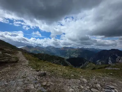 Distance: 14.4 kmDuration: 7 h 27 min
Małołączniak via Kobylarzowy Żleb
Małołączniak from Gronik via Kobylarzowy Żleb with a short chain, down via Kopa Kondracka: 14.4 km, 7 h 27 min. Parking, times, when to turn around.
Difficulty: medium
#western tatras#chains#fitness+1View trailNo photo Distance: 4.3 kmDuration: 6 h 25 minOrla Perć (Zawrat - Krzyżne)
Orla Perć from Zawrat to Krzyżne: 4.3 km of ridge in 6 h 25 min, chains, rungs, a ladder and one-way traffic to Kozi Wierch. How to split it into stages.
Difficulty: very difficult (for advanced hikers only)
#high tatras#orla perć#chains+1View trailNo photo Distance: 25.5 kmDuration: 11 h 44 minRysy (from the Polish side)
Rysy (2499 m), Poland's highest peak, from Palenica via Morskie Oko and Czarny Staw: 25.5 km, 11 h 44 min, chains, snow even in July. When to start and turn back.
Difficulty: very difficult
#high tatras#highest peak#chains+2View trailNo photo Distance: 8.8 kmDuration: 5 h 50 minSiwy Wierch (Sivý vrch)
Sivý vrch (Siwy Wierch, 1805 m) in the Slovak Western Tatras: red trail over Radové skaly with chains on limestone. 8.8 km, 5 h 50 min. Closed 1 Nov – 31 May.
Difficulty: moderate (chains, exposure)
#slovakia#western tatras#chains+2View trailNo photo Distance: 18.6 kmDuration: 9 h 32 minŚwinica
Świnica (2301 m) from Kuźnice via Kasprowy Wierch: 18.6 km, 9 h 32 min, chains and exposure. The cable car shortens the climb, not the difficulty. Zawrat variants.
Difficulty: difficult
#high tatras#chains#exposure+1View trail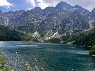 Distance: 24.2 kmDuration: 9 h 22 min
Szpiglasowy Wierch from Five Lakes
Szpiglasowy Wierch from Palenica via the Five Polish Lakes Valley, chains on the way up, down the Ceprostrada to Morskie Oko: 24.2 km, 9 h 22 min.
Difficulty: medium / difficult
#high tatras#chains#panorama+2View trailNo photo Distance: 1.4 kmDuration: 30 minWąwóz Kraków and Smocza Jama
Wąwóz Kraków in the Kościeliska Valley: a ladder, chains and the one-way Smocza Jama cave. 30 min loop from Hala Pisana, about 4 h from Kiry. Bring a headlamp.
Difficulty: medium (ladder + chains)
#western tatras#cave#chains+1View trailNo photo Distance: 21.5 kmDuration: 8 h 41 minWielka Świstówka (Veľká Svišťovka)
Veľká Svišťovka from Biela Voda via Zelené pleso and Skalnaté pleso: 21.5 km, 8 h 41 min, chains. Cable car option down. Closed 1 Nov – 31 May.
Difficulty: difficult (chains)
#slovakia#high tatras#chains+2View trailNo photo Distance: 19.9 kmDuration: 8 h 34 minZawrat Pass (from Hala Gąsienicowa)
Zawrat Pass (2158 m) from Kuźnice via Hala Gąsienicowa: 19.9 km, 8 h 34 min, chains in the gully and snow into summer. The easier Five Lakes side is separate.
Difficulty: difficult
#high tatras#orla perć#chains+1View trailNo photo Distance: 18.6 kmDuration: 9 h 24 minŻleb Kulczyńskiego
Żleb Kulczyńskiego from Kuźnice via Hala Gąsienicowa and Zmarzły Staw: 18.6 km, 9 h 24 min, chains in the gully, loose rock, helmet advised. Approach to Orla Perć.
Difficulty: very difficult
#high tatras#orla perć#chains+2View trail