Western Tatras trails
The Western Tatras are valleys with clearings, grassy ridges, and a few summits where you still queue. Giewont, Kasprowy, and Czerwone Wierchy sit here. Orla Perć does not. For quiet, leave the main floor of Kościeliska or Chochołowska. For a ridge, plan a full day and water — Czerwone Wierchy have almost no shade.
Found 38 results for western tatras
Trails (38)
No photo Distance: 20.6 kmDuration: 9 h 50 minBanówka (Baníkov)
Banówka (2178 m) from the Žiarska Valley car park via Plačlivé and Hrubá kopa: 20.6 km, 9 h 50 min, chains and exposure. Trail closed 1 Nov – 31 May.
Difficulty: difficult (chains, exposure)
#slovakia#western tatras#chains+2View trailNo photo Distance: 16.7 kmDuration: 8 h 25 minBaraniec (Baranec)
Baraniec (2185 m) from the Žiarska Valley: up the yellow ridge, down past the hut. 16.7 km, 8 h 25 min, no chains. Above the hut closed 1 Nov – 15 Jun.
Difficulty: difficult (physically)
#slovakia#western tatras#fitness+2View trailNo photo Distance: 28.1 kmDuration: 11 h 50 minBystra (Bystrá)
Bystrá (2248 m) from Kiry via Ornak and Błyszcz: 28.1 km, 11 h 50 min there and back, no chains. The summit trail is closed from 1 Nov to 31 May.
Difficulty: very demanding (physically)
#slovakia#western tatras#highest peak+2View trail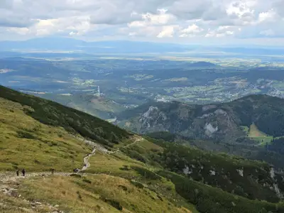 Distance: 18.5 kmDuration: 8 h 09 min
Ciemniak (Czerwone Wierchy - Red Peaks)
Ciemniak (2096 m), part of the Red Peaks (Czerwone Wierchy), from Kiry: 18.5 km, 8 h 09 min loop, no chains. Parking, water and what to do in fog.
Difficulty: medium / difficult (physically demanding)
#western tatras#fitness#autumn+1View trail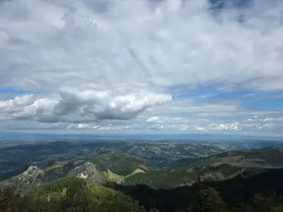 Distance: 15.6 kmDuration: 8 h 27 min
Czerwone Wierchy (Red Peaks)
Czerwone Wierchy (Red Peaks) from Kiry to Kuźnice over four 2000 m summits: 15.6 km, 8 h 27 min, no chains. Where to shorten the walk and what to do in fog.
Difficulty: average
#western tatras#ridge#fitness+2View trail- Distance: 15.4 kmDuration: 7 h 56 min
Czerwone Wierchy from Kuźnice
Czerwone Wierchy (Red Peaks) ridge from Kuźnice to Kiry over four summits: 15.4 km, 7 h 56 min, no chains. A gentle start near Zakopane and a long descent.
Difficulty: medium
#western tatras#ridge#fitness+1View trail 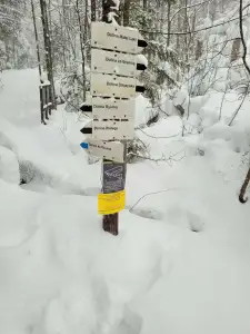 Distance: 5.1 kmDuration: 2 h 10 min
Dolina Białego (The Biały Valley)
Dolina Białego, a gorge walk right from Zakopane: 5.1 km, 2 h 10 min there and back, easy. Pushchair only in the lower part. The Sarnia Skała loop is separate.
Difficulty: easy
#western tatras#valley#for family+2View trailNo photo Distance: 12.6 kmDuration: 3 h 45 minDolina Chochołowska (The Chochołowska Valley)
Dolina Chochołowska from Siwa Polana to the mountain hut: 12.6 km, 3 h 45 min, easy. The only valley in Tatra National Park open to dogs on a lead. Bikes, crocuses.
Difficulty: easy
#western tatras#valley#for family+2View trail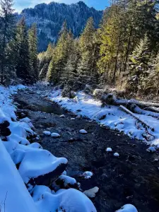 Distance: 11.1 kmDuration: 2 h 59 min
Dolina Kościeliska (The Kościeliska Valley)
Dolina Kościeliska, an easy valley walk near Zakopane: 11.1 km, 2 h 59 min from Kiry to the Ornak hut, pushchair-friendly. Mroźna and Mylna caves on the way.
Difficulty: easy
#western tatras#valley#for family+2View trailNo photo Distance: 4.2 kmDuration: 1 h 47 minDolina Małej Łąki (The Mała Łąka Valley)
Dolina Małej Łąki from Gronik to Wielka Polana with a view of Giewont: 4.2 km, 1 h 47 min, easy and quieter than the other valleys near Zakopane.
Difficulty: easy
#western tatras#valley#for family+2View trail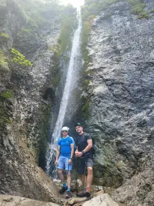 Distance: 4.8 kmDuration: 1 h 41 min
Dolina Strążyska i Wodospad Siklawica (The Strążyska Valley and Siklawica Waterfall)
Dolina Strążyska from Zakopane to Siklawica waterfall: 4.8 km, 1 h 41 min, very easy. Pushchair to the tea room on the meadow. Parking and the Sarnia Skała add-on.
Difficulty: very easy
#western tatras#valley#for family+2View trail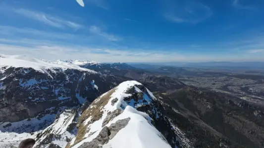 Distance: 11.8 kmDuration: 5 h 57 min
Giewont
Giewont is 1894 m high. The hike from Kuźnice in Zakopane: about 3 h up, an 11.8 km loop, chains on the summit dome and a queue to the cross. How hard and how dangerous it is.
Difficulty: medium / difficult
#western tatras#chains#exposure+1View trail- Distance: 6 kmDuration: 3 h 15 min
Giewont from Strążyska
Giewont from Dolina Strążyska in Zakopane via Grzybowiec Pass: 6 km, 3 h 15 min, +1014 m, chains on the summit dome. Parking on Strążyska street, winter closure.
Difficulty: medium / difficult
#western tatras#chains#exposure+1View trail 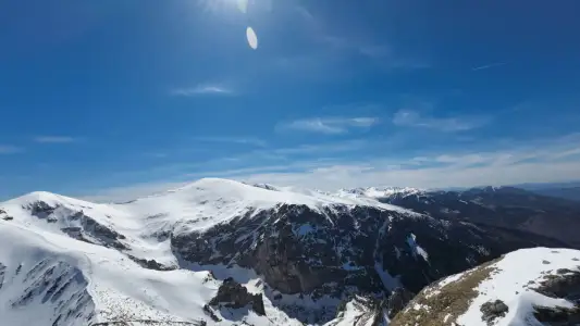 Distance: 6 kmDuration: 3 h 31 min
Giewont from Gronik
Giewont from Gronik via Dolina Małej Łąki and Kondracka Pass: 6 km, 3 h 31 min, +981 m, chains on the dome. Quieter than from Kuźnice, same queue at the cross.
Difficulty: medium / difficult
#western tatras#chains#exposure+1View trail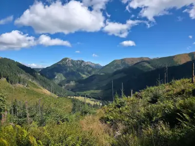 Distance: 18.1 kmDuration: 6 h 50 min
Grześ
Grześ (1653 m) from Siwa Polana via the Chochołowska Valley and hut: 18.1 km, 6 h 50 min, easy, no chains. A Roháče panorama to start the Western Tatras.
Difficulty: easy
#western tatras#panorama#for family+2View trailNo photo Distance: 24.1 kmDuration: 10 hJarząbczy Wierch
Jarząbczy Wierch (2137 m) from Siwa Polana via the hut and the Jarząbcza Valley, down Krowiniec: 24.1 km, 10 h, no chains but a lot of fitness needed.
Difficulty: difficult (fitness-wise)
#western tatras#fitness#ridge+2View trail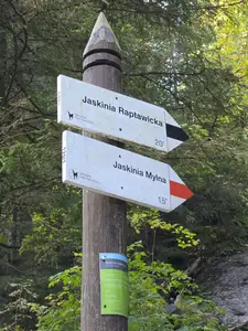 Distance: 1 kmDuration: 57 min
Jaskinia Mylna
Mylna Cave in the Kościeliska Valley: an unlit labyrinth, crawling, a chain on the way down and Pawlikowski's Window. 57 min from Polana Pisana, about 3 h from Kiry.
Difficulty: moderate (crawling, chain on the exit)
#western tatras#cave#chains+1View trailNo photo Distance: 0.5 kmDuration: 30 minJaskinia Raptawicka
Raptawicka Cave in the Kościeliska Valley: chains, a 4 m ladder and a big daylight chamber. 30 min loop from Polana Pisana, about 2 h 30 min from Kiry.
Difficulty: medium (ladder + chains)
#western tatras#cave#chains+1View trail- Distance: 7.2 kmDuration: 3 h 20 min
Kalatówki and Hala Kondratowa
Kalatówki and Hala Kondratowa from Kuźnice: an easy walk to the Kondratowa hut, 7.2 km, 3 h 20 min, +327 m. A good first day in the Tatras.
Difficulty: easy
#western tatras#easy routes#for family+1View trail 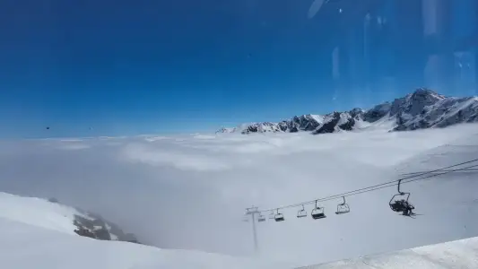 Distance: 12.9 kmDuration: 5 h 31 min
Kasprowy Wierch
Kasprowy Wierch (1987 m) from Kuźnice in Zakopane on the green trail: 12.9 km, 5 h 31 min, no chains. How to combine it with the PKL cable car, tickets, parking.
Difficulty: medium
#western tatras#panorama#winter+2View trail- Distance: 7.6 kmDuration: 4 h 01 min
Kasprowy Wierch via Gąsienicowa
Kasprowy Wierch from Kuźnice via Hala Gąsienicowa and Sucha Pass: 7.6 km, 4 h 01 min up, no chains. Prettier than the green trail. Down on foot or by cable car.
Difficulty: medium
#high tatras#western tatras#panorama+1View trail No photo Distance: 18.3 kmDuration: 8 hKończysty Wierch
Kończysty Wierch (2002 m) from Siwa Polana via Trzydniowiański Wierch: 18.3 km, 8 h there and back, no chains. A quiet 2000 m peak in the Western Tatras.
Difficulty: medium / difficult (fitness-wise)
#western tatras#2,000-metre peak#panorama+2View trail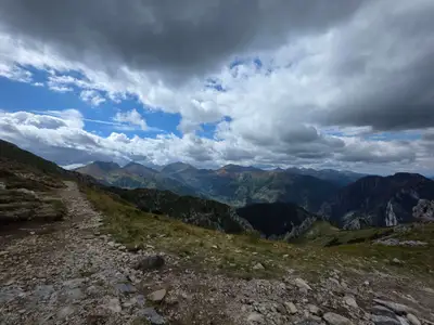 Distance: 12.7 kmDuration: 6 h 07 min
Kopa Kondracka
Kopa Kondracka (2005 m) from Kuźnice via Hala Kondratowa: 12.7 km, 6 h 07 min, no chains. A 2000 m peak right next to Giewont, with a variant from Gronik.
Difficulty: medium (fitness-wise)
#western tatras#panorama#2,000-metre peak+1View trailNo photo Distance: 19.6 kmDuration: 8 h 34 minKrzesanica
Krzesanica (2122 m), highest of the Czerwone Wierchy (Red Peaks), from Kiry: 19.6 km, 8 h 34 min, no chains. Beware of fog near the edge of Mułowy Kocioł.
Difficulty: medium / difficult (fitness-wise)
#western tatras#fitness#panorama+1View trail- Distance: 15.6 kmDuration: 8 h 02 min
Małołączniak
Małołączniak (2096 m) from Gronik near Zakopane via Kondracka Pass and Kopa: 15.6 km, 8 h 02 min, no chains. A 2000 m peak for fit beginners. Parking and times.
Difficulty: medium
#western tatras#ridge#fitness+1View trail - Distance: 14.4 kmDuration: 7 h 27 min
Małołączniak via Kobylarzowy Żleb
Małołączniak from Gronik via Kobylarzowy Żleb with a short chain, down via Kopa Kondracka: 14.4 km, 7 h 27 min. Parking, times, when to turn around.
Difficulty: medium
#western tatras#chains#fitness+1View trail No photo Distance: 2.5 kmDuration: 58 minNosal
Nosal (1206 m) from Kuźnice: a short 2.5 km loop in 58 min, easy, no chains. A quick view over Zakopane and Giewont for a first day or an afternoon.
Difficulty: easy
#western tatras#panorama#for family+2View trailNo photo Distance: 19.2 kmDuration: 7 h 49 minOrnak
Ornak (1854 m) from Kiry via the Ornak hut and Iwaniacka Pass: 19.2 km, 7 h 49 min, no chains. A quieter ridge than the Red Peaks (Czerwone Wierchy).
Difficulty: medium
#western tatras#ridge#quiet+2View trail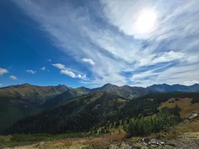 Distance: 22.6 kmDuration: 8 h 50 min
Rakoń
Rakoń (1879 m) from Siwa Polana via Grześ and Długi Upłaz, down the green trail: 22.6 km, 8 h 50 min, no chains. Gentle ridge, Roháče views, often windy.
Difficulty: medium
#western tatras#ridge#panorama+1View trailNo photo Distance: 13 kmDuration: 5 h 50 minRoháčske plesá (Rohackie Stawy)
Roháčske plesá (Rohackie Stawy): a waterfall, four lakes and Ťatliakova chata. 13 km, 5 h 50 min, no chains. Trail closed from 1 Nov to 15 Jun.
Difficulty: moderate
#slovakia#western tatras#lake+2View trail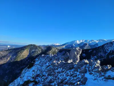 Distance: 6.7 kmDuration: 2 h 48 min
Sarnia Skała
Sarnia Skała (1377 m) from Dolina Strążyska in Zakopane, down Dolina Białego: 6.7 km, 2 h 48 min, no chains. A close-up view of Giewont for little effort.
Difficulty: medium
#western tatras#panorama#for family+1View trailNo photo Distance: 8.8 kmDuration: 5 h 50 minSiwy Wierch (Sivý vrch)
Sivý vrch (Siwy Wierch, 1805 m) in the Slovak Western Tatras: red trail over Radové skaly with chains on limestone. 8.8 km, 5 h 50 min. Closed 1 Nov – 31 May.
Difficulty: moderate (chains, exposure)
#slovakia#western tatras#chains+2View trail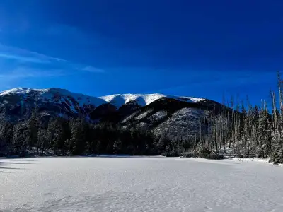 Distance: 13.5 kmDuration: 3 h 52 min
Smreczyński Staw
Smreczyński Staw from Kiry via the Kościeliska Valley and the Ornak hut: 13.5 km, 3 h 52 min, easy, no chains. A quiet lake in a spruce forest near Zakopane.
Difficulty: easy
#western tatras#lake#for family+2View trailNo photo Distance: 22.4 kmDuration: 10 h 18 minStarorobociański Wierch
Starorobociański Wierch (2176 m), the highest peak of the Polish Western Tatras, from Siwa Polana: 22.4 km, 10 h 18 min, no chains, a lot of fitness needed.
Difficulty: difficult (fitness-wise)
#western tatras#highest peak#fitness+2View trailNo photo Distance: 18.2 kmDuration: 6 h 55 minTrzydniowiański Wierch
Trzydniowiański Wierch (1758 m) from Siwa Polana, down the Jarząbcza Valley: 18.2 km, 6 h 55 min, no chains. Few people and views of the Western Tatras ridge.
Difficulty: medium
#western tatras#loop#quiet+2View trailNo photo Distance: 1.4 kmDuration: 30 minWąwóz Kraków and Smocza Jama
Wąwóz Kraków in the Kościeliska Valley: a ladder, chains and the one-way Smocza Jama cave. 30 min loop from Hala Pisana, about 4 h from Kiry. Bring a headlamp.
Difficulty: medium (ladder + chains)
#western tatras#cave#chains+1View trailNo photo Distance: 4.8 kmDuration: 1 h 50 minWielki Kopieniec
Wielki Kopieniec (1328 m) from Toporowa Cyrhla near Zakopane: 4.8 km, 1 h 50 min, easy. A warm-up summit: meadow, shepherd huts, spring crocuses and Tatra views.
Difficulty: easy
#western tatras#easy routes#panorama+2View trailNo photo Distance: 22.1 kmDuration: 8 h 55 minWołowiec
Wołowiec (2064 m) from Siwa Polana via the Chochołowska hut: 22.1 km, 8 h 55 min, no chains. A good first 2000 m peak. Variant with Grześ and Rakoń.
Difficulty: medium / difficult (fitness-wise)
#western tatras#2,000-metre peak#fitness+1View trail